Bethel Springs, Tennessee
| Bethel Springs, Tennessee | |
|---|---|
| Town | |
|
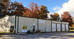
Bethel Springs City Hall and Fire Department in November 2013. | |
 Location in McNairy County and the state of Tennessee. | |
| Coordinates: 35°14′15″N 88°36′41″W / 35.23750°N 88.61139°W | |
| Country | United States |
| State | Tennessee |
| County | McNairy |
| Area | |
| • Total | 2.2 sq mi (5.7 km2) |
| • Land | 2.2 sq mi (5.7 km2) |
| • Water | 0.0 sq mi (0.0 km2) |
| Elevation | 479 ft (146 m) |
| Population (2010) | |
| • Total | 718 |
| • Density | 345.2/sq mi (133.3/km2) |
| Time zone | Central (CST) (UTC-6) |
| • Summer (DST) | CDT (UTC-5) |
| ZIP code | 38315 |
| Area code(s) | 731 |
| FIPS code | 47-05380[1] |
| GNIS feature ID | 1305159[2] |
Bethel Springs is a town in McNairy County, Tennessee. The population was 718 at the 2010 census.[3]
Geography
Bethel Springs is located at 35°14′15″N 88°36′41″W / 35.23750°N 88.61139°W (35.237378, -88.611429).[4] Bethel Springs was named after a Presbyterian church that was founded in the area. The name Bethel was derived from Bethlehem, and springs from the numerous springs in the area.
According to the United States Census Bureau, the town has a total area of 2.2 square miles (5.7 km2), all land.
Demographics
| Historical population | |||
|---|---|---|---|
| Census | Pop. | %± | |
| 1900 | 369 | — | |
| 1930 | 573 | — | |
| 1940 | 560 | −2.3% | |
| 1950 | 623 | 11.3% | |
| 1960 | 533 | −14.4% | |
| 1970 | 781 | 46.5% | |
| 1980 | 873 | 11.8% | |
| 1990 | 755 | −13.5% | |
| 2000 | 763 | 1.1% | |
| 2010 | 718 | −5.9% | |
| Est. 2015 | 713 | [5] | −0.7% |
| Sources:[6][7] | |||
As of the census[1] of 2000, there were 763 people, 317 households, and 219 families residing in the town. The population density was 345.2 people per square mile (133.3/km²). There were 347 housing units at an average density of 157.0 per square mile (60.6/km²). The racial makeup of the town was 85.58% White, 13.50% African American, 0.13% Asian, 0.26% from other races, and 0.52% from two or more races. Hispanic or Latino of any race were 1.31% of the population.
There were 317 households out of which 30.9% had children under the age of 18 living with them, 54.3% were married couples living together, 12.0% had a female householder with no husband present, and 30.6% were non-families. 28.7% of all households were made up of individuals and 14.5% had someone living alone who was 65 years of age or older. The average household size was 2.41 and the average family size was 2.96.
In the town the population was spread out with 24.2% under the age of 18, 10.6% from 18 to 24, 22.9% from 25 to 44, 26.2% from 45 to 64, and 16.0% who were 65 years of age or older. The median age was 39 years. For every 100 females there were 86.6 males. For every 100 females age 18 and over, there were 84.7 males.
The median income for a household in the town was $27,500, and the median income for a family was $33,750. Males had a median income of $26,500 versus $19,792 for females. The per capita income for the town was $14,402. About 12.8% of families and 14.7% of the population were below the poverty line, including 21.1% of those under age 18 and 11.4% of those age 65 or over.
Notable people
References
- 1 2 "American FactFinder". United States Census Bureau. Archived from the original on 2013-09-11. Retrieved 2008-01-31.
- ↑ "US Board on Geographic Names". United States Geological Survey. 2007-10-25. Retrieved 2008-01-31.
- ↑ Tennessee Department of Economic and Community Development, Certified Population of Tennessee Incorporated Municipalities and Counties, State of Tennessee official website, 14 July 2011. Retrieved: 6 December 2013.
- ↑ "US Gazetteer files: 2010, 2000, and 1990". United States Census Bureau. 2011-02-12. Retrieved 2011-04-23.
- ↑ "Annual Estimates of the Resident Population for Incorporated Places: April 1, 2010 to July 1, 2015". Retrieved July 2, 2016.
- ↑ "Census of Population and Housing: Decennial Censuses". United States Census Bureau. Retrieved 2012-03-04.
- ↑ "Incorporated Places and Minor Civil Divisions Datasets: Subcounty Resident Population Estimates: April 1, 2010 to July 1, 2012". Population Estimates. U.S. Census Bureau. Archived from the original on 17 June 2013. Retrieved 11 December 2013.
External links
Coordinates: 35°14′15″N 88°36′41″W / 35.237378°N 88.611429°W
Municipalities and communities of McNairy County, Tennessee, United States | ||
|---|---|---|
| Cities | ||
| Towns | ||
| Unincorporated communities | ||
| Footnotes | ‡This populated place also has portions in an adjacent county or counties | |