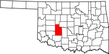
Binger, Oklahoma
| Binger, Oklahoma | |
|---|---|
| Town | |
|
Location of Binger, Oklahoma | |
| Coordinates: 35°18′32″N 98°20′28″W / 35.30889°N 98.34111°WCoordinates: 35°18′32″N 98°20′28″W / 35.30889°N 98.34111°W | |
| Country | United States |
| State | Oklahoma |
| County | Caddo |
| Area | |
| • Total | 0.87 sq mi (2.26 km2) |
| • Land | 0.87 sq mi (2.26 km2) |
| • Water | 0.0 sq mi (0.0 km2) |
| Elevation | 1,319 ft (402 m) |
| Population (2010) | |
| • Total | 672 |
| • Density | 771/sq mi (297.7/km2) |
| Time zone | Central (CST) (UTC-6) |
| • Summer (DST) | CDT (UTC-5) |
| ZIP code | 73009 |
| Area code(s) | 405 |
| FIPS code | 40-06200[1] |
| GNIS feature ID | 1090145[2] |
Binger is a town in Caddo County, Oklahoma, United States. The population was 672 at the 2010 census.[3] It is the headquarters of the Caddo Nation of Oklahoma, who were settled there in the 1870s.
Geography
Binger is located in northeast Caddo County at 35°18′32″N 98°20′28″W / 35.30889°N 98.34111°W (35.309023, -98.341243).[4] It is in the valley of Sugar Creek, a tributary of the Washita River, part of the Red River watershed.
U.S. Route 281 passes through the town, leading north 12 miles (19 km) to Hinton and 16 miles (26 km) to Interstate 40, and leading east then south 20 miles (32 km) to Anadarko. Oklahoma State Highway 152 also passes through the town, leading west 36 miles (58 km) to New Cordell and east 56 miles (90 km) to the center of Oklahoma City.
According to the United States Census Bureau, the town of Binger has a total area of 0.87 square miles (2.26 km2), all of it land.[3]
Demographics
| Historical population | |||
|---|---|---|---|
| Census | Pop. | %± | |
| 1910 | 280 | — | |
| 1920 | 482 | 72.1% | |
| 1930 | 849 | 76.1% | |
| 1940 | 840 | −1.1% | |
| 1950 | 773 | −8.0% | |
| 1960 | 603 | −22.0% | |
| 1970 | 730 | 21.1% | |
| 1980 | 791 | 8.4% | |
| 1990 | 724 | −8.5% | |
| 2000 | 708 | −2.2% | |
| 2010 | 672 | −5.1% | |
| Est. 2015 | 654 | [5] | −2.7% |
As of the census[1] of 2000, there were 712 people, 281 households, and 202 families residing in the town. The population density was 908.3 people per square mile (350.5/km²). There were 327 housing units at an average density of 419.5 per square mile (161.9/km²). The racial makeup of the town was 70.90% White, 4.80% African American, 13.70% Native American, 0.28% Asian, 3.81% from other races, and 6.50% from two or more races. Hispanic or Latino of any race were 7.06% of the population.
There were 281 households out of which 33.5% had children under the age of 18 living with them, 54.8% were married couples living together, 12.1% had a female householder with no husband present, and 28.1% were non-families. 27.0% of all households were made up of individuals and 16.4% had someone living alone who was 65 years of age or older. The average household size was 2.52 and the average family size was 3.05.
In the town the population was spread out with 27.5% under the age of 18, 5.4% from 18 to 24, 28.4% from 25 to 44, 22.6% from 45 to 64, and 16.1% who were 65 years of age or older. The median age was 38 years. For every 100 females there were 92.9 males. For every 100 females age 18 and over, there were 92.9 males.
The median income for a household in the town was $24,333, and the median income for a family was $31,406. Males had a median income of $31,625 versus $19,844 for females. The per capita income for the town was $11,862. About 15.5% of families and 22.3% of the population were below the poverty line, including 28.6% of those under age 18 and 15.5% of those age 65 or over.
"The Mound"
"The Mound", a horror novella ghostwritten by H.P. Lovecraft for Zealia Bishop, takes place in Binger.
Notable people
- Johnny Bench, Major League Baseball Hall of Fame catcher for the Cincinnati Reds during the Big Red Machine era
Cade Roth, singer-songwriter (MFCR)
Verlon Thompson, award winning singer-songwriter, performer, partnered for many years with Guy Clark, Darrell Scott.
References
- 1 2 "American FactFinder". United States Census Bureau. Archived from the original on 2013-09-11. Retrieved 2008-01-31.
- ↑ "US Board on Geographic Names". United States Geological Survey. 2007-10-25. Retrieved 2008-01-31.
- 1 2 "Geographic Identifiers: 2010 Demographic Profile Data (G001): Binger town, Oklahoma". U.S. Census Bureau, American Factfinder. Retrieved February 6, 2015.
- ↑ "US Gazetteer files: 2010, 2000, and 1990". United States Census Bureau. 2011-02-12. Retrieved 2011-04-23.
- ↑ "Annual Estimates of the Resident Population for Incorporated Places: April 1, 2010 to July 1, 2015". Retrieved July 2, 2016.
- ↑ "Census of Population and Housing". Census.gov. Archived from the original on May 11, 2015. Retrieved June 4, 2015.
