Blue Hills Reservation is a 6,000-acre (2,400 ha) state park in Norfolk County, Massachusetts. Managed by the Massachusetts Department of Conservation and Recreation, it covers parts of Milton, Quincy, Braintree, Canton, Randolph, and Dedham. Located approximately ten miles south of downtown Boston, the reservation is one of the largest parcels of undeveloped conservation land within the metropolitan area. The park's varied terrain and scenic views make it a popular destination for hikers from the Boston area.[2]
History
European explorers sailing the coastline noticed the bluish hue of the mountains, which is caused by the presence of riebeckite,[3] and the gave area its modern name.[2] The name of the state of Massachusetts derives from the Massachusett Indian tribe's name of the hill: massa-adchu-es-et.[4] In 1893, the Metropolitan Parks Commission purchased the lands of Blue Hills Reservation as one of the state's first areas dedicated to public recreation.[2]
Flora and fauna
The ecology of the Blue Hills is diverse and includes marshes, swamps, upland and bottomland forests, meadows, and an Atlantic white cedar bog. A number of endangered species in Massachusetts, such as the timber rattlesnake, reside in the reservation. Other flora and fauna include dogwood, lady's slipper, white-tailed deer, coyotes, wild turkey, red fox, turkey vultures, and copperheads.[2]
Activities and amenities
Blue Hills Reservation is primarily used for hiking and mountain biking. It is also used for snowshoeing, downhill skiing, and cross country skiing during winter, and rock climbing (in certain areas) and horseback riding during permissible months. Between approximately December and March, Great Blue Hill offers a ski area. Houghton's Pond and nearby Ponkapoag Pond are popular swimming and recreation areas during the summer. Other recreational opportunities include non-motorized boating, camping, fishing, picnicking, playing fields, ice skating, and interpretive programs.
Points of interest
- Observatory
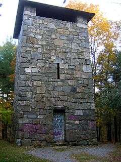
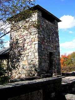
The highest point within the reservation, Great Blue Hill in Milton, is the site of the historic Blue Hill Meteorological Observatory. The observatory was founded in 1885 and is the oldest continuous weather recording station in the United States.[5] Its tower offers views of Boston and the surrounding area. The tower and observatory are among numerous reservation features listed on the National Register of Historic Places.
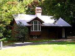
- Features listed on the National Register of Historic Places
- Museum
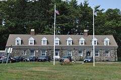
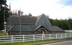
The Blue Hills Trailside Museum, which is affiliated with the Massachusetts Audubon Society, offers indoor and outdoor animal exhibits.[6]
References
External links
|
|---|
|
| Coastal reservations | |
|---|
|
| River reservations | |
|---|
|
| Woodland reservations | |
|---|
|
| Heritage state parks | |
|---|
|
| Parkways and roads | |
|---|
|
|
|
|---|
|
|
|
|
|
|
|
| Wildlife Management Areas |
|---|
| Wildlife
Management Areas | |
|---|
| Wildlife
Sanctuaries |
- Billingsgate Island
- Carr Island
- E. Howe Forbush
- Egg Rock
- Grace A. Robson
- J.C. Phillips
- Knight
- Penikese Island
- Ram Island (Salisbury)
- Ram Island (Mattapoisett)
- Susan B. Minns
- Tarpaulin Cove
- Watatic Mountain
|
|---|
|
|
|
| |
|---|
|
- Black Pond Bog
- Boat Meadow
- Francis Newhall Woods
- Grassy Pond
- Greene Swamp
- Halfway Pond Island
- Hawley Bog
- Hockomock Swamp
- Hoft Farm
- Homer-Watcha Preserve
- Katama Plains
- McElwain-Olsen
- Miacomet Moors
- Reed Brook
- Drury
- Sandy Neck
- David H. Smith Preserve and Fire Trail
- Stacy Mountain
- Tatkon
|
|
|
|
|
|
|
|
|
|