Boone, Iowa
| Boone, Iowa | |
|---|---|
|
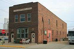
Stoll Bottling Works Building in Boone | |
 Location of Boone, Iowa | |
| Coordinates: 42°3′40″N 93°53′10″W / 42.06111°N 93.88611°WCoordinates: 42°3′40″N 93°53′10″W / 42.06111°N 93.88611°W | |
| Country | USA |
| State |
|
| County | Boone |
| Township | Des Moines |
| Incorporated | 1849 |
| Government | |
| • Mayor | John Slight |
| Area[1] | |
| • Total | 9.02 sq mi (23.36 km2) |
| • Land | 9.02 sq mi (23.36 km2) |
| • Water | 0 sq mi (0 km2) |
| Elevation | 1,135 ft (346 m) |
| Population (2010)[2] | |
| • Total | 12,661 |
| • Estimate (2012[3]) | 12,546 |
| • Density | 1,403.7/sq mi (542.0/km2) |
| Demonym(s) | Booninites |
| Time zone | Central (CST) (UTC-6) |
| • Summer (DST) | CDT (UTC-5) |
| ZIP codes | 50036-50037 |
| Area code(s) | 515 |
| FIPS code | 19-07480 |
| GNIS feature ID | 0454753 |
| Website | www.boonegov.com |
Boone (/ˈbuːn/ BOON) is a city in Des Moines Township, and county seat of Boone County, Iowa, United States.[4] It is the principal city of the Boone, Iowa Micropolitan Statistical Area, which encompasses all of Boone County. This micropolitan statistical area, along with the Ames, Iowa Metropolitan Statistical Area comprise the larger Ames-Boone, Iowa Combined Statistical Area. The population of the city was 12,661 at the 2010 census.
History
Coal mining played an important part in the early history of the Boone area. Local blacksmiths were already mining coal from the banks of Honey Creek south of what became Boone in 1849.
Boone was platted as a town in 1865 by John Insley Blair. It was incorporated the following year, when the Chicago and North Western Transportation Company railroad station was built there. The town was originally named "Montana";[5] it was renamed to Boone in 1871.[6] The nearby town of Boonesboro was also chartered in 1866; Boonseboro was annexed to Boone in 1887.[6]
Commercial mining was spurred by the arrival of the railroad. In 1867, Canfield and Taylor opened a mine just west of town. Their mine shaft was 242 feet deep, and they hauled coal to the railroad by wagon. In 1874, a railroad spur was built to the mine. This mine was taken over by the railroad, and operated for 30 years. There were coal seams in the Boone area; the upper vein, about 3 feet thick, was always worked using longwall mining, while the lower vein was always mined using room and pillar mining.[7] In 1912, United Mine Workers Local 869 in Boone had 554 members, close to 10% of the population at the time.[8]
The first Casey's General Store was also founded in Boone, Iowa in 1968.
The "Twister Hill" scene where Bill Harding and Jo Harding try and drop Dorothy amid a tornado in the Warner Bros. 1996 film Twister was filmed here.
Geography
According to the United States Census Bureau, the city has a total area of 9.02 square miles (23.36 km2), all of it land.[1]
Ledges State Park is located four miles south of Boone and is a popular destination.
Demographics
| Historical population | |||
|---|---|---|---|
| Census | Pop. | %± | |
| 1880 | 3,330 | — | |
| 1890 | 6,520 | 95.8% | |
| 1900 | 8,880 | 36.2% | |
| 1910 | 10,347 | 16.5% | |
| 1920 | 12,451 | 20.3% | |
| 1930 | 11,886 | −4.5% | |
| 1940 | 12,373 | 4.1% | |
| 1950 | 12,164 | −1.7% | |
| 1960 | 12,468 | 2.5% | |
| 1970 | 12,468 | 0.0% | |
| 1980 | 12,602 | 1.1% | |
| 1990 | 12,392 | −1.7% | |
| 2000 | 12,803 | 3.3% | |
| 2010 | 12,661 | −1.1% | |
| Est. 2015 | 12,692 | [9] | 0.2% |
2010 census
At the 2010 census,[2] there were 12,661 people, 5,380 households and 3,278 families residing in the city. The population density was 1,403.7 inhabitants per square mile (542.0/km2). There were 5,917 housing units at an average density of 656.0 per square mile (253.3/km2). The racial makeup of the city was 96.7% White, 0.8% African American, 0.3% Native American, 0.4% Asian, 0.5% from other races, and 1.3% from two or more races. Hispanic or Latino of any race were 2.0% of the population.
There were 5,380 households of which 29.4% had children under the age of 18 living with them, 47.3% were married couples living together, 9.7% had a female householder with no husband present, 3.9% had a male householder with no wife present, and 39.1% were non-families. 32.1% of all households were made up of individuals and 12.5% had someone living alone who was 65 years of age or older. The average household size was 2.32 and the average family size was 2.92.
The median age was 38.1 years. 23.5% of residents were under the age of 18; 9.3% were between the ages of 18 and 24; 25% were from 25 to 44; 26.1% were from 45 to 64; and 16.2% were 65 years of age or older. The gender makeup of the city was 48.9% male and 51.1% female.
2000 census
At the 2000 census,[11] there were 12,803 people, 5,313 households and 3,363 families residing in the city. The population density was 1,433.9 per square mile (553.6/km²). There were 5,585 housing units at an average density of 625.5 per square mile (241.5/km²). The racial makeup of the city was 98.34% White, 0.32% African American, 0.22% Native American, 0.21% Asian, 0.35% from other races, and 0.56% from two or more races. Hispanic or Latino of any race were 0.87% of the population.
There were 5,313 households of which 30.2% had children under the age of 18 living with them, 51.0% were married couples living together, 9.8% had a female householder with no husband present, and 36.7% were non-families. 31.5% of all households were made up of individuals and 13.8% had someone living alone who was 65 years of age or older. The average household size was 2.34 and the average family size was 2.94.
24.3% of the population were under the age of 18, 9.5% from 18 to 24, 27.2% from 25 to 44, 21.4% from 45 to 64, and 17.6% who were 65 years of age or older. The median age was 38 years. For every 100 females there were 89.3 males. For every 100 females age 18 and over, there were 85.4 males.
The median household income was $43,256. Males had a median income of $32,106 and females $22,119. The per capita income was $22,611. About 5.4% of families and 8.4% of the population were below the poverty line, including 10.9% of those under age 18 and 5.8% of those age 65 or over.
Transportation
Boone is located on US Highway 30. The original Lincoln Highway ran through the center of town, but a new 4-lane highway was built in the late 1960s that bypassed the center of Boone to the south. There is also a network of paved country roads radiating out in all directions.
Boone is served by the mainline of the Union Pacific Railroad which purchased the Chicago & Northwestern Railroad (C&NW) in 1995. Boone was a division and crew change point on the railroad under the Chicago & Northwestern and some of that business remains today. There is a moderate-sized rail yard to the east of the downtown area. The locomotives no longer sound their horns in the town proper due to modifications to the various points where streets intersect with the rail line.
Boone was also the exact midpoint on the Fort Dodge, Des Moines & Southern Railroad, an electric interurban line converted to diesel in 1955 after a flood on the Des Moines River devastated the Fraser hydroelectric power plant that supplied power to the railroad. It connected with the C&NW downtown. It was purchased by the C&NW in 1968 and subsequently abandoned. The western part of the line to Fraser has been resurrected as the Boone and Scenic Valley Railroad, a tourist line.
The Chicago, Milwaukee, St. Paul and Pacific Railroad also ran a branch line into Boone from the southeast. It likewise connected with the C&NW. The line was trimmed back to Luther in the late 1960s and completely abandoned a few years later.
Economy
The grocery chain Fareway is based in Boone.
- Unemployment rate
- 4.3 (7.8% USA)
- Recent job growth
- -0.48% (-0.12% USA)
- Future job growth
- 33.14% (31.25% USA)
- Sales taxes
- 7.00% (6.80% USA)
- Income per capita
- $23,283 ($27,067 USA)
- Household income
- $46,749 ($52,954)[12]
Arts and culture
Festivals and events
Pufferbilly Days, an annual event celebrating Boone's railroad heritage, is held the week after Labor Day and is one of Iowa’s top five community festivals with over 30,000 attendees.[13]
Boone is also the site of the annual Farm Progress Show. Back in the days when the show rotated from one farm to another in Iowa, Illinois and Indiana before the permanent sites were established at Boone, Iowa and Decatur, Illinois. The show now alternates between these two permanent sites on an annual basis.
Tourist attraction
Vincenzo Miserendino's final and largest statue of Theodore Roosevelt, which was eight times life-size was commissioned in 1941, and was scheduled to arrive in Boone, Iowa, in 1943. However, before casting, its 4,000 pounds of bronze was appropriated for WWII. Miserendino commented that Theodore Roosevelt himself would have approved of that decision to put the service of the country first.[14] Later, in 1946, the Roman Bronze Corporation of Corona, New York City, produced the casting in Miserendino's original mold.[lower-alpha 1] On January 6, 1948, it was placed in McHose Park.[lower-alpha 2] Residing on three large granite blocks, the 6' 3" statue depicts Roosevelt rising out of a mountainous landscape with his hand outstretched as if addressing a crowd. Below the statue are ten bas reliefs of Roosevelt’s outdoor accomplishments.[15]
Notable people
- Mamie Geneva Doud, First Lady of the United States, wife of President Dwight D. Eisenhower, was born in Boone. Mamie Eisenhower Avenue, one of the main east-west streets in Boone, is named in her honor.
- Norman Arthur Erbe, was a Republican Governor of Iowa from 1961 to 1963; he was born and resided in Boone
- Jerry McNertney, MLB player for the Seattle Pilots/Milwaukee Brewers, St. Louis Cardinals, and the Pittsburgh Pirates
- Hap Moran, an All-American basketball player from Boone High School and New York Giants football star
- Chad Rinehart, an offensive lineman for the San Diego Chargers; he was an all-American for the University of Northern Iowa.
- Darlene Rose, a missionary in Papua New Guinea during and after World War Two and survived imprisonment in a Japanese War Camp [16]
- Kate Shelley, who averted a terrible train accident
- Ray Lyman Wilbur, third president of Stanford University, also United States Secretary of the Interior; born in Boone
Notes
- ↑ Miserendino died in 1943 before the 1946 casting of Roosevelt.
- ↑ James Buritt McHose was an admirer of Theodore Roosevelt. On July 25, 1924, McHose and his wife, Ella, gave nearly 200 acres of land on the southwest side of Boone to the city for a park which is named in their honor. When McHose died in June of 1927 at the age of 78, shortly after the park’s dedication, his last will and testament specified that a statue of Roosevelt be placed in the park. John W. Jordan, the attorney for McHose's will, oversaw the Roosevelt statue project for the park.
References
- 1 2 "US Gazetteer files 2010". United States Census Bureau. Archived from the original on January 24, 2012. Retrieved May 11, 2012.
- 1 2 "American FactFinder". United States Census Bureau. Retrieved May 11, 2012.
- ↑ "Population Estimates". United States Census Bureau. Archived from the original on June 17, 2013. Retrieved May 23, 2013.
- ↑ "Find a County". National Association of Counties. Archived from the original on May 31, 2011. Retrieved June 7, 2011.
- ↑ "Bird's eye view of the city of Montana, Boone Co., Iowa 1868". historymap.com. Retrieved November 25, 2012.
- 1 2 "County History". Boone County, Iowa. Retrieved November 25, 2012.
- ↑ James H. Lees, History of Coal Mining in Iowa, Chapter III of Annual Report, 1908, Iowa Geological Survey, 1909, pages 575–579.
- ↑ Tally Sheet, Proceedings of the 23rd Annual Convention of the United Mine Workers of America Jan. 16 – Feb. 2, 1912, Indianapolis; Volume 2, page 182A.
- ↑ "Annual Estimates of the Resident Population for Incorporated Places: April 1, 2010 to July 1, 2015". Retrieved July 2, 2016.
- ↑ "Census of Population and Housing". Census.gov. Archived from the original on May 11, 2015. Retrieved June 4, 2015.
- ↑ "American FactFinder". United States Census Bureau. Archived from the original on September 11, 2013. Retrieved January 31, 2008.
- ↑
- ↑ "Pufferbilly Days". Travel Iowa by iowa.gov. Retrieved January 23, 2016.
- ↑ "Vincenzo "Vincent" Miserendino (1875 - 1943) Memorial". Findagrave.com. Retrieved January 23, 2016.
- ↑ Caswell, Suzanne (April 24, 2013). "The statue of Teddy Roosevelt". Iowa Living Magazines. Retrieved January 23, 2016.
- ↑ Rose, Darlene Deibler. Evidence Not Seen: A Woman's Miraculous Faith in the Jungles of World War II. San Francisco: Harper & Row, 1990. Print.
External links
| Wikimedia Commons has media related to Boone, Iowa. |
- Official Boone City website
- Boone Area Chamber of Commerce
- Vintage Life magazine photos
 Chisholm, Hugh, ed. (1911). "Boone". Encyclopædia Britannica (11th ed.). Cambridge University Press.
- City Data Detailed statistical data and more about Boone
Municipalities and communities of Boone County, Iowa, United States | ||
|---|---|---|
| Cities | ||
| Townships | ||
| Unincorporated communities | ||
| Footnotes | ‡This populated place also has portions in an adjacent county or counties | |