Borup, Minnesota
| Borup, Minnesota | |
|---|---|
| City | |
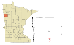 Location of Borup, Minnesota | |
| Coordinates: 47°10′50″N 96°30′18″W / 47.18056°N 96.50500°W | |
| Country | United States |
| State | Minnesota |
| County | Norman |
| Area[1] | |
| • Total | 0.25 sq mi (0.65 km2) |
| • Land | 0.25 sq mi (0.65 km2) |
| • Water | 0 sq mi (0 km2) |
| Elevation | 906 ft (276 m) |
| Population (2010)[2] | |
| • Total | 110 |
| • Estimate (2013[3]) | 107 |
| • Density | 440.0/sq mi (169.9/km2) |
| Time zone | Central (CST) (UTC-6) |
| • Summer (DST) | CDT (UTC-5) |
| ZIP code | 56519 |
| Area code(s) | 218 |
| FIPS code | 27-07030 |
| GNIS feature ID | 0640389[4] |
Borup is a city in Norman County, Minnesota, United States. The population was 110 at the 2010 census.[5]
The city was named for Charles William Wulff Borup, a Minnesota banker.[6]
History
A post office called Borup has been in operation since 1896.[7]
Geography
According to the United States Census Bureau, the city has a total area of 0.25 square miles (0.65 km2), all of it land.[1]
Minnesota State Highway 9 serves as a main route in the community.
Demographics
| Historical population | |||
|---|---|---|---|
| Census | Pop. | %± | |
| 1960 | 145 | — | |
| 1970 | 128 | −11.7% | |
| 1980 | 160 | 25.0% | |
| 1990 | 119 | −25.6% | |
| 2000 | 91 | −23.5% | |
| 2010 | 110 | 20.9% | |
| Est. 2015 | 107 | [8] | −2.7% |
| U.S. Decennial Census[9] 2013 Estimate[10] | |||
2010 census
As of the census[2] of 2010, there were 110 people, 37 households, and 27 families residing in the city. The population density was 440.0 inhabitants per square mile (169.9/km2). There were 51 housing units at an average density of 204.0 per square mile (78.8/km2). The racial makeup of the city was 97.3% White, 1.8% Native American, and 0.9% from two or more races. Hispanic or Latino of any race were 5.5% of the population.
There were 37 households of which 40.5% had children under the age of 18 living with them, 62.2% were married couples living together, 10.8% had a female householder with no husband present, and 27.0% were non-families. 21.6% of all households were made up of individuals and 8.1% had someone living alone who was 65 years of age or older. The average household size was 2.97 and the average family size was 3.63.
The median age in the city was 28.8 years. 37.3% of residents were under the age of 18; 7.2% were between the ages of 18 and 24; 20.9% were from 25 to 44; 21.8% were from 45 to 64; and 12.7% were 65 years of age or older. The gender makeup of the city was 52.7% male and 47.3% female.
2000 census
As of the census of 2000, there were 91 people, 38 households, and 22 families residing in the city. The population density was 372.7 people per square mile (146.4/km²). There were 50 housing units at an average density of 204.8 per square mile (80.4/km²). The racial makeup of the city was 86.81% White, 2.20% Native American, 2.20% Asian, and 8.79% from two or more races.
There were 38 households out of which 28.9% had children under the age of 18 living with them, 57.9% were married couples living together, 2.6% had a female householder with no husband present, and 39.5% were non-families. 39.5% of all households were made up of individuals and 10.5% had someone living alone who was 65 years of age or older. The average household size was 2.39 and the average family size was 3.26.
In the city the population was spread out with 27.5% under the age of 18, 9.9% from 18 to 24, 26.4% from 25 to 44, 20.9% from 45 to 64, and 15.4% who were 65 years of age or older. The median age was 36 years. For every 100 females there were 116.7 males. For every 100 females age 18 and over, there were 135.7 males.
The median income for a household in the city was $41,042, and the median income for a family was $41,875. Males had a median income of $32,083 versus $22,083 for females. The per capita income for the city was $17,081. None of the population or the families were below the poverty line.
References
- 1 2 "US Gazetteer files 2010". United States Census Bureau. Archived from the original on 2012-01-24. Retrieved 2012-11-13.
- 1 2 "American FactFinder". United States Census Bureau. Retrieved 2012-11-13.
- ↑ "Population Estimates". United States Census Bureau. Retrieved 2014-06-09.
- ↑ "US Board on Geographic Names". United States Geological Survey. 2007-10-25. Retrieved 2008-01-31.
- ↑ "2010 Census Redistricting Data (Public Law 94-171) Summary File". American FactFinder. U.S. Census Bureau, 2010 Census. Archived from the original on 21 July 2011. Retrieved 23 April 2011.
- ↑ Upham, Warren (1920). Minnesota Geographic Names: Their Origin and Historic Significance. Minnesota Historical Society. p. 382.
- ↑ "Norman County". Jim Forte Postal History. Retrieved 26 July 2015.
- ↑ "Annual Estimates of the Resident Population for Incorporated Places: April 1, 2010 to July 1, 2015". Retrieved July 2, 2016.
- ↑ United States Census Bureau. "Census of Population and Housing". Archived from the original on May 11, 2015. Retrieved February 12, 2014.
- ↑ "Annual Estimates of the Resident Population: April 1, 2010 to July 1, 2013". Retrieved June 9, 2014.
Municipalities and communities of Norman County, Minnesota, United States | ||
|---|---|---|
| Cities | 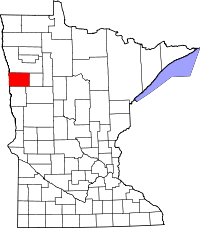 | |
| Townships | ||
| Unincorporated communities | ||
Coordinates: 47°10′49″N 96°30′22″W / 47.18028°N 96.50611°W