Brandon, Wisconsin
| Brandon, Wisconsin | |
|---|---|
| Village | |
|
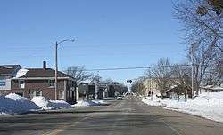
Looking west in Brandon | |
 Location of Brandon, Wisconsin | |
| Coordinates: 43°44′8″N 88°46′56″W / 43.73556°N 88.78222°WCoordinates: 43°44′8″N 88°46′56″W / 43.73556°N 88.78222°W | |
| Country | United States |
| State | Wisconsin |
| County | Fond du Lac |
| Area[1] | |
| • Total | 0.77 sq mi (1.99 km2) |
| • Land | 0.76 sq mi (1.97 km2) |
| • Water | 0.01 sq mi (0.03 km2) |
| Elevation[2] | 1,001 ft (305 m) |
| Population (2010)[3] | |
| • Total | 879 |
| • Estimate (2012[4]) | 873 |
| • Density | 1,156.6/sq mi (446.6/km2) |
| Time zone | Central (CST) (UTC-6) |
| • Summer (DST) | CDT (UTC-5) |
| Area code(s) | 920 |
| FIPS code | 55-09300[5] |
| GNIS feature ID | 1562145[2] |
| Website |
villageofbrandon |
Brandon is a village in Fond du Lac County, Wisconsin, United States. The population was 879 at the 2010 census.
History
Brandon was originally dubbed "Bungtown" in the town's creation in 1856.[6]
The Rens Hemp Company of Brandon, Wisconsin, closed in 1958, the last legal hemp producer nationwide in operation following the World Wars.[7] Prior to its 1957 shutdown, Rens had been the primary provider of hemp rope for the United States Navy.[8]
Geography
Brandon is located at 43°44′8″N 88°46′56″W / 43.73556°N 88.78222°W (43.735444, -88.782093).[9]
According to the United States Census Bureau, the village has a total area of 0.77 square miles (1.99 km2), of which, 0.76 square miles (1.97 km2) of it is land and 0.01 square miles (0.03 km2) is water.[1]
Demographics
| Historical population | |||
|---|---|---|---|
| Census | Pop. | %± | |
| 1880 | 601 | — | |
| 1890 | 660 | 9.8% | |
| 1900 | 663 | 0.5% | |
| 1910 | 684 | 3.2% | |
| 1920 | 682 | −0.3% | |
| 1930 | 646 | −5.3% | |
| 1940 | 708 | 9.6% | |
| 1950 | 728 | 2.8% | |
| 1960 | 758 | 4.1% | |
| 1970 | 872 | 15.0% | |
| 1980 | 862 | −1.1% | |
| 1990 | 872 | 1.2% | |
| 2000 | 912 | 4.6% | |
| 2010 | 879 | −3.6% | |
| Est. 2015 | 859 | [10] | −2.3% |
2010 census
As of the census[3] of 2010, there were 879 people, 336 households, and 233 families residing in the village. The population density was 1,156.6 inhabitants per square mile (446.6/km2). There were 369 housing units at an average density of 485.5 per square mile (187.5/km2). The racial makeup of the village was 94.8% White, 0.5% African American, 0.3% Native American, 3.1% from other races, and 1.4% from two or more races. Hispanic or Latino of any race were 5.0% of the population.
There were 336 households of which 36.6% had children under the age of 18 living with them, 56.8% were married couples living together, 9.5% had a female householder with no husband present, 3.0% had a male householder with no wife present, and 30.7% were non-families. 25.9% of all households were made up of individuals and 11.9% had someone living alone who was 65 years of age or older. The average household size was 2.58 and the average family size was 3.13.
The median age in the village was 38.4 years. 28.2% of residents were under the age of 18; 7.2% were between the ages of 18 and 24; 26.4% were from 25 to 44; 25.2% were from 45 to 64; and 13% were 65 years of age or older. The gender makeup of the village was 49.5% male and 50.5% female.
2000 census
As of the census[5] of 2000, there were 912 people, 342 households, and 258 families residing in the village. The population density was 1,165.9 people per square mile (451.4/km²). There were 357 housing units at an average density of 456.4 per square mile (176.7/km²). The racial makeup of the village was 99.78% White, 0.11% Native American, 0.11% from other races. Hispanic or Latino of any race were 0.77% of the population.
There were 342 households out of which 40.4% had children under the age of 18 living with them, 66.4% were married couples living together, 7.3% had a female householder with no husband present, and 24.3% were non-families. 21.9% of all households were made up of individuals and 11.1% had someone living alone who was 65 years of age or older. The average household size was 2.67 and the average family size was 3.14.
In the village the population was spread out with 29.7% under the age of 18, 6.7% from 18 to 24, 32.2% from 25 to 44, 18.2% from 45 to 64, and 13.2% who were 65 years of age or older. The median age was 34 years. For every 100 females there were 86.5 males. For every 100 females age 18 and over, there were 87.4 males.
The median income for a household in the village was $43,542, and the median income for a family was $50,227. Males had a median income of $35,595 versus $22,176 for females. The per capita income for the village was $17,437. About 4.3% of families and 5.3% of the population were below the poverty line, including 4.9% of those under age 18 and 9.1% of those age 65 or over.
Notable people
- Robert M. Graham, dairyist and legislator
- John E. Johnson, legislator
- Lester Johnson, U.S. Representative
- Lewis Ralph Jones, botanist
- Laura Ramsey, actress
- David Whitton, lawyer and legislator
- Andrew J. Yorty, businessman and legislator
Images
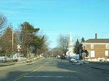
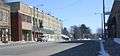 Looking east at downtown Brandon
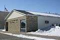 Post office
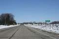 Sign
Sign Train depot
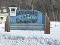 Welcome sign
 Fire station
References
- 1 2 "US Gazetteer files 2010". United States Census Bureau. Archived from the original on 2012-01-24. Retrieved 2012-11-18.
- 1 2 "US Board on Geographic Names". United States Geological Survey. 2007-10-25. Retrieved 2008-01-31.
- 1 2 "American FactFinder". United States Census Bureau. Retrieved 2012-11-18.
- ↑ "Population Estimates". United States Census Bureau. Archived from the original on 2013-06-17. Retrieved 2013-06-24.
- 1 2 "American FactFinder". United States Census Bureau. Archived from the original on 2013-09-11. Retrieved 2008-01-31.
- ↑ History of Brandon, Wisconsin
- ↑ Tappi Journal. Technical Association of the Pulp and Paper Industry. 1999. p. 114.
- ↑ John Roulac (1 January 1997). Hemp Horizons: The Comeback of the World's Most Promising Plant. Chelsea Green Pub. p. 59. ISBN 978-0-930031-93-0.
- ↑ "US Gazetteer files: 2010, 2000, and 1990". United States Census Bureau. 2011-02-12. Retrieved 2011-04-23.
- ↑ "Annual Estimates of the Resident Population for Incorporated Places: April 1, 2010 to July 1, 2015". Retrieved July 2, 2016.
- ↑ "Census of Population and Housing". Census.gov. Archived from the original on May 11, 2015. Retrieved June 4, 2015.
External links
| Wikimedia Commons has media related to Brandon, Wisconsin. |
- Village of Brandon
- Sanborn fire insurance maps: 1900 1908 1914
Municipalities and communities of Fond du Lac County, Wisconsin, United States | ||
|---|---|---|
| Cities | 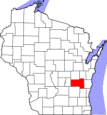 | |
| Villages | ||
| Towns | ||
| CDPs | ||
| Unincorporated communities |
| |
| Ghost towns | ||
| Footnotes | ‡This populated place also has portions in an adjacent county or counties | |