Brettenham, Norfolk
| Brettenham | |
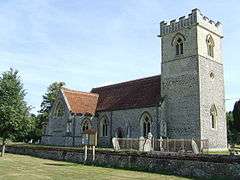 St Andrews Church, Brettenham |
|
 Brettenham |
|
| Area | 26.37 km2 (10.18 sq mi) |
|---|---|
| Population | 475 (2001 census[1]) 555 (2011 Census).[2] |
| – density | 18/km2 (47/sq mi) |
| OS grid reference | TL935836 |
| Civil parish | Brettenham |
| District | Breckland |
| Shire county | Norfolk |
| Region | East |
| Country | England |
| Sovereign state | United Kingdom |
| Post town | THETFORD |
| Postcode district | IP24 |
| Dialling code | 01842 |
| Police | Norfolk |
| Fire | Norfolk |
| Ambulance | East of England |
| EU Parliament | East of England |
| Website | http://eoe.xarg.co.uk/brettenham-and-kilverstone-parish-council/ |
Coordinates: 52°24′56″N 0°50′42″E / 52.41555°N 0.845°E
Brettenham is a village and civil parish in the English county of Norfolk. It covers an area of 26.37 km2 (10.18 sq mi) and had a population of 475 in 159 households at the 2001 census, [1] including Rushford and increasing to 555 at the 2011 Census. For the purposes of local government, it falls within the district of Breckland.
Notes
- 1 2 Census population and household counts for unparished urban areas and all parishes. Office for National Statistics & Norfolk County Council (2001). Retrieved 20 June 2009.
- ↑ "Civil Parish population 2011". Neighbourhood Statistics. Office for National Statistics. Retrieved 31 July 2016.
References
- The geographic coordinates are from the Ordnance Survey.
External links
![]() Media related to Brettenham, Norfolk at Wikimedia Commons
Media related to Brettenham, Norfolk at Wikimedia Commons
This article is issued from Wikipedia - version of the 11/8/2016. The text is available under the Creative Commons Attribution/Share Alike but additional terms may apply for the media files.