Brice, Ohio
| Brice, Ohio | |
|---|---|
| Village | |
|
Brice village offices | |
 Location of Brice within Ohio | |
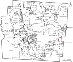 Location of Brice within Franklin County | |
| Coordinates: 39°55′4″N 82°49′55″W / 39.91778°N 82.83194°WCoordinates: 39°55′4″N 82°49′55″W / 39.91778°N 82.83194°W | |
| Country | United States |
| State | Ohio |
| County | Franklin |
| Area[1] | |
| • Total | 0.10 sq mi (0.26 km2) |
| • Land | 0.10 sq mi (0.26 km2) |
| • Water | 0 sq mi (0 km2) |
| Elevation[2] | 784 ft (239 m) |
| Population (2010)[3] | |
| • Total | 114 |
| • Estimate (2012[4]) | 116 |
| • Density | 1,140.0/sq mi (440.2/km2) |
| Time zone | Eastern (EST) (UTC-5) |
| • Summer (DST) | EDT (UTC-4) |
| ZIP code | 43109 |
| Area code(s) | 614 |
| FIPS code | 39-08532[5] |
| GNIS feature ID | 1048548[2] |

Brice is a village in Franklin County, Ohio, United States, on the southeast side of the Columbus metropolitan area. The population was 114 at the 2010 census. The village theme is "An Early American Village."
Geography
Brice is located at 39°55′4″N 82°49′55″W / 39.91778°N 82.83194°W (39.917707, -82.832010).[6]
According to the United States Census Bureau, the village has a total area of 0.10 square miles (0.26 km2), all land.[1]
Demographics
| Historical population | |||
|---|---|---|---|
| Census | Pop. | %± | |
| 1970 | 228 | — | |
| 1980 | 93 | −59.2% | |
| 1990 | 109 | 17.2% | |
| 2000 | 70 | −35.8% | |
| 2010 | 114 | 62.9% | |
| Est. 2015 | 121 | [7] | 6.1% |
2010 census
As of the census[3] of 2010, there were 114 people, 41 households, and 27 families residing in the village. The population density was 1,140.0 inhabitants per square mile (440.2/km2). There were 44 housing units at an average density of 440.0 per square mile (169.9/km2). The racial makeup of the village was 78.1% White, 10.5% African American, 1.8% Asian, 0.9% Pacific Islander, 0.9% from other races, and 7.9% from two or more races.
There were 41 households of which 36.6% had children under the age of 18 living with them, 43.9% were married couples living together, 14.6% had a female householder with no husband present, 7.3% had a male householder with no wife present, and 34.1% were non-families. 26.8% of all households were made up of individuals and 7.3% had someone living alone who was 65 years of age or older. The average household size was 2.78 and the average family size was 3.26.
The median age in the village was 40 years. 26.3% of residents were under the age of 18; 4.3% were between the ages of 18 and 24; 25.4% were from 25 to 44; 31.6% were from 45 to 64; and 12.3% were 65 years of age or older. The gender makeup of the village was 48.2% male and 51.8% female.
2000 census
As of the census[5] of 2000, there were 70 people, 25 households, and 17 families residing in the village. The population density was 909.9 people per square mile (337.8/km²). There were 27 housing units at an average density of 350.9 per square mile (130.3/km²). The racial makeup of the village was 97.14% White, 1.43% Native American, and 1.43% from two or more races.
There were 25 households out of which 48.0% had children under the age of 18 living with them, 60.0% were married couples living together, 4.0% had a female householder with no husband present, and 32.0% were non-families. 28.0% of all households were made up of individuals and 8.0% had someone living alone who was 65 years of age or older. The average household size was 2.80 and the average family size was 3.59.
In the village the population was spread out with 32.9% under the age of 18, 10.0% from 18 to 24, 28.6% from 25 to 44, 20.0% from 45 to 64, and 8.6% who were 65 years of age or older. The median age was 30 years. For every 100 females there were 100.0 males. For every 100 females age 18 and over, there were 80.8 males.
The median income for a household in the village was $34,375, and the median income for a family was $34,375. Males had a median income of $41,250 versus $41,250 for females. The per capita income for the village was $18,651. None of the population and none of the families were below the poverty line.
References
- 1 2 "US Gazetteer files 2010". United States Census Bureau. Archived from the original on 2012-01-24. Retrieved 2013-01-06.
- 1 2 "US Board on Geographic Names". United States Geological Survey. 2007-10-25. Retrieved 2008-01-31.
- 1 2 "American FactFinder". United States Census Bureau. Retrieved 2013-01-06.
- ↑ "Population Estimates". United States Census Bureau. Archived from the original on 2013-06-17. Retrieved 2013-06-17.
- 1 2 "American FactFinder". United States Census Bureau. Archived from the original on 2013-09-11. Retrieved 2008-01-31.
- ↑ "US Gazetteer files: 2010, 2000, and 1990". United States Census Bureau. 2011-02-12. Retrieved 2011-04-23.
- ↑ "Annual Estimates of the Resident Population for Incorporated Places: April 1, 2010 to July 1, 2015". Retrieved July 2, 2016.
- ↑ "Census of Population and Housing". Census.gov. Archived from the original on May 11, 2015. Retrieved June 4, 2015.
External links
Municipalities and communities of Franklin County, Ohio, United States | ||
|---|---|---|
| Cities |  | |
| Villages | ||
| Townships | ||
| CDPs | ||
| Unincorporated communities | ||
| Footnotes | ‡This populated place also has portions in an adjacent county or counties | |