Lincoln County, Mississippi
| Lincoln County, Mississippi | |
|---|---|
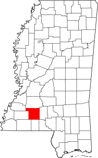 Location in the U.S. state of Mississippi | |
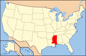 Mississippi's location in the U.S. | |
| Founded | 1870 |
| Named for | Abraham Lincoln |
| Seat | Brookhaven |
| Largest city | Brookhaven |
| Area | |
| • Total | 588 sq mi (1,523 km2) |
| • Land | 586 sq mi (1,518 km2) |
| • Water | 2.1 sq mi (5 km2), 0.4% |
| Population | |
| • (2010) | 34,869 |
| • Density | 59/sq mi (23/km²) |
| Congressional district | 3rd |
| Time zone | Central: UTC-6/-5 |
Lincoln County is a county located in the U.S. state of Mississippi. As of the 2010 census, the population was 34,869.[1] Its county seat is Brookhaven.[2]
The county was created by the legislature in April 7, 1870, during the Reconstruction Era. It was formed from portions of Lawrence, Pike, Franklin, Copiah, and Amite counties. It was named for Abraham Lincoln, the 16th President of the United States.[3]
Lincoln County comprises the Brookhaven, MS Micropolitan Statistical Area, which is included in the Jackson-Vicksburg-Brookhaven Combined Statistical Area. The county is southwest of the state capital of Jackson.
Geography
According to the U.S. Census Bureau, the county has a total area of 588 square miles (1,520 km2), of which 586 square miles (1,520 km2) is land and 2.1 square miles (5.4 km2) (0.4%) is water.[4]
Major highways
Adjacent counties
- Copiah County (north)
- Lawrence County (east)
- Walthall County (southeast)
- Pike County (south)
- Amite County (southwest)
- Franklin County (west)
- Jefferson County (northwest)
National protected area
- Homochitto National Forest (part), supervised by the United States Forestry Service of the U.S. Department of Agriculture.
Demographics
| Historical population | |||
|---|---|---|---|
| Census | Pop. | %± | |
| 1870 | 10,184 | — | |
| 1880 | 13,547 | 33.0% | |
| 1890 | 17,912 | 32.2% | |
| 1900 | 21,552 | 20.3% | |
| 1910 | 28,597 | 32.7% | |
| 1920 | 24,652 | −13.8% | |
| 1930 | 26,357 | 6.9% | |
| 1940 | 27,506 | 4.4% | |
| 1950 | 27,899 | 1.4% | |
| 1960 | 26,759 | −4.1% | |
| 1970 | 26,198 | −2.1% | |
| 1980 | 30,174 | 15.2% | |
| 1990 | 30,278 | 0.3% | |
| 2000 | 33,166 | 9.5% | |
| 2010 | 34,869 | 5.1% | |
| Est. 2015 | 34,649 | [5] | −0.6% |
| U.S. Decennial Census[6] 1790-1960[7] 1900-1990[8] 1990-2000[9] 2010-2013[1] | |||
As of the United States Census of 2000,[10] (which precedes the large changes and increases reflected in the figures, resulting from the substantial annexations and tripling of the size of the City of Brookhaven, the county seat, from late 2007, which would be reflected in the newer United States Census of 2010) - there were 33,166 people, 12,538 households, and 9,190 families residing in the county. The population density was 57 people per square mile (22/km²). There were 14,052 housing units at an average density of 24 per square mile (9/km²). The racial makeup of the county was 69.38% White, 29.67% Black or African American, 0.17% Native American, 0.24% Asian, 0.01% Pacific Islander, 0.16% from other races, and 0.37% from two or more races. 0.69% of the population were Hispanic or Latino of any race.
There were 12,538 households out of which 34.90% had children under the age of 18 living with them, 54.90% were married couples living together, 14.70% had a female householder with no husband present, and 26.70% were non-families. 24.40% of all households were made up of individuals and 11.50% had someone living alone who was 65 years of age or older. The average household size was 2.59 and the average family size was 3.08.
In the county the population was spread out with 26.70% under the age of 18, 9.50% from 18 to 24, 27.60% from 25 to 44, 22.30% from 45 to 64, and 13.90% who were 65 years of age or older. The median age was 36 years. For every 100 females there were 92.20 males. For every 100 females age 18 and over, there were 88.60 males.
The median income for a household in the county was $27,279, and the median income for a family was $33,552. Males had a median income of $29,060 versus $18,877 for females. The per capita income for the county was $13,961. About 16.00% of families and 19.20% of the population were below the poverty line, including 22.80% of those under age 18 and 17.10% of those age 65 or over.
Government
The Board of Supervisors governing Lincoln County, currently (June 2006) has the following members:
- District 1: Rev. Jerry Wilson (vice-president)
- District 2: Bobby J. Watts
- District 3: Nolan Earl Williamson
- District 4: Doug Moak
- District 5: Gary Walker (president)
The offices of president and vice-president on the county supervisors rotate annually.
This county does not have "home rule;" thus, the legislature reserved to itself power over the county. Its representatives and state senators help serve its residents.
Economy
The telecommunications company MCI Worldcom is located in Lincoln County. Its Chief Executive Officer (CEO) and founder Bernard Ebbers resided near Brookhaven prior to his conviction; he was sentenced to prison.
Education
.jpg)
The county is served by two separate public school districts, a private school, and a couple of smaller "Christian" or religious/private schools. The Lincoln County Public School District consists of four K-12 schools of elementary, middle school, and high school levels. These include Loyd Star, Bogue Chitto, West Lincoln and Enterprise. Through annexations, the City tripled its size in 2007.
Media
Lincoln County is served by the local newspaper Daily Leader, printed daily except Monday and Saturday. Residents may also purchase the larger daily newspaper from the state capital of Jackson, The Clarion-Ledger, which serves the central state metropolitan area and the entire State of Mississippi.
Communities
City
- Brookhaven (county seat)
Hamlets
Unincorporated communities
- Auburn
- East Lincoln
- Ruth
- Caseyville
Ghost towns
- Norfield
- Woolworth
See also
References
- 1 2 "State & County QuickFacts". United States Census Bureau. Retrieved September 4, 2013.
- ↑ "Find a County". National Association of Counties. Retrieved 2011-06-07.
- ↑ Gannett, Henry (1905). The Origin of Certain Place Names in the United States. U.S. Government Printing Office. p. 187.
- ↑ "2010 Census Gazetteer Files". United States Census Bureau. August 22, 2012. Retrieved November 6, 2014.
- ↑ "County Totals Dataset: Population, Population Change and Estimated Components of Population Change: April 1, 2010 to July 1, 2015". Retrieved July 2, 2016.
- ↑ "U.S. Decennial Census". United States Census Bureau. Retrieved November 6, 2014.
- ↑ "Historical Census Browser". University of Virginia Library. Retrieved November 6, 2014.
- ↑ "Population of Counties by Decennial Census: 1900 to 1990". United States Census Bureau. Retrieved November 6, 2014.
- ↑ "Census 2000 PHC-T-4. Ranking Tables for Counties: 1990 and 2000" (PDF). United States Census Bureau. Retrieved November 6, 2014.
- ↑ "American FactFinder". United States Census Bureau. Retrieved 2008-01-31.
External links
 |
Jefferson County | Copiah County | | |
| Franklin County | |
Lawrence County | ||
| ||||
| | ||||
| Amite County | Pike County | Walthall County |
Municipalities and communities of Lincoln County, Mississippi, United States | ||
|---|---|---|
| Cities | | |
| Town | ||
| CDPs | ||
| Other unincorporated communities | ||
| Ghost town | ||
| Footnotes | ‡This populated place also has portions in an adjacent county or counties | |
.svg.png)
Coordinates: 31°32′N 90°27′W / 31.54°N 90.45°W