Jefferson Davis County, Mississippi
| Jefferson Davis County, Mississippi | |
|---|---|
| County | |
| County of Jefferson Davis | |
 Jefferson Davis County courthouse in Prentiss | |
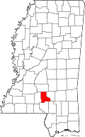 Location in the U.S. state of Mississippi | |
 Mississippi's location in the U.S. | |
| Founded | 1906 |
| Named for | Jefferson Davis |
| Seat | Prentiss |
| Largest town | Prentiss |
| Area | |
| • Total | 409 sq mi (1,059 km2) |
| • Land | 408 sq mi (1,057 km2) |
| • Water | 0.7 sq mi (2 km2), 0.2% |
| Population | |
| • (2010) | 12,487 |
| • Density | 31/sq mi (12/km²) |
| Congressional district | 3rd |
| Time zone | Central: UTC-6/-5 |
| Website | www.jeffersondaviscountyms.com |
Jefferson Davis County is a county located in the U.S. state of Mississippi. As of the 2010 census, the population was 12,487.[1] Its county seat is Prentiss.[2] The county is named in honor of Mississippi Senator and Confederate President Jefferson Davis. The county was carved out of Covington and Lawrence counties in March 1906. Governor James K. Vardaman signed the bill creating the county on May 9, 1906.
Geography
According to the U.S. Census Bureau, the county has a total area of 409 square miles (1,060 km2), of which 408 square miles (1,060 km2) is land and 0.7 square miles (1.8 km2) (0.2%) is water.[3]
Major highways
 U.S. Route 84
 Mississippi Highway 13
 Mississippi Highway 35
 Mississippi Highway 42
 Mississippi Highway 43
Adjacent counties
- Simpson County (north)
- Covington County (east)
- Lamar County (southeast)
- Marion County (south)
- Lawrence County (west)
Demographics
| Historical population | |||
|---|---|---|---|
| Census | Pop. | %± | |
| 1910 | 12,860 | — | |
| 1920 | 12,755 | −0.8% | |
| 1930 | 14,281 | 12.0% | |
| 1940 | 15,869 | 11.1% | |
| 1950 | 15,500 | −2.3% | |
| 1960 | 13,540 | −12.6% | |
| 1970 | 12,936 | −4.5% | |
| 1980 | 13,846 | 7.0% | |
| 1990 | 14,051 | 1.5% | |
| 2000 | 13,962 | −0.6% | |
| 2010 | 12,487 | −10.6% | |
| Est. 2015 | 11,665 | [4] | −6.6% |
| U.S. Decennial Census[5] 1790-1960[6] 1900-1990[7] 1990-2000[8] 2010-2013[1] | |||
As of the 2010 United States Census, there were 12,487 people residing in the county. 59.9% were Black or African American, 38.7% White, 0.3% Native American, 0.1% Asian, 0.3% of some other race and 0.7% of two or more races. 0.8% were Hispanic or Latino (of any race).
As of the census[9] of 2000, there were 13,962 people, 5,177 households, and 3,768 families residing in the county. The population density was 34 people per square mile (13/km²). There were 5,891 housing units at an average density of 14 per square mile (6/km²). The racial makeup of the county was 41.66% White, 57.38% Black or African American, 0.14% Native American, 0.18% Asian, 0.01% Pacific Islander, 0.08% from other races, and 0.57% from two or more races. 0.77% of the population were Hispanic or Latino of any race.
There were 5,177 households out of which 32.9% had children under the age of 18 living with them, 45.7% were married couples living together, 21.6% had a female householder with no husband present, and 27.2% were non-families. 25.0% of all households were made up of individuals and 11.9% had someone living alone who was 65 years of age or older. The average household size was 2.68 and the average family size was 3.20.
In the county the population was spread out with 28.4% under the age of 18, 9.9% from 18 to 24, 25.4% from 25 to 44, 22.5% from 45 to 64, and 13.8% who were 65 years of age or older. The median age was 35 years. For every 100 females there were 89.9 males. For every 100 females age 18 and over, there were 84.7 males.
The median income for a household in the county was $21,834, and the median income for a family was $27,594. Males had a median income of $23,942 versus $16,510 for females. The per capita income for the county was $11,974. About 23.2% of families and 28.2% of the population were below the poverty line, including 38.7% of those under age 18 and 24.5% of those age 65 or over.
Communities
Towns
Unincorporated communities
- Carson
- Oak Vale (partly in Lawrence County)
- Society Hill
Ghost town
See also
References
- 1 2 "State & County QuickFacts". United States Census Bureau. Retrieved September 3, 2013.
- ↑ "Find a County". National Association of Counties. Retrieved 2011-06-07.
- ↑ "2010 Census Gazetteer Files". United States Census Bureau. August 22, 2012. Retrieved November 4, 2014.
- ↑ "County Totals Dataset: Population, Population Change and Estimated Components of Population Change: April 1, 2010 to July 1, 2015". Retrieved July 2, 2016.
- ↑ "U.S. Decennial Census". United States Census Bureau. Retrieved November 4, 2014.
- ↑ "Historical Census Browser". University of Virginia Library. Retrieved November 4, 2014.
- ↑ "Population of Counties by Decennial Census: 1900 to 1990". United States Census Bureau. Retrieved November 4, 2014.
- ↑ "Census 2000 PHC-T-4. Ranking Tables for Counties: 1990 and 2000" (PDF). United States Census Bureau. Retrieved November 4, 2014.
- ↑ "American FactFinder". United States Census Bureau. Retrieved 2008-01-31.
External links
- Jefferson Davis County Website
- Jefferson Davis County Courthouse Pictures
- Jefferson Davis County Economic Development District Website
 |
Simpson County | | ||
| Lawrence County | |
Covington County | ||
| ||||
| | ||||
| Marion County | Lamar County |
Municipalities and communities of Jefferson Davis County, Mississippi, United States | ||
|---|---|---|
| Towns | | |
| Unincorporated communities | ||
| ghost town | ||
| Footnotes | ‡This community also has portions in adjacent county or counties | |
.svg.png)
Coordinates: 31°34′N 89°49′W / 31.56°N 89.82°W