Bunker, Missouri
| Bunker, Missouri | |
|---|---|
| City | |
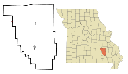 Location of Bunker, Missouri | |
| Coordinates: 37°27′19″N 91°12′37″W / 37.45528°N 91.21028°WCoordinates: 37°27′19″N 91°12′37″W / 37.45528°N 91.21028°W | |
| Country | United States |
| State | Missouri |
| Counties | Reynolds, Dent |
| Area[1] | |
| • Total | 0.66 sq mi (1.71 km2) |
| • Land | 0.66 sq mi (1.71 km2) |
| • Water | 0 sq mi (0 km2) |
| Elevation | 1,394 ft (425 m) |
| Population (2010)[2] | |
| • Total | 407 |
| • Estimate (2012[3]) | 408 |
| • Density | 616.7/sq mi (238.1/km2) |
| Time zone | Central (CST) (UTC-6) |
| • Summer (DST) | CDT (UTC-5) |
| ZIP code | 63629 |
| Area code(s) | 573 |
| FIPS code | 29-09694[4] |
| GNIS feature ID | 0749109[5] |
Bunker is a city in Dent and Reynolds Counties in the U.S. state of Missouri. The population was 407 at the 2010 census.
Community
Bunker is a logging and lead mine community, founded by Sylvanus J. Bunker in 1907.[6] Numerous small logging operations are still in existence. Bunker lies on the largest lead producing trend in North America. The Doe Run Company owns and operates the major lead mining operations in the region. The Bunker-Culler railroad was around for many years providing economical stability for the residents. The railroad moved lumber and supplies through Bunker and was located at the junction of Toms Creek Road and Highway 72. The rail yard allowed the locomotives hauling of timber logs off to the mills in southern Missouri.
Geography
Bunker is located at 37°27′19″N 91°12′37″W / 37.45528°N 91.21028°W (37.455356, -91.210317).[7]
According to the United States Census Bureau, the city has a total area of 0.66 square miles (1.71 km2), all of it land.[1]
Demographics
| Historical population | |||
|---|---|---|---|
| Census | Pop. | %± | |
| 1960 | 401 | — | |
| 1970 | 447 | 11.5% | |
| 1980 | 673 | 50.6% | |
| 1990 | 390 | −42.1% | |
| 2000 | 427 | 9.5% | |
| 2010 | 407 | −4.7% | |
| Est. 2015 | 400 | [8] | −1.7% |
2010 census
As of the census[2] of 2010, there were 407 people, 167 households, and 107 families residing in the city. The population density was 616.7 inhabitants per square mile (238.1/km2). There were 196 housing units at an average density of 297.0 per square mile (114.7/km2). The racial makeup of the city was 99.26% White, 0.25% Native American, and 0.49% from two or more races. Hispanic or Latino of any race were 0.98% of the population.
There were 167 households of which 32.9% had children under the age of 18 living with them, 43.7% were married couples living together, 16.2% had a female householder with no husband present, 4.2% had a male householder with no wife present, and 35.9% were non-families. 33.5% of all households were made up of individuals and 15.6% had someone living alone who was 65 years of age or older. The average household size was 2.37 and the average family size was 2.98.
The median age in the city was 38.3 years. 27.3% of residents were under the age of 18; 7.8% were between the ages of 18 and 24; 24.1% were from 25 to 44; 26.8% were from 45 to 64; and 14.3% were 65 years of age or older. The gender makeup of the city was 49.4% male and 50.6% female.
2000 census
As of the census[4] of 2000, there were 427 people, 176 households, and 111 families residing in the city. The population density was 661.8 people per square mile (253.6/km²). There were 196 housing units at an average density of 303.8 per square mile (116.4/km²). The racial makeup of the city was 92.97% White, 0.23% African American, 2.11% Native American, 0.23% Asian, 0.23% from other races, and 4.22% from two or more races. Hispanic or Latino of any race were 2.11% of the population.
There were 176 households out of which 33.0% had children under the age of 18 living with them, 45.5% were married couples living together, 13.6% had a female householder with no husband present, and 36.4% were non-families. 31.8% of all households were made up of individuals and 15.3% had someone living alone who was 65 years of age or older. The average household size was 2.36 and the average family size was 2.96.
In the city the population was spread out with 26.7% under the age of 18, 8.2% from 18 to 24, 29.7% from 25 to 44, 22.5% from 45 to 64, and 12.9% who were 65 years of age or older. The median age was 35 years. For every 100 females there were 99.5 males. For every 100 females age 18 and over, there were 92.0 males.
The median income for a household in the city was $19,659, and the median income for a family was $21,625. Males had a median income of $22,083 versus $15,417 for females. The per capita income for the city was $9,671. About 25.2% of families and 32.3% of the population were below the poverty line, including 41.3% of those under age 18 and 20.5% of those age 65 or over.
Notable natives
- Mel Bay (Musician best known for his series of music education books)
References
- 1 2 "US Gazetteer files 2010". United States Census Bureau. Archived from the original on 2012-01-24. Retrieved 2012-07-08.
- 1 2 "American FactFinder". United States Census Bureau. Retrieved 2012-07-08.
- ↑ "Population Estimates". United States Census Bureau. Archived from the original on 2013-06-17. Retrieved 2013-05-30.
- 1 2 "American FactFinder". United States Census Bureau. Archived from the original on 2013-09-11. Retrieved 2008-01-31.
- ↑ "US Board on Geographic Names". United States Geological Survey. 2007-10-25. Retrieved 2008-01-31.
- ↑ A BRIEF HISTORY OF BUNKER, MISSOURI Archived April 26, 2012, at the Wayback Machine.; Derived from the works of Floyd E. Sutterfield, Bunker Historian
- ↑ "US Gazetteer files: 2010, 2000, and 1990". United States Census Bureau. 2011-02-12. Retrieved 2011-04-23.
- ↑ "Annual Estimates of the Resident Population for Incorporated Places: April 1, 2010 to July 1, 2015". Retrieved July 2, 2016.
- ↑ "Census of Population and Housing". Census.gov. Archived from the original on April 22, 2013. Retrieved June 4, 2015.
Municipalities and communities of Dent County, Missouri, United States | ||
|---|---|---|
| Cities | 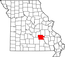 | |
| Townships | ||
| Unincorporated communities | ||
| Ghost towns | ||
| Footnotes | ‡This populated place also has portions in an adjacent county or counties | |
Municipalities and communities of Reynolds County, Missouri, United States | ||
|---|---|---|
| Cities |  | |
| Townships |
| |
| Unincorporated communities | ||
| Footnotes | ‡This populated place also has portions in an adjacent county or counties | |