Salem, Missouri
| Salem, Missouri | |
|---|---|
| City | |
|
Salem business district | |
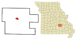 Location of Salem, Missouri | |
| Coordinates: 37°38′29″N 91°32′20″W / 37.64139°N 91.53889°W | |
| Country | United States |
| State | Missouri |
| County | Dent |
| Township | Spring Creek East |
| Government | |
| • Type | Mayor–council government |
| • Mayor | Brad Nash (also Dent County Fire Chief) |
| Area | |
| • Total | 3.18 sq mi (8.24 km2) |
| • Land | 3.18 sq mi (8.24 km2) |
| • Water | 0 sq mi (0 km2) |
| Elevation | 1,184 ft (361 m) |
| Population (2010)[1] | |
| • Total | 4,950 |
| • Estimate (2012[2]) | 4,964 |
| • Density | 1,556.6/sq mi (601.0/km2) |
| Time zone | Central (CST) (UTC-6) |
| • Summer (DST) | CDT (UTC-5) |
| ZIP code | 65560 |
| Area code(s) | 573 |
| FIPS code | 29-65234[3] |
| GNIS feature ID | 0725919[4] |
.JPG)
Salem is the county seat of Dent County, Missouri, United States. The population was 4,950 at the 2010 census which allows Salem to become a Class 3 city in Missouri; however, the city has chosen to remain a Class 4 city under Missouri Revised Statutes.[5][6][7] Salem is located a few miles north of the Ozark Scenic Riverways and close to Montauk State Park, which contains the headwaters of the Current River.
The name Salem is derived from the Hebrew word Shalom, meaning "peace".[8]
History
Dent County was first explored by Dustin Counts and settled between 1818 and 1829. In 1851 the Missouri Assembly created Dent County from Crawford and Shannon counties. It was named for early settler Lewis Dent, who served as the first representative. A log courthouse, built about 1851 or 1852, was Dent County's first and was located on the Wingfield farm northeast of Salem. W. P. Williams became the first mayor of Salem in 1860, just after the Missouri State Legislature passed laws regarding the administration of village government.[9] During the American Civil War, Salem was sometimes manned by units of the 5th Missouri State Militia.[10] Village governments were suspended during the Civil War.[11] In 1881, Salem was incorporated as a town.[12]
The town boasts a number of museums including the Ozark Natural & Cultural Resource Center, the Bonebrake Center of Nature and History, and a historic Downtown Walking Tour.[13][14]
A 2012 dog bite case that resulted in legal action generated significant media coverage for Salem.[15][16] David Backes of the St. Louis Blues and his wife got involved by securing a home for the dog in a no-kill animal shelter, though the offer was not needed after the matter was resolved.[17] The dog's owners applied for civil relief before associate circuit judge Scott Bernstein, which was granted, and the dog was returned to them sixteen months after being seized by town officials.[18] The result of the case was that political leadership in the 4th Class city arrangement was adjusted and at the next local election, the mayor of fourteen years was replaced by the veterinarian who boarded the yellow Labrador retriever.[19]
Geography
According to the United States Census Bureau, the city has a total area of 3.18 square miles (8.24 km2), all of it land.
Climate
Salem has a humid subtropical climate (Köppen climate classification Cfa). It has cool winters and warm summers with consistent rainfall year-round.
| Climate data for Salem, Missouri | |||||||||||||
|---|---|---|---|---|---|---|---|---|---|---|---|---|---|
| Month | Jan | Feb | Mar | Apr | May | Jun | Jul | Aug | Sep | Oct | Nov | Dec | Year |
| Average high °F (°C) | 43 (6) |
49 (9) |
59 (15) |
70 (21) |
77 (25) |
85 (29) |
90 (32) |
89 (32) |
81 (27) |
71 (22) |
57 (14) |
46 (8) |
68.1 (20) |
| Average low °F (°C) | 23 (−5) |
28 (−2) |
36 (2) |
45 (7) |
53 (12) |
61 (16) |
66 (19) |
64 (18) |
57 (14) |
46 (8) |
37 (3) |
27 (−3) |
45.3 (7.4) |
| Average precipitation inches (mm) | 2.19 (55.6) |
2.37 (60.2) |
4.02 (102.1) |
4.39 (111.5) |
4.55 (115.6) |
3.64 (92.5) |
3.56 (90.4) |
4.14 (105.2) |
3.80 (96.5) |
3.48 (88.4) |
4.36 (110.7) |
3.40 (86.4) |
43.9 (1,115) |
| Source: [20] | |||||||||||||
Demographics
| Historical population | |||
|---|---|---|---|
| Census | Pop. | %± | |
| 1870 | 280 | — | |
| 1880 | 1,624 | 480.0% | |
| 1890 | 1,815 | 11.8% | |
| 1900 | 1,481 | −18.4% | |
| 1910 | 1,796 | 21.3% | |
| 1920 | 1,771 | −1.4% | |
| 1930 | 2,250 | 27.0% | |
| 1940 | 3,151 | 40.0% | |
| 1950 | 3,611 | 14.6% | |
| 1960 | 3,870 | 7.2% | |
| 1970 | 4,363 | 12.7% | |
| 1980 | 4,454 | 2.1% | |
| 1990 | 4,486 | 0.7% | |
| 2000 | 4,854 | 8.2% | |
| 2010 | 4,950 | 2.0% | |
| Est. 2015 | 4,992 | [21] | 0.8% |
2010 census
As of the census[1] of 2010, there were 4,950 people, 2,152 households, and 1,248 families residing in the city. The population density was 1,556.6 inhabitants per square mile (601.0/km2). There were 2,408 housing units at an average density of 757.2 per square mile (292.4/km2). The racial makeup of the city was 95.94% White, 0.53% Black or African American, 1.13% Native American, 0.16% Asian, 0.08% Native Hawaiian or Pacific Islander, 0.32% from other races, and 1.84% from two or more races. Hispanic or Latino of any race were 1.17% of the population.
There were 2,152 households of which 28.5% had children under the age of 18 living with them, 40.1% were married couples living together, 13.6% had a female householder with no husband present, 4.3% had a male householder with no wife present, and 42.0% were non-families. 37.3% of all households were made up of individuals and 17.9% had someone living alone who was 65 years of age or older. The average household size was 2.24 and the average family size was 2.93.
The median age in the city was 39.5 years. 24.2% of residents were under the age of 18; 8.8% were between the ages of 18 and 24; 22.5% were from 25 to 44; 24.1% were from 45 to 64; and 20.3% were 65 years of age or older. The gender makeup of the city was 46.5% male and 53.5% female.
2000 census

As of the census[3] of 2000, there were 4,854 people, 2,115 households, and 1,269 families residing in the city. The population density was 1,607.4 people per square mile (620.6/km²). There were 2,368 housing units at an average density of 784.2 per square mile (302.7/km²). The racial makeup of the city was 97.05% White, 0.74% African American, 0.54% Native American, 0.16% Asian, 0.25% from other races, and 1.26% from two or more races. Hispanic or Latino of any race were 0.82% of the population.
There were 2,115 households out of which 28.2% had children under the age of 18 living with them, 44.3% were married couples living together, 12.7% had a female householder with no husband present, and 40.0% were non-families. 36.3% of all households were made up of individuals and 21.1% had someone living alone who was 65 years of age or older. The average household size was 2.21 and the average family size was 2.86.
In the city the population was spread out with 24.4% under the age of 18, 8.9% from 18 to 24, 24.7% from 25 to 44, 18.9% from 45 to 64, and 23.1% who were 65 years of age or older. The median age was 39 years. For every 100 females there were 81.6 males. For every 100 females age 18 and over, there were 74.9 males.
The median income for a household in the city was $21,648, and the median income for a family was $29,460. Males had a median income of $27,006 versus $17,285 for females. The per capita income for the city was $12,766. About 12.9% of families and 17.4% of the population were below the poverty line, including 22.8% of those under age 18 and 11.3% of those age 65 or over.
Education
Salem High School is the only high school located within the city. Salem is also home to an extension of Southwest Baptist University.
Notable people
- James Yancy Callahan, delegate to the United States House of Representatives representing the Oklahoma Territory (1887-1899).
- Ben Cantwell, MLB baseball player.
- Orien Crow, NFL football player.
- William P. Elmer, U.S. Representative from Missouri's 8th congressional district (1943-1945).
- Ralph K. Hofer, World War II Royal Canadian and (later) American fighter pilot, killed in action and recipient of the Distinguished Flying Cross (United States).
- Elmer Jacobs, MLB baseball player.
- Mitchell F. Jayne and The Dillards, bluegrass musicians.
- Paulette Jiles, novelist and poet.
- Jason T. Smith, U.S. Representative from Missouri's 8th congressional district (2013- ).
See also
References
- 1 2 "American FactFinder". United States Census Bureau. Retrieved 19 May 2013.
- ↑ "Population Estimates". United States Census Bureau. Retrieved 2013-05-30.
- 1 2 "American FactFinder". United States Census Bureau. Retrieved 2008-01-31.
- ↑ "US Board on Geographic Names". United States Geological Survey. 2007-10-25. Retrieved 2008-01-31.
- ↑ Missouri Revised Statutes. "Chapter 77 Third Class Cities". Government regulation publication. Missouri General Assembly. Retrieved 20 June 2013.
- ↑ Missouri Revised Statutes. "Chapter 79 Fourth Class Cities". State Government Legislation. Missouri General Assembly. Retrieved 20 June 2013.
- ↑ "About Salem, Missouri--Local Government". Government advertising site. Salem Area Chamber of Commerce. Retrieved 13 July 2013.
- ↑ Eaton, David Wolfe (1916). How Missouri Counties, Towns and Streams Were Named. The State Historical Society of Missouri. p. 165.
- ↑ "Salem's Historical Walking Tour" (PDF). Pamphlet, online. City of Salem. Retrieved 19 May 2013.
- ↑ Hewett, J. (1994). Supplement to the Official records of the Union and Confederate Armies. Wilmington, NC: Broadfoot Pub. Co. , Volume 35, p. 136
- ↑ "Salem's Historic Walking Tour" (PDF). Pamphlet available on the Internet. City of Salem. Retrieved 19 May 2013.
- ↑ "Historic Downtown Walking Tour of Salem" (PDF). Pamphlet available online. City of Salem. Retrieved 19 May 2013.
- ↑ "Our Community". Salem Missouri Website. City of Salem. Retrieved 19 May 2013.
- ↑ Pozen, Lauren (16 May 2013). "KSPR33". KSPR33-Shurz Communications. Retrieved 19 May 2013.
- ↑ "Phineas,The Dog Facing Death Row". Video. Inside Edition Inc. Retrieved 1 March 2014.
- ↑ Ribeiro, João Miguel. "Phineas, o cão de Salem, evita a morte ao desaparecer pela segunda vez". Portuguese Jornal. PT Jornal. Retrieved 22 October 2013.
- ↑ Peters, Chris (17 May 2013). "David Backes taking up fight to save dog on death row". CBS Sports, CBS Broadcasting. Retrieved 19 May 2013.
- ↑ Dudley, Allyssa (27 October 2013). "Phineas at safe house; Judge says he's innocent". The Salem News. Retrieved 27 October 2013.
- ↑ Dodd, Donald. "If change is in the wind, much of it will be in the hands of aldermen". Newspaper. Salem News Online. Retrieved 15 April 2014.
- ↑ "Monthly averages for Salem, MO". The Weather Channel. Retrieved 19 May 2013.
- ↑ "Annual Estimates of the Resident Population for Incorporated Places: April 1, 2010 to July 1, 2015". Retrieved July 2, 2016.
- ↑ "Census of Population and Housing". Census.gov. Retrieved June 4, 2015.
External links
Coordinates: 37°38′29″N 91°32′20″W / 37.64139°N 91.53889°W
- Salem, Missouri Chamber of Commerce website
- Historic maps of Salem in the Sanborn Maps of Missouri Collection at the University of Missouri
Municipalities and communities of Dent County, Missouri, United States | ||
|---|---|---|
| Cities | 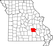 | |
| Townships | ||
| Unincorporated communities | ||
| Ghost towns | ||
| Footnotes | ‡This populated place also has portions in an adjacent county or counties | |