Caldwell, Kansas
| Caldwell, Kansas | |
|---|---|
| City | |
 Location within Sumner County and Kansas | |
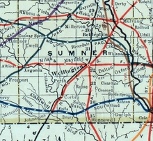
 KDOT map of Sumner County (legend) | |
| Coordinates: 37°2′3″N 97°36′32″W / 37.03417°N 97.60889°WCoordinates: 37°2′3″N 97°36′32″W / 37.03417°N 97.60889°W | |
| Country | United States |
| State | Kansas |
| County | Sumner |
| Area[1] | |
| • Total | 1.09 sq mi (2.82 km2) |
| • Land | 1.09 sq mi (2.82 km2) |
| • Water | 0 sq mi (0 km2) |
| Elevation | 1,142 ft (348 m) |
| Population (2010)[2] | |
| • Total | 1,068 |
| • Estimate (2015)[3] | 1,030 |
| • Density | 980/sq mi (380/km2) |
| Time zone | Central (CST) (UTC-6) |
| • Summer (DST) | CDT (UTC-5) |
| ZIP code | 67022 |
| Area code | 620 |
| FIPS code | 20-09900 [4] |
| GNIS feature ID | 0470089 [5] |
| Website | City Website |
Caldwell is a city in Sumner County, Kansas, United States. As of the 2010 census, the city population was 1,068.[6]
History
Caldwell was founded in 1871. It is named for Senator Alexander Caldwell.[7] Caldwell was incorporated as a city in 1879.[8] The first post office in Caldwell was established in May 1871.[9] The Chisholm Trail ran along the east side of the community from 1867 to 1871.[10]
In 1887, the Chicago, Kansas and Nebraska Railway built a branch line north-south from Herington to Caldwell.[11] This branch line connected Herington, Lost Springs, Lincolnville, Antelope, Marion, Aulne, Peabody, Elbing, Whitewater, Furley, Kechi, Wichita, Peck, Corbin, Wellington, Caldwell. This branch line was extended to Pond Creek, Oklahoma in 1888,[11] and connected Caldwell, Renfrow, Medford, Jefferson (the original Pond Creek). By 1893, it was incrementally built to Fort Worth, Texas. This railroad foreclosed in 1891 and was taken over by Chicago, Rock Island and Pacific Railway, which shut down in 1980 and reorganized as Oklahoma, Kansas and Texas Railroad, merged in 1988 with Missouri Pacific Railroad, merged in 1997 with Union Pacific Railroad. Most locals still refer to this railroad as the "Rock Island."
Geography
Caldwell is located at 37°2′3″N 97°36′32″W / 37.03417°N 97.60889°W (37.034077, -97.609022).[12] According to the United States Census Bureau, the city has a total area of 1.09 square miles (2.82 km2), all of it land.[1]
Climate
The climate in this area is characterized by hot, humid summers and generally mild to cool winters. According to the Köppen Climate Classification system, Caldwell has a humid subtropical climate, abbreviated "Cfa" on climate maps.[13]
Demographics
| Historical population | |||
|---|---|---|---|
| Census | Pop. | %± | |
| 1880 | 1,005 | — | |
| 1890 | 1,642 | 63.4% | |
| 1900 | 1,574 | −4.1% | |
| 1910 | 2,205 | 40.1% | |
| 1920 | 2,191 | −0.6% | |
| 1930 | 2,046 | −6.6% | |
| 1940 | 1,962 | −4.1% | |
| 1950 | 2,000 | 1.9% | |
| 1960 | 1,788 | −10.6% | |
| 1970 | 1,540 | −13.9% | |
| 1980 | 1,401 | −9.0% | |
| 1990 | 1,351 | −3.6% | |
| 2000 | 1,284 | −5.0% | |
| 2010 | 1,068 | −16.8% | |
| Est. 2015 | 1,030 | [3] | −3.6% |
| U.S. Decennial Census | |||
2010 census
As of the census[2] of 2010, there were 1,068 people, 495 households, and 277 families residing in the city. The population density was 979.8 inhabitants per square mile (378.3/km2). There were 642 housing units at an average density of 589.0 per square mile (227.4/km2). The racial makeup of the city was 95.2% White, 0.8% African American, 1.7% Native American, 0.1% Asian, 1.1% from other races, and 1.0% from two or more races. Hispanic or Latino of any race were 3.1% of the population.
There were 495 households of which 23.6% had children under the age of 18 living with them, 45.5% were married couples living together, 7.3% had a female householder with no husband present, 3.2% had a male householder with no wife present, and 44.0% were non-families. 40.0% of all households were made up of individuals and 22.1% had someone living alone who was 65 years of age or older. The average household size was 2.14 and the average family size was 2.85.
The median age in the city was 47.1 years. 21.1% of residents were under the age of 18; 6.5% were between the ages of 18 and 24; 19.7% were from 25 to 44; 28.6% were from 45 to 64; and 24% were 65 years of age or older. The gender makeup of the city was 48.0% male and 52.0% female.
2000 census
As of the census[4] of 2000, there were 1,284 people, 574 households, and 328 families residing in the city. The population density was 1,169.3 people per square mile (450.7/km²). There were 668 housing units at an average density of 608.3 per square mile (234.5/km²). The racial makeup of the city was 96.50% White, 0.08% African American, 1.32% Native American, 0.47% Asian, 0.08% from other races, and 1.56% from two or more races. Hispanic or Latino of any race were 1.17% of the population.
There were 574 households out of which 25.8% had children under the age of 18 living with them, 48.8% were married couples living together, 6.4% had a female householder with no husband present, and 42.7% were non-families. 40.6% of all households were made up of individuals and 23.0% had someone living alone who was 65 years of age or older. The average household size was 2.14 and the average family size was 2.88.
In the city the population was spread out with 21.7% under the age of 18, 6.1% from 18 to 24, 20.8% from 25 to 44, 22.7% from 45 to 64, and 28.7% who were 65 years of age or older. The median age was 46 years. For every 100 females there were 88.8 males. For every 100 females age 18 and over, there were 81.6 males.
The median income for a household in the city was $26,991, and the median income for a family was $39,931. Males had a median income of $31,346 versus $19,453 for females. The per capita income for the city was $17,340. About 9.3% of families and 15.5% of the population were below the poverty line, including 17.8% of those under age 18 and 8.9% of those age 65 or over.
Transportation
The Caldwell Municipal Airport is a city-owned public-use airport located one nautical mile (1.15 mi, 1.85 km) east of Caldwell's central business district.[14]
Area attractions
Area events
- Community Calendar
- Lighted Christmas Parade
- Oktoberfest
- Chisholm Trail Festival
Notable people
- Gladys Anderson Emerson, scientist, educator, and historian
- Byron Berline, famous American fiddle player
- Max Showalter, American film, television actor, musician
See also
References
- 1 2 "US Gazetteer files 2010". United States Census Bureau. Archived from the original on 2012-07-14. Retrieved 2012-07-06.
- 1 2 "American FactFinder". United States Census Bureau. Retrieved 2012-07-06.
- 1 2 "Annual Estimates of the Resident Population for Incorporated Places: April 1, 2010 to July 1, 2015". Retrieved July 2, 2016.
- 1 2 "American FactFinder". United States Census Bureau. Archived from the original on 2013-09-11. Retrieved 2008-01-31.
- ↑ "US Board on Geographic Names". United States Geological Survey. 2007-10-25. Retrieved 2008-01-31.
- ↑ "2010 City Population and Housing Occupancy Status". U.S. Census Bureau. Archived from the original on July 21, 2011. Retrieved March 6, 2011.
- ↑ Kansas State Historical Society (1916). Biennial Report of the Board of Directors of the Kansas State Historical Society. Kansas State Printing Plant. p. 305.
- ↑ Blackmar, Frank Wilson (1912). Kansas: A Cyclopedia of State History, Embracing Events, Institutions, Industries, Counties, Cities, Towns, Prominent Persons, Etc. Standard Publishing Company. p. 269.
- ↑ "Kansas Post Offices, 1828-1961". Kansas Historical Society. Archived from the original on October 9, 2013. Retrieved 27 June 2014.
- ↑ Route of the Chisholm cattle trail in Kansas; Kansas Historical Society, 1960s.
- 1 2 Rock Island Rail History
- ↑ "US Gazetteer files: 2010, 2000, and 1990". United States Census Bureau. 2011-02-12. Retrieved 2011-04-23.
- ↑ Climate Summary for Caldwell, Kansas
- ↑ FAA Airport Master Record for 01K (Form 5010 PDF). Federal Aviation Administration. Effective 30 June 2011.
External links
| Wikimedia Commons has media related to Caldwell, Kansas. |
- City
- Schools
- USD 360, local school district
- Maps
- Caldwell City Map, KDOT
Municipalities and communities of Sumner County, Kansas, United States | ||
|---|---|---|
| Cities |  | |
| CDP | ||
| Unincorporated communities | ||
| Footnotes | ‡This populated place also has portions in an adjacent county or counties | |