Herington, Kansas
| Herington, Kansas | |
|---|---|
| City | |
|
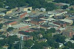
Aerial view of Herington (2013) | |
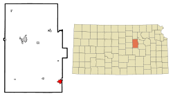 Location within Dickinson County and Kansas | |
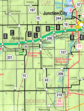 KDOT map of Dickinson County (legend) | |
| Coordinates: 38°40′19″N 96°56′44″W / 38.67194°N 96.94556°WCoordinates: 38°40′19″N 96°56′44″W / 38.67194°N 96.94556°W | |
| Country | United States |
| State | Kansas |
| Counties | Dickinson, Morris |
| Area[1] | |
| • Total | 5.09 sq mi (13.18 km2) |
| • Land | 5.06 sq mi (13.11 km2) |
| • Water | 0.03 sq mi (0.08 km2) |
| Elevation | 1,355 ft (413 m) |
| Population (2010)[2] | |
| • Total | 2,526 |
| • Estimate (2015)[3] | 2,396 |
| • Density | 500/sq mi (190/km2) |
| Time zone | Central (CST) (UTC-6) |
| • Summer (DST) | CDT (UTC-5) |
| ZIP code | 67449 |
| Area code | 785 |
| FIPS code | 20-31400 [4] |
| GNIS feature ID | 0476991 [5] |
| Website | City Website |
Herington is a city in Dickinson and Morris counties in the U.S. state of Kansas. As of the 2010 census, the city population was 2,526.[6]
History
Early history
For many millennia, the Great Plains of North America was inhabited by nomadic Native Americans. From the 16th century to 18th century, the Kingdom of France claimed ownership of large parts of North America. In 1762, after the French and Indian War, France secretly ceded New France to Spain, per the Treaty of Fontainebleau.
19th century
In 1802, Spain returned most of the land to France. In 1803, most of the land for modern day Kansas was acquired by the United States from France as part of the 828,000 square mile Louisiana Purchase for 2.83 cents per acre.
In 1854, the Kansas Territory was organized, then in 1861 Kansas became the 34th U.S. state. In 1857, Dickinson County was established within the Kansas Territory, which included the land for modern day Herington.
Herington was named after its founder, Monroe Davis Herington. His name at birth was Davis Monroe Herrington, but he later dropped the second "r" from his last name.[7]
The first post office in Herrington was established in February 1884.[8]
In 1887, Mr. Herington successfully got the Chicago, Kansas and Nebraska Railway to build through Herington. He gave the land and right-of-way for Herington to become a division point with shops, two round houses, freight house, bridge yards, telegraph office and many other buildings. He furnished the limestone for the freight house, and for a two story depot that was 28 by 66 feet (8.5 m × 20.1 m) and later enlarged to 28 by 105 feet (8.5 m × 32.0 m).[9]
In 1887, the Chicago, Kansas and Nebraska Railway built a main line from Topeka to Herington.[10] This main line connected Topeka, Valencia, Willard, Maple Hill, Vera, Paxico, McFarland, Alma, Volland, Alta Vista, Dwight, White City, Latimer, Herington.
In 1887, the Chicago, Kansas and Nebraska Railway extended its main line from Herington to Pratt.[10] This main line connected Herington, Ramona, Tampa, Durham, Waldeck, Canton, Galva, McPherson, Groveland, Inman, Medora, Hutchinson, Whiteside, Partridge, Arlington, Langdon, Turon, Preston, Natrona, Pratt. In 1888, this main line was extended to Liberal. Later, this line was extended to Tucumcari, New Mexico and El Paso, Texas. This line is called the "Golden State Limited".
In 1887, the Chicago, Kansas and Nebraska Railway built a branch line north-south from Herington to Caldwell.[10] This branch line connected Herington, Lost Springs, Lincolnville, Antelope, Marion, Aulne, Peabody, Elbing, Whitewater, Furley, Kechi, Wichita, Peck, Corbin, Wellington, Caldwell. By 1893, this branch line was incrementally built to Fort Worth, Texas. This line is called the "OKT".
The Chicago, Kansas and Nebraska Railway was foreclosed in 1891 and was taken over by Chicago, Rock Island and Pacific Railway, which shut down in 1980 and reorganized as Oklahoma, Kansas and Texas Railroad, merged in 1988 with Missouri Pacific Railroad, merged in 1997 with Union Pacific Railroad. Most locals still refer to this railroad as the "Rock Island".
20th century
The National Old Trails Road, also known as the Ocean-to-Ocean Highway, was established in 1912, and was routed through Herington, Delavan, Council Grove.
In World War II, Herington Army Airfield was built and was one of only two fields that processed heavy bombardment crews and equipment staging to the coasts for overseas duty. The field was later turned over to the City of Herington and is currently used as a municipal airport.[9]
Geography
Herington is located at 38°40′19″N 96°56′44″W / 38.67194°N 96.94556°W (38.671990, -96.945423).[11] According to the United States Census Bureau, the city has a total area of 5.09 square miles (13.18 km2), of which, 5.06 square miles (13.11 km2) is land and 0.03 square miles (0.08 km2) is water.[1]
Area attractions
- Herington Historial Museum, 800 S Broadway St.[12]
- Kansas Historical Marker - Dwight David Eisenhower, approximately 1 mi south on US-56.[13] In 2012, the Eisnhower maker replaced the previous Father Juan De Padilla And Quivira marker.[14]
Demographics
| Historical population | |||
|---|---|---|---|
| Census | Pop. | %± | |
| 1890 | 1,353 | — | |
| 1900 | 1,607 | 18.8% | |
| 1910 | 3,273 | 103.7% | |
| 1920 | 4,065 | 24.2% | |
| 1930 | 4,519 | 11.2% | |
| 1940 | 3,804 | −15.8% | |
| 1950 | 3,775 | −0.8% | |
| 1960 | 3,702 | −1.9% | |
| 1970 | 3,165 | −14.5% | |
| 1980 | 2,930 | −7.4% | |
| 1990 | 2,685 | −8.4% | |
| 2000 | 2,563 | −4.5% | |
| 2010 | 2,526 | −1.4% | |
| Est. 2015 | 2,396 | [3] | −5.1% |
| U.S. Decennial Census | |||
2010 census
As of the census[2] of 2010, there were 2,526 people, 1,082 households, and 666 families residing in the city. The population density was 499.2 inhabitants per square mile (192.7/km2). There were 1,300 housing units at an average density of 256.9 per square mile (99.2/km2). The racial makeup of the city was 93.3% White, 0.4% African American, 0.9% Native American, 0.5% Asian, 0.2% Pacific Islander, 1.7% from other races, and 2.9% from two or more races. Hispanic or Latino of any race were 5.7% of the population.
There were 1,082 households of which 32.3% had children under the age of 18 living with them, 44.0% were married couples living together, 12.4% had a female householder with no husband present, 5.2% had a male householder with no wife present, and 38.4% were non-families. 33.5% of all households were made up of individuals and 16.8% had someone living alone who was 65 years of age or older. The average household size was 2.29 and the average family size was 2.89.
The median age in the city was 39.2 years. 25.1% of residents were under the age of 18; 7.8% were between the ages of 18 and 24; 22.8% were from 25 to 44; 24.4% were from 45 to 64; and 19.9% were 65 years of age or older. The gender makeup of the city was 47.8% male and 52.2% female.
2000 census
As of the census[4] of 2000, there were 2,563 people, 1,126 households, and 669 families residing in the city. The population density was 1,206.9 people per square mile (466.8/km²). There were 1,305 housing units at an average density of 614.5 per square mile (237.7/km²).
The racial makeup of the city was 95.8% White, 0.6% African American, 0.4% Native American, 0.5% Asian, <0.1% Pacific Islander, 1.6% from other races, and 1.0% from two or more races. Hispanic or Latino of any race were 4.5% of the population.
There were 1,126 households out of which 26.6% had children under the age of 18 living with them, 47.2% were married couples living together, 8.9% had a female householder with no husband present, and 40.5% were non-families. 36.9% of all households were made up of individuals and 19.9% had someone living alone who was 65 years of age or older. The average household size was 2.21 and the average family size was 2.88.
In the city the population was spread out with 24.0% under the age of 18, 7.0% from 18 to 24, 25.0% from 25 to 44, 20.1% from 45 to 64, and 24.0% who were 65 years of age or older. The median age was 41 years. For every 100 females there were 88.7 males. For every 100 females age 18 and over, there were 83.7 males.
The median income for a household in the city was $28,333, and the median income for a family was $36,696. Males had a median income of $28,359 versus $15,515 for females. The per capita income for the city was $16,526. About 6.2% of families and 8.2% of the population were below the poverty line, including 10.0% of those under age 18 and 7.6% of those age 65 or over.
Government
The Herington government consists of a mayor and four council members.
- City Hall, 17 N Broadway St.[12]
- Police and Fire Department, 700 S Broadway St.[12]
- Community Building, 810 S Broadway St.[12]
Education
Primary and secondary education
Herington is part of Unified School District 487.[15][16] The high school is a member of T.E.E.N., a shared video teaching network between five area high schools.[17]
- Herington High School, 1401 N "D" St.[12]
- Herington Middle School, 1317 N "D" St.[12]
- Herington Elementary School, 201 E Hawley St.[12]
- Herington Little Railer Preschool, 201 E Hawley St.[12]
Library
- Herington Public Library, 102 S Broadway St, a Carnegie library.[18]
Transportation
Herington has had a rich history with railroads. From its beginnings, Herington has been a hub for the Rock Island, the Cotton Belt Route, Southern Pacific, and currently Union Pacific Railroad. UP still uses this as its hub on its system to this day. Herington has also been served by the Rio Grande, Missouri Pacific, and the Oklahoma, Kansas and Texas Railroad.
Herington Regional Airport, FAA:HRU,[19] ICAO:KHRU, is located seven nautical miles (13 km) east of its central business district, centered at 38°41′54″N 96°48′29″W / 38.69833°N 96.80800°W.[20]
Notable people
- Bruce P. Blake, Bishop of the United Methodist Church
- John H. Eastwood, World War II US Army Air Forces chaplain
- Emil Kapaun, Roman Catholic priest and Medal Of Honor recipient United States Army chaplain
- Terry Nichols, accomplice in the bombing of the Alfred P. Murrah Federal Building in Oklahoma City, Oklahoma
See also
Further reading
References
- 1 2 "US Gazetteer files 2010". United States Census Bureau. Retrieved 2012-07-06.
- 1 2 "American FactFinder". United States Census Bureau. Retrieved 2012-07-06.
- 1 2 "Annual Estimates of the Resident Population for Incorporated Places: April 1, 2010 to July 1, 2015". Retrieved July 2, 2016.
- 1 2 "American FactFinder". United States Census Bureau. Retrieved 2008-01-31.
- ↑ "US Board on Geographic Names". United States Geological Survey. 2007-10-25. Retrieved 2008-01-31.
- ↑ "2010 City Population and Housing Occupancy Status". U.S. Census Bureau. Retrieved March 6, 2011.
- ↑ Herington History
- ↑ "Kansas Post Offices, 1828-1961 (archived)". Kansas Historical Society. Archived from the original on September 9, 2013. Retrieved 8 June 2014.
- 1 2 Herington History
- 1 2 3 Rock Island Rail History
- ↑ "US Gazetteer files: 2010, 2000, and 1990". United States Census Bureau. 2011-02-12. Retrieved 2011-04-23.
- 1 2 3 4 5 6 7 8 Herington Service Summary
- ↑ Kansas Historical Marker - Dwight David Eisenhower
- ↑ Kansas Historical Marker - Father Juan De Padilla And Quivira
- ↑ USD 487
- ↑ Kansas School District Boundary Map
- ↑ T.E.E.N. video teaching network
- ↑ Herington Public Library
- ↑ Herington Regional Airport map
- ↑ Herington Regional Airport information
External links
| Wikimedia Commons has media related to Herington, Kansas. |
- City
- Schools
- USD 487, local school district
- USD 487 School District Boundary Map, KDOT
- Historical
- Historic Images of Herington, Special Photo Collections at Wichita State University Library
- 1961 photo of Chicago, Rock Island & Pacific Railroad depot
- 1961 photo of Missouri Pacific Railroad depot
- Maps
- Herington City Map, KDOT
Municipalities and communities of Dickinson County, Kansas, United States | ||
|---|---|---|
| Cities | 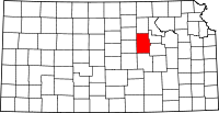 | |
| CDPs | ||
| Unincorporated communities | ||
| Townships | ||
| Footnotes | ‡This populated place also has portions in an adjacent county or counties | |
Municipalities and communities of Morris County, Kansas, United States | ||
|---|---|---|
| Cities | 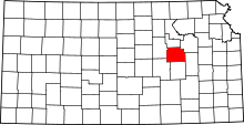 | |
| Unincorporated communities | ||
| Townships |
| |
| Footnotes | ‡This populated place also has portions in an adjacent county or counties | |