Caledonia, Michigan
| Caledonia, Michigan | |
|---|---|
| Village | |
 Location of Caledonia, Michigan | |
| Coordinates: 42°47′23″N 85°30′50″W / 42.78972°N 85.51389°W | |
| Country | United States |
| State | Michigan |
| County | Kent |
| Area[1] | |
| • Total | 1.41 sq mi (3.65 km2) |
| • Land | 1.33 sq mi (3.44 km2) |
| • Water | 0.08 sq mi (0.21 km2) |
| Elevation | 810 ft (247 m) |
| Population (2010)[2] | |
| • Total | 1,511 |
| • Estimate (2012[3]) | 1,534 |
| • Density | 1,136.1/sq mi (438.7/km2) |
| Time zone | Eastern (EST) (UTC-5) |
| • Summer (DST) | EDT (UTC-4) |
| ZIP code | 49316 |
| Area code(s) | 616 |
| FIPS code | 26-12480[4] |
| GNIS feature ID | 0622452[5] |
Caledonia is a village in Kent County of the U.S. state of Michigan. The population was 1,511 at the 2010 census. The village lies entirely within Caledonia Township.
History
Caledonia was incorporated as a village in 1888.[6]
Geography
According to the United States Census Bureau, the village has a total area of 1.41 square miles (3.65 km2), of which, 1.33 square miles (3.44 km2) of it is land and 0.08 square miles (0.21 km2) is water.[1]
The Grand Rapids VOR is located in Caledonia, used by aircraft navigating to nearby Gerald R. Ford International Airport.
Education
There are nine public schools in Caledonia and the surrounding area, all of which belong to Caledonia Community Schools. Caledonia High School(CHS)—built in 2004—has an enrollment of 1,250 students. Across the street is Glenmor High School, the alternative school, built in 2006.
There are two middle schools: Kraft Meadows Middle School (KMMS) and Duncan Lake Middle School (DLMS). They have a few sporty competitions between each other. Both opened in 2004, although the buildings have been around longer. KMMS is the original Caledonia Middle School, and DLMS is what used to be the Caledonia High School.[7]
There are five elementary schools: Caledonia Elementary (the original, across the street from DLMS), Emmons Lake Elementary, Dutton Elementary, Kettle Lake Elementary, and Paris Ridge Elementary.[8]
Emmons Lake runs on an alternative school schedule that is longer on the calendar, but the same amount of school days. They begin in August, three weeks earlier than the rest of the schools, and have Fridays off during those three weeks, get a week off in October and February, receive a two-week spring break, and end a week later than the other schools in the district.
There are also two Christian schools in Caledonia, Faith Reformed Christian School [9] and Dutton Christian School, serving pre-kindergarten to 8th grade.http://www.duttonchristianschool.org/. For the 2009/2010 school year at Dutton Christian School, enrollment was 405 students[10] with an additional 69 students in Noah's Ark Pre-kindergarten program. The elementary is adding on two Early Childhood Program classrooms to be completed by the fall of 2011.[11]
Sports and athletics
Caledonia's athletic teams are known as the Fighting Scots. Colors are Purple and Gold. Prior to 1970 they were known as the scotties, a small dog being the mascot. In the early 1970s the name was changed to the fighting Scots and the mascot to a fighting Scotsman in a kilt who carried a sword. The mascot was painted onto the wall of the gym. The most recent mascot is wearing a kilt, swordless and carrying a knapsack. The boys cross country team were state champions in 1996, while the girls cross country team were state champions in 1993, 1994, 1995, and 1996.[12] Additionally, the football team were state champions in 2005 and the girls golf team won the 2002 State Championship in Division 2.
Demographics
| Historical population | |||
|---|---|---|---|
| Census | Pop. | %± | |
| 1880 | 340 | — | |
| 1890 | 438 | 28.8% | |
| 1900 | 427 | −2.5% | |
| 1910 | 422 | −1.2% | |
| 1920 | 432 | 2.4% | |
| 1930 | 469 | 8.6% | |
| 1940 | 467 | −0.4% | |
| 1950 | 619 | 32.5% | |
| 1960 | 739 | 19.4% | |
| 1970 | 716 | −3.1% | |
| 1980 | 722 | 0.8% | |
| 1990 | 885 | 22.6% | |
| 2000 | 1,102 | 24.5% | |
| 2010 | 1,511 | 37.1% | |
| Est. 2015 | 1,590 | [13] | 5.2% |
Municipalities and communities of Kent County, Michigan, United States | ||
|---|---|---|
| Cities | 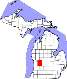 | |
| Villages | ||
| Charter townships | ||
| General law townships | ||
| CDPs | ||
| Other unincorporated communities | ||
| Footnotes | ‡This populated place also has portions in an adjacent county or counties | |
2010 census
As of the census[2] of 2010, there were 1,511 people, 529 households, and 392 families residing in the village. The population density was 1,136.1 inhabitants per square mile (438.7/km2). There were 549 housing units at an average density of 412.8 per square mile (159.4/km2). The racial makeup of the village was 96.8% White, 0.7% African American, 0.1% Native American, 0.7% Asian, 0.6% from other races, and 1.0% from two or more races. Hispanic or Latino of any race were 2.7% of the population.
There were 529 households of which 50.9% had children under the age of 18 living with them, 54.4% were married couples living together, 14.2% had a female householder with no husband present, 5.5% had a male householder with no wife present, and 25.9% were non-families. 21.7% of all households were made up of individuals and 5.3% had someone living alone who was 65 years of age or older. The average household size was 2.86 and the average family size was 3.36.
The median age in the village was 30.7 years. 34.9% of residents were under the age of 18; 8.2% were between the ages of 18 and 24; 29.6% were from 25 to 44; 21.4% were from 45 to 64; and 5.8% were 65 years of age or older. The gender makeup of the village was 49.5% male and 50.5% female.
2000 census
As of the census[4] of 2000, there were 1,102 people, 430 households, and 304 families residing in the village. The population density was 816.3 per square mile (315.2/km²). There were 449 housing units at an average density of 332.6 per square mile (128.4/km²). The racial makeup of the village was 97.91% White, 0.27% African American, 0.09% Native American, 0.54% Asian, 0.09% Pacific Islander, 0.36% from other races, and 0.73% from two or more races. Hispanic or Latino of any race were 1.18% of the population.
There were 430 households out of which 42.3% had children under the age of 18 living with them, 55.6% were married couples living together, 12.8% had a female householder with no husband present, and 29.1% were non-families. 25.1% of all households were made up of individuals and 9.1% had someone living alone who was 65 years of age or older. The average household size was 2.56 and the average family size was 3.08.
In the village the population was spread out with 31.1% under the age of 18, 7.1% from 18 to 24, 34.1% from 25 to 44, 17.6% from 45 to 64, and 10.1% who were 65 years of age or older. The median age was 32 years. For every 100 females there were 97.1 males. For every 100 females age 18 and over, there were 90.7 males.
The median income for a household in the village was $50,724, and the median income for a family was $56,429. Males had a median income of $45,804 versus $33,750 for females. The per capita income for the village was $22,386. About 4.7% of families and 3.7% of the population were below the poverty line, including 4.5% of those under age 18 and 5.5% of those age 65 or over.
See also
Climate
This climatic region is typified by large seasonal temperature differences, with warm to hot (and often humid) summers and cold (sometimes severely cold) winters. According to the Köppen Climate Classification system, Caledonia has a humid continental climate, abbreviated "Dfb" on climate maps.[15]
References
- 1 2 "US Gazetteer files 2010". United States Census Bureau. Archived from the original on 2012-07-14. Retrieved 2012-11-25.
- 1 2 "American FactFinder". United States Census Bureau. Retrieved 2012-11-25.
- ↑ "Population Estimates". United States Census Bureau. Archived from the original on 2013-06-17. Retrieved 2013-06-03.
- 1 2 "American FactFinder". United States Census Bureau. Archived from the original on 2013-09-11. Retrieved 2008-01-31.
- ↑ "US Board on Geographic Names". United States Geological Survey. 2007-10-25. Retrieved 2008-01-31.
- ↑ Walter Romig, Michigan Place Names, p. 93
- ↑ Caledonia Community Schools - In the Pursuit of Excellence
- ↑ Welcome to Paris Ridge Elementary : Paris Ridge Elementary
- ↑ Faith Reformed Christian School - Caledonia, Michigan - MI - School overview
- ↑ http://www.illumed.co/school/michigan/caledonia/dutton-christian-school
- ↑ History of West Michigan Private Christian School | Dutton Christian School
- ↑
- ↑ "Annual Estimates of the Resident Population for Incorporated Places: April 1, 2010 to July 1, 2015". Retrieved July 2, 2016.
- ↑ "Census of Population and Housing". Census.gov. Archived from the original on May 11, 2015. Retrieved June 4, 2015.
- ↑ Climate Summary for Caledonia, Michigan
Coordinates: 42°47′21″N 85°31′00″W / 42.78917°N 85.51667°W