Kent City, Michigan
| Kent City, Michigan | |
|---|---|
| Village | |
 Location of Kent City, Michigan | |
| Coordinates: 43°13′9″N 85°45′13″W / 43.21917°N 85.75361°WCoordinates: 43°13′9″N 85°45′13″W / 43.21917°N 85.75361°W | |
| Country | United States |
| State | Michigan |
| County | Kent |
| Area[1] | |
| • Total | 1.32 sq mi (3.42 km2) |
| • Land | 1.32 sq mi (3.42 km2) |
| • Water | 0 sq mi (0 km2) |
| Elevation | 810 ft (247 m) |
| Population (2010)[2] | |
| • Total | 1,057 |
| • Estimate (2012[3]) | 1,069 |
| • Density | 800.8/sq mi (309.2/km2) |
| Time zone | Eastern (EST) (UTC-5) |
| • Summer (DST) | EDT (UTC-4) |
| ZIP code | 49330 |
| Area code(s) | 616 |
| FIPS code | 26-42780[4] |
| GNIS feature ID | 0629599[5] |
Kent City is a village in Kent County in the U.S. state of Michigan. The population was 1,057 according to the 2010 census.
The village was named for New York jurist and legal scholar, James Kent, as was Kent County.
Geography
According to the United States Census Bureau, the village has a total area of 1.32 square miles (3.42 km2), all of it land.[1]
Demographics
| Historical population | |||
|---|---|---|---|
| Census | Pop. | %± | |
| 1910 | 467 | — | |
| 1920 | 428 | −8.4% | |
| 1930 | 484 | 13.1% | |
| 1940 | 440 | −9.1% | |
| 1950 | 506 | 15.0% | |
| 1960 | 617 | 21.9% | |
| 1970 | 686 | 11.2% | |
| 1980 | 860 | 25.4% | |
| 1990 | 899 | 4.5% | |
| 2000 | 1,061 | 18.0% | |
| 2010 | 1,057 | −0.4% | |
| Est. 2015 | 1,102 | [6] | 4.3% |
2010 census
As of the census[2] of 2010, there were 1,057 people, 373 households, and 268 families residing in the village. The population density was 800.8 inhabitants per square mile (309.2/km2). There were 407 housing units at an average density of 308.3 per square mile (119.0/km2). The racial makeup of the village was 88.8% White, 0.9% African American, 0.3% Native American, 0.2% Asian, 7.7% from other races, and 2.1% from two or more races. Hispanic or Latino of any race were 17.8% of the population.
There were 373 households of which 43.7% had children under the age of 18 living with them, 49.9% were married couples living together, 14.2% had a female householder with no husband present, 7.8% had a male householder with no wife present, and 28.2% were non-families. 23.6% of all households were made up of individuals and 7% had someone living alone who was 65 years of age or older. The average household size was 2.83 and the average family size was 3.33.
The median age in the village was 30.6 years. 30.7% of residents were under the age of 18; 9.8% were between the ages of 18 and 24; 28.9% were from 25 to 44; 22.8% were from 45 to 64; and 7.7% were 65 years of age or older. The gender makeup of the village was 48.2% male and 51.8% female.
2000 census
As of the census[4] of 2000, there were 1,061 people, 373 households, and 270 families residing in the village. The population density was 969.2 per square mile (375.8/km²). There were 392 housing units at an average density of 358.1 per square mile (138.9/km²). The racial makeup of the village was 94.82% White, 0.28% African American, 0.19% Native American, 3.20% from other races, and 1.51% from two or more races. Hispanic or Latino of any race were 11.88% of the population.
There were 373 households out of which 46.1% had children under the age of 18 living with them, 50.9% were married couples living together, 15.8% had a female householder with no husband present, and 27.6% were non-families. 23.9% of all households were made up of individuals and 8.6% had someone living alone who was 65 years of age or older. The average household size was 2.84 and the average family size was 3.33.
In the village the population was spread out with 34.0% under the age of 18, 11.5% from 18 to 24, 29.6% from 25 to 44, 16.2% from 45 to 64, and 8.7% who were 65 years of age or older. The median age was 28 years. For every 100 females there were 90.5 males. For every 100 females age 18 and over, there were 87.2 males.
The median income for a household in the village was $35,341, and the median income for a family was $42,375. Males had a median income of $33,750 versus $24,167 for females. The per capita income for the village was $13,084. About 11.1% of families and 12.0% of the population were below the poverty line, including 15.0% of those under age 18 and 14.1% of those age 65 or over.
Climate
This climatic region is typified by large seasonal temperature differences, with warm to hot (and often humid) summers and cold (sometimes severely cold) winters. According to the Köppen Climate Classification system, Kent City has a humid continental climate, abbreviated "Dfb" on climate maps.[8]
See also
References
- 1 2 "US Gazetteer files 2010". United States Census Bureau. Retrieved 2012-11-25.
- 1 2 "American FactFinder". United States Census Bureau. Retrieved 2012-11-25.
- ↑ "Population Estimates". United States Census Bureau. Retrieved 2013-06-03.
- 1 2 "American FactFinder". United States Census Bureau. Retrieved 2008-01-31.
- ↑ "US Board on Geographic Names". United States Geological Survey. 2007-10-25. Retrieved 2008-01-31.
- ↑ "Annual Estimates of the Resident Population for Incorporated Places: April 1, 2010 to July 1, 2015". Retrieved July 2, 2016.
- ↑ "Census of Population and Housing". Census.gov. Retrieved June 4, 2015.
- ↑ Climate Summary for Kent City, Michigan
Municipalities and communities of Kent County, Michigan, United States | ||
|---|---|---|
| Cities | 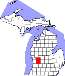 | |
| Villages | ||
| Charter townships | ||
| General law townships | ||
| CDPs | ||
| Other unincorporated communities | ||
| Footnotes | ‡This populated place also has portions in an adjacent county or counties | |