| Image |
[1] |
Landmark name |
Location |
City or town |
Summary |
|---|
 |
652 |
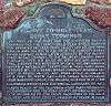
20 Mule Team Borax Terminus |
16246 Sierra Hwy
35°03′24″N 118°10′31″W / 35.056767°N 118.17525°W / 35.056767; -118.17525 (20 Mule Team Borax Terminus) |
Mojave |
|
|
741 |
Bealville |
Bealville Rd.
35°16′19″N 118°37′34″W / 35.271917°N 118.626217°W / 35.271917; -118.626217 (Bealville) |
Caliente |
|
|
504 |
Buena Vista Refinery |
Hwy 33 & LoKern Rd.
35°23′52″N 119°39′54″W / 35.3977°N 119.665°W / 35.3977; -119.665 (Buena Vista Refinery) |
McKittrick |
|
|
492 |
Buttonwillow Tree |
Buttonwillow Dr.
35°24′25″N 119°28′27″W / 35.406867°N 119.474217°W / 35.406867; -119.474217 (Buttonwillow Tree) |
Buttonwillow |
|
|
757 |
Caliente |
35°17′26″N 118°37′36″W / 35.2905°N 118.626683°W / 35.2905; -118.626683 (Caliente) |
Caliente |
|
|
376 |
California Standard Oil Well 1 |
McKittrick Oil Field
|
McKittrick |
|
|
742 |
Campsite of Edward M. Kern |
Old Isabella Rd Recreation Area
35°38′58″N 118°27′30″W / 35.649583°N 118.458233°W / 35.649583; -118.458233 (Campsite of Edward M. Kern) |
Lake Isabella |
|
|
382 |
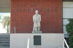
Colonel Thomas Baker Memorial |
Bakersfield City Hall
35°22′23″N 119°01′10″W / 35.37305°N 119.019317°W / 35.37305; -119.019317 (Colonel Thomas Baker Memorial) |
Bakersfield |
|
|
476 |
Desert Spring |
Pappas Ranch on Pappas Rd.
35°18′06″N 117°57′15″W / 35.301783°N 117.95425°W / 35.301783; -117.95425 (Desert Spring) |
Cantil |
|
|
290 |
Discovery well of Kern River Oilfield |
Round Mountain Rd.
35°25′42″N 118°57′17″W / 35.4282°N 118.95485°W / 35.4282; -118.95485 (Discovery well of Kern River Oilfield) |
Bakersfield |
Appointment must be made to view.
|
|
291 |
Fages-Zalvidea Crossing |
State Hwy 166
35°03′33″N 119°04′00″W / 35.059233°N 119.066583°W / 35.059233; -119.066583 (Fages-Zalvidea Crossing) |
Bakersfield |
|
|
129 |
Fort Tejon |
Fort Tejón State Historic Park
34°52′24″N 118°53′44″W / 34.873233°N 118.8955°W / 34.873233; -118.8955 (Fort Tejon) |
Lebec |
Also on the NHRP list as NPS-71000140
|
|
766 |
Freeman Junction |
Historic district
35°36′07″N 117°54′26″W / 35.602067°N 117.907217°W / 35.602067; -117.907217 (Freeman Junction) |
Inyokern |
|
|
631 |
Garcés Baptismal Site |
State Hwy 155
|
Woody |
|
|
277 |
Garcés Circle |
Chester Ave & 30th St.
35°23′13″N 119°01′08″W / 35.387°N 119.019°W / 35.387; -119.019 (Garcés Circle) |
Bakersfield |
|
|
671 |
Site of the town of Garlock |
Historic district
35°24′09″N 117°47′26″W / 35.402417°N 117.79045°W / 35.402417; -117.79045 (Site of the town of Garlock) |
Randsburg |
|
|
495 |
Glennville Adobe |
Kern County Fire Department Glennville Substation
35°43′36″N 118°42′02″W / 35.726667°N 118.700633°W / 35.726667; -118.700633 (Glennville Adobe) |
Glennville |
|
|
137 |
Gordon's Ferry |
Kern River
35°25′29″N 118°58′05″W / 35.4248°N 118.968067°W / 35.4248; -118.968067 (Gordon's Ferry) |
Bakersfield |
|
|
100 |
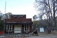
Havilah |
Miller St. & Kern River Canyon Rd.
35°31′06″N 118°30′59″W / 35.5182°N 118.5163°W / 35.5182; -118.5163 (Havilah) |
Caliente |
|
|
457 |
Indian Wells |
Indian Wells Lodge, 2565 Aerospace Highway
35°40′04″N 117°52′20″W / 35.667867°N 117.87235°W / 35.667867; -117.87235 (Indian Wells) |
Inyokern |
|
|
588 |
Kern River Slough Station |
Panama Rd.
35°15′35″N 118°58′03″W / 35.259722°N 118.9675°W / 35.259722; -118.9675 (Kern River Slough Station) |
Lamont |
|
|
132 |
Kernville |
Old Kernville Cemetery, Wofford Rd.
35°43′13″N 118°26′09″W / 35.720217°N 118.435967°W / 35.720217; -118.435967 (Kernville) |
Kernville |
|
|
98 |
Keysville |
Black Gulch Rd.
35°37′33″N 118°30′39″W / 35.625833°N 118.510833°W / 35.625833; -118.510833 (Keysville) |
Lake Isabella |
|
|
485 |
Lakeview Gusher |
Petroleum Club Rd.
35°05′29″N 119°24′05″W / 35.091424°N 119.401377°W / 35.091424; -119.401377 (Lakeview Gusher) |
Maricopa |
|
|
672 |
Lavers' Crossing |
White River & Jack Ranch Rds.
35°44′10″N 118°43′13″W / 35.73605°N 118.7202°W / 35.73605; -118.7202 (Lavers' Crossing) |
Glennville |
|
|
498 |
McKittrick Brea Pit |
State Hwy 33 and State Hwy 58
35°18′20″N 119°37′21″W / 35.305556°N 119.6225°W / 35.305556; -119.6225 (McKittrick Brea Pit) |
McKittrick |
|
|
589 |
Mountain House |
Dry Creek on Bakersfield-Glenville Rds.
|
Woody |
|
|
97 |
Oak Creek Pass |
Willow Pass Rd.
35°03′40″N 118°23′19″W / 35.061117°N 118.388667°W / 35.061117; -118.388667 (Oak Creek Pass) |
Tehachapi |
|
|
643 |
Old Town (Tehachapi) |
Old Town Rd. & Woodford-Tehachapi Rd.
35°07′56″N 118°26′56″W / 35.132222°N 118.448889°W / 35.132222; -118.448889 (Old Town (Tehachapi)) |
Tehachapi |
|
|
371 |
Outermost point in the South San Joaquin Valley visited by Padre Garcés in 1776 |
Saint Thomas the Apostle Church
35°12′29″N 118°49′17″W / 35.20805°N 118.821383°W / 35.20805; -118.821383 (Outermost point in the South San Joaquin Valley visited by Padre Garcés in 1776) |
Arvin |
Located in the courtyard of the church
|
|
278 |
Place where Francisco Garcés crossed the Kern River |
State Hwy 178 and Rancheria Rd.
|
Bakersfield |
|
|
660 |
Point on the Jedediah Smith Trail |
Old Bena & Tower Line Rd.
35°19′56″N 118°48′24″W / 35.332133°N 118.806583°W / 35.332133; -118.806583 (Point on the Jedediah Smith Trail) |
Edison |
|
|
539 |
Posey Creek Station of Butterfield Overland Mail Lines |
Bakersfield-Glennville Rd. & Round Mountain Rd.
35°31′22″N 118°57′47″W / 35.522778°N 118.963056°W / 35.522778; -118.963056 (Posey Creek Station of Butterfield Overland Mail Lines) |
Bakersfield |
|
|
938 |
Rand Mining District |
Kern County Desert Museum
35°22′05″N 117°39′20″W / 35.368067°N 117.655417°W / 35.368067; -117.655417 (Rand Mining District) |
Randburg |
|
|
300 |
Rose Station |
Grapevine Rd. & D. St.
34°56′29″N 118°55′57″W / 34.941383°N 118.932583°W / 34.941383; -118.932583 (Rose Station) |
Lebec |
|
|
133 |
Sebastian Indian Reservation |
Grapevine Rd. & D St.
34°56′29″N 118°55′57″W / 34.941383°N 118.932583°W / 34.941383; -118.932583 (Sebastian Indian Reservation) |
Lebec |
|
|
1022 |
Shafter Cotton Research Station |
17053 Shafter Avenue
35°31′57″N 119°16′41″W / 35.53245°N 119.278067°W / 35.53245; -119.278067 (Shafter Cotton Research Station) |
Shafter |
|
|
540 |
Sinks of Tejon |
David and Wheeler Ridge Rds.
35°05′34″N 118°54′54″W / 35.092833°N 118.91505°W / 35.092833; -118.91505 (Sinks of Tejon) |
Mettler |
|
|
923 |
Site of the flight of the Gossamer Condor |
Shafter Airport
35°30′00″N 119°10′54″W / 35.500117°N 119.181633°W / 35.500117; -119.181633 (Site of the flight of the Gossamer Condor) |
Shafter, California |
|
|
690 |
Site of the last home of Alexis Godey |
414 19th St. W.
35°22′41″N 119°00′27″W / 35.378°N 119.00755°W / 35.378; -119.00755 (Site of the last home of Alexis Godey) |
Bakersfield |
|
|
732 |
Site of the hoem of Elisha Stevens |
W. Columbus & Isle Verde Sts.
35°23′50″N 119°00′21″W / 35.3973°N 119.0059°W / 35.3973; -119.0059 (Site of the hoem of Elisha Stevens) |
Bakersfield |
|
|
508 |
Tehachapi Loop |
Old State Highway
35°12′03″N 118°32′13″W / 35.20085°N 118.53681°W / 35.20085; -118.53681 (Tehachapi Loop) |
Tehachapi |
|
|
283 |
Top of Grapevine Pass where Don Pedro Fages passed in 1772 |
37°47′28″N 122°23′58″E / 37.791133°N 122.399433°E / 37.791133; 122.399433 (Top of Grapevine Pass where Don Pedro Fages passed in 1772) |
Lebec |
|
|
374 |
Tulamniu Indian Site |
SE of Blockhouse #BV4
|
Taft |
|
|
99 |
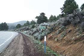
Walker's Pass |
State Hwy 178
35°39′46″N 118°01′37″W / 35.662817°N 118.02685°W / 35.662817; -118.02685 (Walker's Pass) |
Onyx |
Also on the NHRP list as NPS-66000210
|
|
581 |
Well 2-6 |
Broadway Ave
35°10′47″N 119°32′56″W / 35.1797°N 119.5489°W / 35.1797; -119.5489 (Well 2-6) |
Fellows |
Marker is across the street from Fellows Park
|
|
130 |
Willow Springs |
Manly Rd.
34°52′38″N 118°17′51″W / 34.8773°N 118.297517°W / 34.8773; -118.297517 (Willow Springs) |
Rosamond |
|