Camaderry
| Camaderry | |
|---|---|
| Sliabh Céim an Doire | |
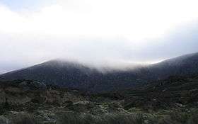 Camaderry from the north | |
| Highest point | |
| Elevation | 698 m (2,290 ft) |
| Prominence | 71[1] |
| Listing | Hewitt |
| Geography | |
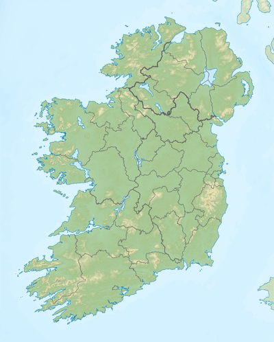 Camaderry Location in Ireland | |
| Location | Wicklow, Republic of Ireland |
| Parent range | Wicklow Mountains |
| Topo map | OSi Discovery 56 |
Camaderry (Irish: Sliabh Céim an Doire, meaning "step/pass of the oak-wood") is a mountain in the Wicklow Mountains.
Geography
The mountain is located just south of the Wicklow Gap in County Wicklow, which runs over the gap between it and Tonelagee Mountain. It dominates the village of Glendalough and it forms the northern wall of the Upper Lake.
Standing at 698 metres, Camaderry is the 17th / 18th highest mountain in the Wicklow Mountains and the 114th highest mountain in Ireland, joint with Silsean which also has a height of 698 metres.
On its western flank is Turlough Hill, on top of which sits a reservoir as part of a hydroelectric scheme.
References
- ↑ Camaderry Mountain , mountainviews.ie
See also
External links
Coordinates: 53°01′28″N 6°22′38″W / 53.02444°N 6.37722°W
This article is issued from Wikipedia - version of the 11/18/2016. The text is available under the Creative Commons Attribution/Share Alike but additional terms may apply for the media files.