Great Sugar Loaf
| Great Sugar Loaf | |
|---|---|
| Ó Cualann | |
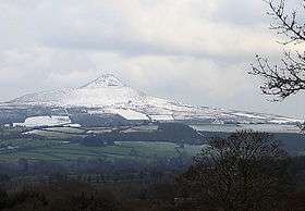 The Great Sugar Loaf, from the west | |
| Highest point | |
| Elevation | 501 m (1,644 ft) [1] |
| Prominence | 216 m (709 ft) [1] |
| Listing | Marilyn |
| Coordinates | 53°9′18″N 6°9′0″W / 53.15500°N 6.15000°WCoordinates: 53°9′18″N 6°9′0″W / 53.15500°N 6.15000°W |
| Geography | |
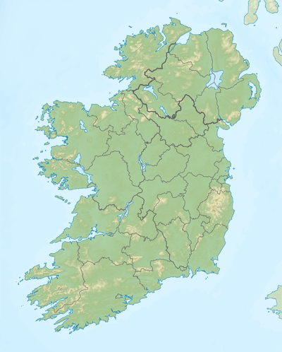 Great Sugar Loaf Location in Ireland | |
| Location | Wicklow, Ireland |
| Parent range | Wicklow Mountains |
| OSI/OSNI grid | O237130 |
| Topo map | OSi Discovery 56 |
The Great Sugar Loaf (Irish: Ó Cualann or Beannach Mhór), also known as the Big Sugar Loaf and often as simply the Sugar Loaf, is a mountain in east County Wicklow in Ireland.
Geography
The mountain is located between Delgany and Kilmacanogue, and just to the north of the Glen of the Downs Nature Reserve. The smaller Little Sugar Loaf lies across the N11 road, to the east.
Though only 501 metres (1,644 ft) high, the Great Sugar Loaf's isolation from other hills, steep slopes and volcanic appearance makes it appear much taller than it is. Due to its height relative to the surrounding landscape, the hill qualifies as a Marilyn.
Geology
The Great Sugar Loaf is composed of Cambrian quartzite, in contrast to the rounded mountains to the west, which are made of Devonian granite. Popularly mistaken for a volcano, it is in fact an erosion-resistant metamorphosed sedimentary deposit from the deep sea.
See also
References
- 1 2 "Dublin/Wicklow Area - Great Sugar Loaf". MountainViews. Ordnance Survey Ireland. Retrieved July 4, 2015.
Gallery
-
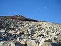
The rocky, steep slopes of the Great Sugar Loaf.
-

The Little Sugar Loaf from the summit of the Great Sugar Loaf.
-

Sunrise over the Great Sugar Loaf, as seen from Glencullen, County Dublin.
-

The Great Sugar Loaf as seen from Powerscourt Estate.
-

View from the top of Great Sugar Loaf to the sea.
| Wikimedia Commons has media related to Great Sugar Loaf. |
Lists of Marilyns | |
|---|---|