Cape du Couedic
| Cape du Couedic South Australia | |
|---|---|
 Cape du Couedic at sunset | |
 Cape du Couedic | |
| Coordinates | 36°3′34.88″S 136°42′0.32″E / 36.0596889°S 136.7000889°ECoordinates: 36°3′34.88″S 136°42′0.32″E / 36.0596889°S 136.7000889°E |
| Elevation | 78 m (256 ft)[1] |
Cape du Couedic is a headland located on the south west tip of Kangaroo Island in South Australia. It was named after a French naval officer, Charles Louis du Couëdic, the Seigneur de Kergoualer (1740–1780), by the Baudin expedition to Australia during January 1803. It is the site for the Cape du Couedic Lighthouse. It is currently located within the Flinders Chase National Park.
Description
Cape du Couedic is located 96 kilometres (60 mi) south west of Kingscote. It is the most south westerly point of the Kangaroo Island coast. It is the termination for a pair of coastlines - the western coastline extending from Cape Borda in the north and the southern coastline extending from Cape Willoughby in the east. It is described as ‘a narrow promontory about 1 mile long' (i.e. 1 nautical mile (1.9 km; 1.2 mi)) and that ‘its SW face slopes to the sea whereas its N and S sides are steep.’[2][3]
Formation, geology & oceanography
Cape du Couedic was formed when the sea reached its present level 7,500 years ago after sea levels started to rise at the start of the Holocene.[4] The cliff line which includes Cape du Couedic consists of a metamorphic rock belonging to the Kanmantoo group bedrock called Middleton Sandstone.[4][5] The water adjoining Cape du Couedic drops to depths ranging between 20 metres (66 ft) to 30 metres (98 ft) at the base of its cliff face.[5]
Cape du Couedic is one of twenty geological features on Kangaroo Island that have been listed as a geological monument by the Geological Society of Australia.[6]
History
Aboriginal use
Aboriginal sites have been identified by the South Australian Museum at Cape du Couedic. As of 1999, radiocarbon dating of material recovered via archaeological excavation from sites at Cape du Couedic and Rocky River suggest Aboriginal presence in the western end of Kangaroo Island from approximately 7,500 years BP to as recent as 350–400 years BP.[7][8]
European discovery
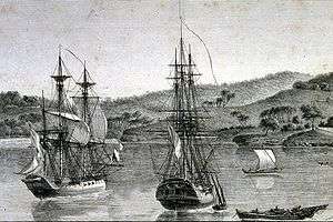
Cape du Couedic was named in January 1803 by the Baudin expedition of 1800-03 in the memory of Charles Louis Chevalier du Couëdic de Kergoualer (1740–1780), a French naval officer, who commanded the frigate La Surveilante and who died in 1780 as the result of wounds received in the Action of 6 October 1779 against HMS Quebec.[9]
Navigation aid
The loss of both Loch Vennachar and Loch Sloy convinced the Marine Board of South Australia to argue for the bringing forward of a plan that it recommended in 1902 to build a lighthouse at Cape du Couedic. Its view was that the loss of both ships could have been avoided if a lighthouse had been operating at Cape du Couedic. Construction commenced in 1907 and the light was officially lit on 27 June 1909.[10][11]
Protected area status
Cape du Couedic is currently located within the protected area known as the Flinders Chase National Park.[12] As of 2012, the waters surrounding its shores are part of a combined restricted access and sanctuary zone located within the boundaries of the Western Kangaroo Island Marine Park.[13]
See also
References
- ↑ "Lighthouses of Australia: South Australia". Russ Rowlett and the University of North Carolina. Retrieved 23 June 2014.
- ↑ South Australia. Department of Marine and Harbors (1985), The Waters of South Australia a series of charts, sailing notes and coastal photographs, Dept. of Marine and Harbors, South Australia, pp. Chart 14, ISBN 978-0-7243-7603-2
- ↑ Pub175, Sailing directions (enroute) north, west, and south coast of Australia (PDF) (10th ed.). National Geospatial-Intelligence Agency. 2010. p. 200. Retrieved 16 May 2014.
- 1 2 Robinson, A. C.; Armstrong, D. M. (eds.). A Biological Survey of Kangaroo Island, South Australia, 1989 & 1990 (PDF). Adelaide, SA: Heritage and Biodiversity Section, Department for Environment, Heritage and Aboriginal Affairs, South Australia. p. 26. ISBN 0 7308 5862 6. Retrieved 1 May 2014.
- 1 2 Fairclough, Martin C (December 2007). "KINGSCOTE Special 1:250 000 geological map" (PDF). MESA Journal. Government of South Australia, DMITRE. 47: 28–31. ISSN 1326-3544. Retrieved 18 May 2014.
- ↑ Kangaroo Island Natural Resources Management Board (2009), Here to stay for our children and grandchildren : a natural resources management plan for the Kangaroo Island region 2009 (PDF), 1, Kangaroo Island Natural Resources Management Board, pp. 88–89, ISBN 978-1-921595-00-4
- ↑ "Flinders Chase National Park, Kelly Hill Conservation Park, Ravine des Casoars Wilderness Protection Area and Cape Bouguer Wilderness Protection Area Management Plans" (PDF). Department for Environment, Heritage and Aboriginal Affairs. 1999. p. 37. Retrieved 1 May 2014.
- ↑ Robinson, A. C.; Armstrong, D. M. (eds.). A Biological Survey of Kangaroo Island, South Australia, 1989 & 1990 (PDF). Adelaide, SA: Heritage and Biodiversity Section, Department for Environment, Heritage and Aboriginal Affairs, South Australia. pp. 34–35. ISBN 0 7308 5862 6. Retrieved 1 May 2014.
- ↑ Robinson, A. C.; Canty, P.; Mooney, T.; Rudduck, P. (1996). "South Australia's offshore islands" (PDF). Australian Heritage Commission. p. 119. Retrieved 13 December 2013.
- ↑ "Lighthouse, Cape Du Couedic Rd, Parndana, SA, Australia". Department of the Environment. Retrieved 23 June 2014.
- ↑ "Lighthouse for Cape Couedie". The Register (Adelaide, SA). 12 May 1906. p. 6. Retrieved 8 October 2013.
- ↑ "Flinders Chase National Park, Kelly Hill Conservation Park, Ravine des Casoars Wilderness Protection Area and Cape Bouguer Wilderness Protection Area Management Plans" (PDF). Department for Environment, Heritage and Aboriginal Affairs. 1999. p. 5. Retrieved 1 May 2014.
- ↑ "Western Kangaroo Island Park Management plan summary" (PDF). Department of Environment, Water and Natural Resources. p. 27 of 29. Retrieved 23 June 2014.
| Major townships | |||||||||||||||
|---|---|---|---|---|---|---|---|---|---|---|---|---|---|---|---|
| Beaches | |||||||||||||||
| Coastal features |
| ||||||||||||||
| Protected areas |
| ||||||||||||||
| Islands adjacent to Kangaroo Island coast | |||||||||||||||
| Related and uncategorised | |||||||||||||||
| |||||||||||||||
Australian places named by French explorers in the 18th and 19th centuries | ||
|---|---|---|
| South Australia |
|  |
| Western Australia | ||
Only places with the name still in use in either the original or anglicised version are listed above. Many names have been anglicised; for these the original French name appears in brackets. | ||