Island Beach, South Australia
| Island Beach South Australia | |||||||||||||
|---|---|---|---|---|---|---|---|---|---|---|---|---|---|
 Map of Kangaroo Island | |||||||||||||
 Island Beach | |||||||||||||
| Coordinates | 35°39′11″S 137°38′03″E / 35.65306°S 137.63417°ECoordinates: 35°39′11″S 137°38′03″E / 35.65306°S 137.63417°E | ||||||||||||
| Population | 319 (shared with other localities in the “State Suburb of Island Beach”) (2011 census)[1][lower-alpha 1] | ||||||||||||
| Postcode(s) | 5222[2] | ||||||||||||
| Time zone | ACST (UTC+9:30) | ||||||||||||
| • Summer (DST) | ACDT (UTC+10:30) | ||||||||||||
| Location |
| ||||||||||||
| LGA(s) | Kangaroo Island Council[3] | ||||||||||||
| State electorate(s) | Finniss[4] | ||||||||||||
| Federal Division(s) | Mayo[5] | ||||||||||||
| |||||||||||||
| |||||||||||||
| Footnotes |
Location[2] Climate[6] Adjoining localities[3] | ||||||||||||
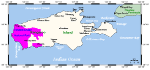
Island Beach is a locality in the Australian state of South Australia overlooking Eastern Cove in Nepean Bay on the north-west coast of the Dudley Peninsula on Kangaroo Island about 121 kilometres (75 mi) from the Adelaide city centre and about 21 kilometres (13 mi) from Penneshaw.[2][3]
John Stewart Browne subdivided Island Beach in 1961 into 254 allotments, with average block sizes exceeding 1,000 square metres (11,000 sq ft). Development stalled for a number of years, due largely to a reluctance of the local council to construct roads through the estate, which under planning regulations of the time were not the responsibility of the developer.
In the late 1970s a separate land subdivision occurred to the south of the original estate. Known locally as Carter's Estate, these allotments were more traditionally under 1,000 square metres (11,000 sq ft) in size. Throughout the late 1980s and beyond, development accelerated with substantial seafront residences being erected, and land values beginning to rise.
Facilities at Island Beach include a general store and fuel station.There is limited access to the beach for boat launching and retrieval.[7]
Island Beach is located within the federal division of Mayo, the state electoral district of Finniss and the local government area of the Kangaroo Island Council.[3][4][5]
References
- Notes
- ↑ For the 2011 census, the State Suburb of Island Beach covered the full extent of the Dudley Peninsula with the exception of Penneshaw - refer Dudley Peninsula#Demographics for more information
- Citations
- ↑ Australian Bureau of Statistics (31 October 2012). "Island Beach". 2011 Census QuickStats. Retrieved 1 May 2016.
- 1 2 3 "Postcode for Island Beach, South Australia". postcodes-australia.com. Retrieved 24 May 2016.
- 1 2 3 4 "Search result for "Island Beach (Locality Bounded)" (Record no SA0044357) with the following layers selected - "Suburbs and Localities"". Department of Planning, Transport and Infrastructure. Retrieved 1 May 2016.
- 1 2 "District of Finniss Background Profile". ELECTORAL COMMISSION SA. Retrieved 2 August 2015.
- 1 2 "Federal electoral division of Mayo, boundary gazetted 16 December 2011" (PDF). Australian Electoral Commission. Retrieved 2 August 2015.
- ↑ "Monthly climate statistics: Summary statistics KINGSCOTE (nearest station)". Commonwealth of Australia , Bureau of Meteorology. Retrieved 20 April 2016.
- ↑ "Kangaroo Island boat ramps". Archived from the original on 2007-07-01. Retrieved 2007-07-15.
| Major townships | |||||||||||||||
|---|---|---|---|---|---|---|---|---|---|---|---|---|---|---|---|
| Beaches | |||||||||||||||
| Coastal features |
| ||||||||||||||
| Protected areas |
| ||||||||||||||
| Islands adjacent to Kangaroo Island coast | |||||||||||||||
| Related and uncategorised | |||||||||||||||
| |||||||||||||||