Carlisle, Ohio
| Carlisle, Ohio | |
|---|---|
| Village | |
|
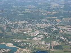
Aerial view of Carlisle | |
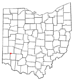 Location of Carlisle, Ohio | |
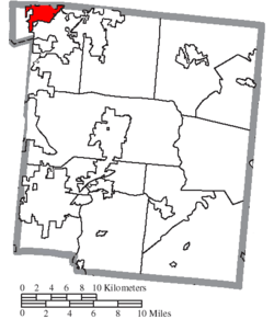 Location of Carlisle in Warren County | |
| Coordinates: 39°34′47″N 84°19′9″W / 39.57972°N 84.31917°WCoordinates: 39°34′47″N 84°19′9″W / 39.57972°N 84.31917°W | |
| Country | United States |
| State | Ohio |
| Counties | Warren, Montgomery |
| Government | |
| • Mayor | Randy Winkler |
| Area[1] | |
| • Total | 3.73 sq mi (9.66 km2) |
| • Land | 3.53 sq mi (9.14 km2) |
| • Water | 0.20 sq mi (0.52 km2) |
| Elevation[2] | 699 ft (213 m) |
| Population (2010)[3] | |
| • Total | 4,915 |
| • Estimate (2012[4]) | 5,031 |
| • Density | 1,392.4/sq mi (537.6/km2) |
| Time zone | Eastern (EST) (UTC-5) |
| • Summer (DST) | EDT (UTC-4) |
| ZIP code | 45005 |
| Area code(s) | 937 |
| FIPS code | 39-12168[5] |
| GNIS feature ID | 1056767[2] |
| Website | http://www.carlisleoh.org/ |
Carlisle /ˈkɑːrlaɪl/[6] is a village in northwestern Warren and southern Montgomery counties in the southwestern part of the U.S. state of Ohio. As of the 2010 census, the village's population was 4,915, down from 5,121 in the 2000 census. This population loss caused Carlisle to once again become a village. (Carlisle had become a city after the 2000 census, as its population had increased from 4,872 in 1990.) The village is in Franklin Township, Warren County, Ohio and German Township, Montgomery County, Ohio.
The Warren County portion of Carlisle is part of the Cincinnati–Middletown, OH-KY-IN Metropolitan Statistical Area, while the Montgomery County portion is part of the Dayton, OH Metropolitan Statistical Area.
Carlisle is known for an area landmark: a "double UFO" house off Chamberlain Road, which resembles two silver-colored flying saucers connected by a metal duct. This is actually two Futuro houses combined into one residence.[7][8]
History
Carlisle had its start in about 1848 when the railroad was extended to that point.[9] The village was named for "railroad man" George B. Carlisle, who in the mid-19th century "bought and platted a large section of the community".[10][11] A post office was established at Carlisle in 1852, and remained in operation until 1961.[12]
Geography
Carlisle is located at 39°34′47″N 84°19′9″W / 39.57972°N 84.31917°W (39.579836, -84.319288).[13]
According to the United States Census Bureau, the city has a total area of 3.73 square miles (9.66 km2), of which 3.53 square miles (9.14 km2) is land and 0.20 square miles (0.52 km2) is water.[1]
Demographics
| Historical population | |||
|---|---|---|---|
| Census | Pop. | %± | |
| 1880 | 197 | — | |
| 1960 | 671 | — | |
| 1970 | 3,821 | 469.4% | |
| 1980 | 4,276 | 11.9% | |
| 1990 | 4,872 | 13.9% | |
| 2000 | 5,121 | 5.1% | |
| 2010 | 4,915 | −4.0% | |
| Est. 2015 | 5,259 | [14] | 7.0% |
2010 census
As of the census[3] of 2010, there were 4,915 people, 1,866 households, and 1,430 families residing in the city. The population density was 1,392.4 inhabitants per square mile (537.6/km2). There were 2,066 housing units at an average density of 585.3 per square mile (226.0/km2). The racial makeup of the city was 98.3% White, 0.4% African American, 0.1% Native American, 0.1% Asian, 0.2% from other races, and 0.8% from two or more races. Hispanic or Latino of any race were 1.0% of the population.
There were 1,866 households of which 33.9% had children under the age of 18 living with them, 62.8% were married couples living together, 9.3% had a female householder with no husband present, 4.5% had a male householder with no wife present, and 23.4% were non-families. 20.6% of all households were made up of individuals and 10.1% had someone living alone who was 65 years of age or older. The average household size was 2.60 and the average family size was 2.99.
The median age in the city was 40.5 years. 24.3% of residents were under the age of 18; 7.2% were between the ages of 18 and 24; 25% were from 25 to 44; 28.3% were from 45 to 64; and 15.1% were 65 years of age or older. The gender makeup of the city was 48.5% male and 51.5% female.
2000 census
As of the census[5] of 2000, there were 5,121 people, 1,849 households, and 1,475 families residing in the city. The population density was 1,504.7 people per square mile (581.5/km²). There were 1,937 housing units at an average density of 569.2 per square mile (220.0/km²). The racial makeup of the city was 98.38% White, 0.23% African American, 0.18% Native American, 0.29% Asian, 0.06% Pacific Islander, 0.14% from other races, and 0.72% from two or more races. Hispanic or Latino of any race were 0.58% of the population.
There were 1,849 households out of which 36.9% had children under the age of 18 living with them, 66.9% were married couples living together, 8.9% had a female householder with no husband present, and 20.2% were non-families. 16.4% of all households were made up of individuals and 5.3% had someone living alone who was 65 years of age or older. The average household size was 2.74 and the average family size was 3.08.
In the city the population was spread out with 26.5% under the age of 18, 8.2% from 18 to 24, 31.1% from 25 to 44, 24.9% from 45 to 64, and 9.3% who were 65 years of age or older. The median age was 36 years. For every 100 females there were 102.2 males. For every 100 females age 18 and over, there were 100.5 males.
The median income for a household in the city was $45,446, and the median income for a family was $50,599. Males had a median income of $36,544 versus $26,300 for females. The per capita income for the city was $19,358. About 6.4% of families and 8.4% of the population were below the poverty line, including 10.4% of those under age 18 and 8.4% of those age 65 or over.
References
- 1 2 "US Gazetteer files 2010". United States Census Bureau. Archived from the original on 2012-07-14. Retrieved 2013-01-06.
- 1 2 "US Board on Geographic Names". United States Geological Survey. 2007-10-25. Retrieved 2008-01-31.
- 1 2 "American FactFinder". United States Census Bureau. Retrieved 2013-01-06.
- ↑ "Population Estimates". United States Census Bureau. Archived from the original on 2013-06-17. Retrieved 2013-06-17.
- 1 2 "American FactFinder". United States Census Bureau. Archived from the original on 2013-09-11. Retrieved 2008-01-31.
- ↑ http://scrippsjschool.org/pronunciation/
- ↑ "Futuro House - Home of the Future: The Futuro of Carlisle, Ohio". Retrieved November 25, 2011.
- ↑ "Carlisle, Ohio - Futuro - Mating Flying Saucer House". RoadsideAmerica.com. Retrieved November 25, 2011.
- ↑ The History of Warren County, Ohio: Containing a History of the County ; Its Townships, Towns. W.H. Beers & Company. 1882. p. 677.
- ↑ "History of Carlisle". Village of Carlisle. Retrieved November 25, 2011.
- ↑ "The Library Lens: George B. Carlisle, c. 1870". Middletown (Ohio) Library. Retrieved November 25, 2011.
- ↑ "Warren County". Jim Forte Postal History. Retrieved 2 March 2015.
- ↑ "US Gazetteer files: 2010, 2000, and 1990". United States Census Bureau. 2011-02-12. Retrieved 2011-04-23.
- ↑ "Annual Estimates of the Resident Population for Incorporated Places: April 1, 2010 to July 1, 2015". Retrieved July 2, 2016.
- ↑ "Census of Population and Housing". Census.gov. Archived from the original on May 11, 2015. Retrieved June 4, 2015.
External links
Municipalities and communities of Montgomery County, Ohio, United States | ||
|---|---|---|
| Cities | 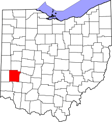 | |
| Villages | ||
| Townships | ||
| CDPs | ||
| Unincorporated communities | ||
| Ghost towns | ||
| Footnotes | ‡This populated place also has portions in an adjacent county or counties | |
Municipalities and communities of Warren County, Ohio, United States | ||
|---|---|---|
| Cities |  | |
| Villages | ||
| Townships | ||
| CDPs | ||
| Unincorporated communities |
| |
| Ghost towns | ||
| Footnotes | ‡This populated place also has portions in an adjacent county or counties | |