South Lebanon, Ohio
| South Lebanon, Ohio | |
|---|---|
| Village | |
|
Village Hall | |
| Motto: "Reclaiming Our Past Embracing Our Future" | |
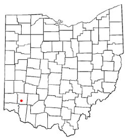 Location of South Lebanon, Ohio | |
 Location of South Lebanon in Warren County | |
| Coordinates: 39°22′14″N 84°12′58″W / 39.37056°N 84.21611°WCoordinates: 39°22′14″N 84°12′58″W / 39.37056°N 84.21611°W | |
| Country | United States |
| State | Ohio |
| County | Warren |
| Area[1] | |
| • Total | 2.68 sq mi (6.94 km2) |
| • Land | 2.65 sq mi (6.86 km2) |
| • Water | 0.03 sq mi (0.08 km2) |
| Elevation[2] | 623 ft (190 m) |
| Population (2010)[3] | |
| • Total | 4,115 |
| • Estimate (2012[4]) | 4,182 |
| • Density | 1,552.8/sq mi (599.5/km2) |
| Time zone | Eastern (EST) (UTC-5) |
| • Summer (DST) | EDT (UTC-4) |
| ZIP code | 45065 |
| Area code(s) | 513 |
| FIPS code | 39-73446[5] |
| GNIS feature ID | 1065348[2] |

South Lebanon is a village located in Union and Hamilton Townships in central Warren County in the southwestern part of the U.S. state of Ohio. The population was 4,115 at the 2010 census.
History
The first settlement at South Lebanon was made in the 1790s.[6] The village was originally called "Deerfield"[7] because it was the chief settlement of Deerfield Township, Hamilton County, Ohio, but renamed because of its proximity to the county seat of Lebanon. A post office was established under the name Deerfield Village in 1828, and the name of the post office was changed to South Lebanon in 1871.[8]
Geography
South Lebanon is located at 39°22′14″N 84°12′58″W / 39.37056°N 84.21611°W (39.370581, -84.216084).[9]
According to the United States Census Bureau, the village has a total area of 2.68 square miles (6.94 km2), of which 2.65 square miles (6.86 km2) is land and 0.03 square miles (0.08 km2) is water.[1]
Demographics
| Historical population | |||
|---|---|---|---|
| Census | Pop. | %± | |
| 1880 | 42 | — | |
| 1900 | 484 | — | |
| 1910 | 626 | 29.3% | |
| 1920 | 675 | 7.8% | |
| 1930 | 713 | 5.6% | |
| 1940 | 756 | 6.0% | |
| 1950 | 1,291 | 70.8% | |
| 1960 | 2,720 | 110.7% | |
| 1970 | 3,014 | 10.8% | |
| 1980 | 2,700 | −10.4% | |
| 1990 | 2,696 | −0.1% | |
| 2000 | 2,538 | −5.9% | |
| 2010 | 4,115 | 62.1% | |
| Est. 2015 | 4,346 | [10] | 5.6% |
Most of the village is in the Kings Local School District, but parts are in the Little Miami Local and Lebanon City School Districts. It is entirely in the South Lebanon telephone exchange.
2010 census
As of the census[3] of 2010, there were 4,115 people, 1,533 households, and 1,118 families residing in the village. The population density was 1,552.8 inhabitants per square mile (599.5/km2). There were 1,641 housing units at an average density of 619.2 per square mile (239.1/km2). The racial makeup of the village was 96.2% White, 1.4% African American, 0.1% Native American, 0.7% Asian, 0.5% from other races, and 1.1% from two or more races. Hispanic or Latino of any race were 2.3% of the population.
There were 1,533 households of which 40.2% had children under the age of 18 living with them, 53.0% were married couples living together, 14.2% had a female householder with no husband present, 5.7% had a male householder with no wife present, and 27.1% were non-families. 22.2% of all households were made up of individuals and 7.6% had someone living alone who was 65 years of age or older. The average household size was 2.67 and the average family size was 3.13.
The median age in the village was 35.3 years. 28.9% of residents were under the age of 18; 7.5% were between the ages of 18 and 24; 28.2% were from 25 to 44; 26.5% were from 45 to 64; and 9% were 65 years of age or older. The gender makeup of the village was 48.3% male and 51.7% female.
2000 census
As of the census[5] of 2000, there were 2,538 people, 996 households, and 693 families residing in the village. The population density was 1,521.2 people per square mile (586.8/km²). There were 1,069 housing units at an average density of 640.7 per square mile (247.2/km²). The racial makeup of the village was 98.58% White, 0.04% African American, 0.20% Native American, 0.20% Asian, 0.32% from other races, and 0.67% from two or more races. Hispanic or Latino of any race were 1.10% of the population.
There were 996 households out of which 34.4% had children under the age of 18 living with them, 49.7% were married couples living together, 14.1% had a female householder with no husband present, and 30.4% were non-families. 26.1% of all households were made up of individuals and 9.5% had someone living alone who was 65 years of age or older. The average household size was 2.55 and the average family size was 3.07.
In the village the population was spread out with 27.4% under the age of 18, 9.5% from 18 to 24, 31.6% from 25 to 44, 20.4% from 45 to 64, and 11.0% who were 65 years of age or older. The median age was 34 years. For every 100 females there were 97.7 males. For every 100 females age 18 and over, there were 94.8 males.
The median income for a household in the village was $35,676, and the median income for a family was $40,798. Males had a median income of $30,722 versus $25,417 for females. The per capita income for the village was $16,779. About 11.5% of families and 12.7% of the population were below the poverty line, including 14.3% of those under age 18 and 10.4% of those age 65 or over.
References
- 1 2 "US Gazetteer files 2010". United States Census Bureau. Retrieved 2013-01-06.
- 1 2 "US Board on Geographic Names". United States Geological Survey. 2007-10-25. Retrieved 2008-01-31.
- 1 2 "American FactFinder". United States Census Bureau. Retrieved 2013-01-06.
- ↑ "Population Estimates". United States Census Bureau. Retrieved 2013-06-17.
- 1 2 "American FactFinder". United States Census Bureau. Retrieved 2008-01-31.
- ↑ Karle, Tina. "120 Waterfall Hikes Around Cincinnati Ohio". Lulu.com. p. 19. Retrieved 27 November 2013.
- ↑ The History of Warren County, Ohio: Containing a History of the County ; Its Townships, Towns. W.H. Beers & Company. 1882. p. 710.
- ↑ "Warren County". Jim Forte Postal History. Retrieved 2 March 2015.
- ↑ "US Gazetteer files: 2010, 2000, and 1990". United States Census Bureau. 2011-02-12. Retrieved 2011-04-23.
- ↑ "Annual Estimates of the Resident Population for Incorporated Places: April 1, 2010 to July 1, 2015". Retrieved July 2, 2016.
- ↑ "Census of Population and Housing". Census.gov. Retrieved June 4, 2015.
External links
Municipalities and communities of Warren County, Ohio, United States | ||
|---|---|---|
| Cities | 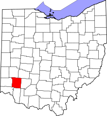 | |
| Villages | ||
| Townships | ||
| CDPs | ||
| Unincorporated communities |
| |
| Ghost towns | ||
| Footnotes | ‡This populated place also has portions in an adjacent county or counties | |