Springboro, Ohio
| Springboro | |
|---|---|
| City | |
| City of Springboro, Ohio | |
|
Lower Springboro from the air | |
| Motto: "Live. Work. Play. Learn. Grow." | |
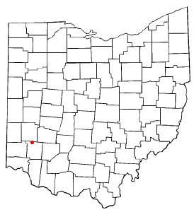 Location of Springboro, Ohio | |
 Location of Springboro in Warren County | |
| Coordinates: 39°33′20″N 84°14′00″W / 39.55556°N 84.23333°WCoordinates: 39°33′20″N 84°14′00″W / 39.55556°N 84.23333°W | |
| Country | United States |
| State | Ohio |
| Counties | Warren, Montgomery |
| Area[1] | |
| • Total | 10.5 sq mi (24.24 km2) |
| • Land | 10.5 sq mi (24.24 km2) |
| • Water | 0 sq mi (0 km2) |
| Elevation[2] | 774 ft (236 m) |
| Population (2010)[3] | |
| • Total | 17,409 |
| • Estimate (2012[4]) | 17,643 |
| • Density | 1,859.9/sq mi (718.1/km2) |
| Time zone | Eastern (EST) (UTC-5) |
| • Summer (DST) | EDT (UTC-4) |
| ZIP code | 45066, 45342 |
| Area code(s) | 937, 513 |
| FIPS code | 39-74076[5] |
| GNIS feature ID | 1061205[2] |
| Website | http://www.cityofspringboro.com/ |
Springboro is a city in the U.S. state of Ohio. An affluent suburb of Cincinnati and Dayton, it is located mostly in Warren County in Clearcreek and Franklin Townships; with a small portion in Miami Township in Montgomery County. The city is part of the Miami Valley. As of the 2010 census, the city had a population of 17,409.[6]
Springboro is located at the geographic center of the Cincinnati-Dayton Metroplex, the 14th largest urban area in the United States.[7][8] Most of the city is located in Warren County, and is part of the Cincinnati–Middletown Metropolitan Statistical Area. The far northern portion is in Montgomery County, the central county of the Dayton Metropolitan Statistical Area. The city has one public school district with one high school, Springboro High School. In 2011, Springboro was ranked the 42nd best place to live in America by Money magazine, and in 2014 Springboro was ranked the 10th best suburb in America by Business Insider.[9][10]
Geography
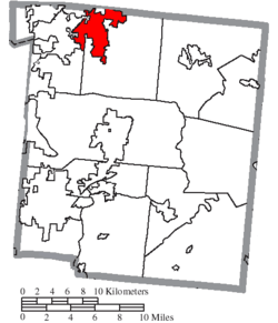
According to the United States Census Bureau, the city has a total area of 9.36 square miles (24.24 km2), all land.[1]
Transportation
Springboro is accessible by three of the major freeways in the Cin-Day Metro Region:
- I-75: From the Cincinnati-Dayton Trans-Metropolitan Freeway
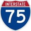 I-75 via the
  SR 73 and Austin Blvd. exits
 - I-71: From the 3-C Highway
 I-71 via the Kings Mills Rd.
  SR 741 and SR 73 exits.
 - I-675: From the Greater Dayton-Bypass
 I-675 via Yankee Street at the
  SR 725 exit.
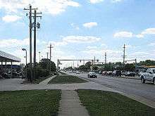
The main crossroads of the city center are ![]() SR 73 (Central Avenue) and
SR 73 (Central Avenue) and ![]() SR 741 (Main Street). Central Avenue runs east-west, and Main Street is the north-south thru-way, connecting the city with the urban cores of Cincinnati and Dayton. Main Street is also used as an alternate route to Interstate-75. In 2016, the IGA grocery store was demolished on the northwest corner of this intersection for future improvements.[11]
SR 741 (Main Street). Central Avenue runs east-west, and Main Street is the north-south thru-way, connecting the city with the urban cores of Cincinnati and Dayton. Main Street is also used as an alternate route to Interstate-75. In 2016, the IGA grocery store was demolished on the northwest corner of this intersection for future improvements.[11]
Springboro is served by the Greater Dayton RTA by a single bus stop on the extreme northern border of the city at Austin Landing.[12]
Dayton-Wright Brothers Airport is located on Springboro Pike, near the city's northern border along the Montgomery-Warren County line. The airport serves strictly private jets and small planes. The airport also serves as a small museum with a scale-replica of the original Wright-B Flyer. For commercial service, Dayton International Airport and Cincinnati-Northern Kentucky International Airport are each about an hour north or south of the city, respectively.[13][14]
In 2010, Springboro was a proposed location for a high-speed rail station on the 3-C corridor line of the Ohio Hub Network, though federal funding for Ohio High-Speed Rail was turned away by Governor John Kasich.[15]
History
Settled as early as 1796, Springboro was founded in 1815 by Jonathan Wright, as "Springborough." Jonathan Wright's father Joel was a surveyor who plotted Columbus and Dayton, Ohio and Louisville, Kentucky. Springboro was predominantly Quaker during its early years.
By the 1830s, two mills and a woolen factory in Springboro had been built up on the abundant springs for which the town was named.[16]
As a stop on the Underground Railroad, Springboro played a significant role by providing hiding places for escaping slaves.[17] On October 17, 1999, Springboro was the first city to erect an Ohio Underground Railroad Historic Marker. The dedication was part of the 4th Annual Ohio Underground Railroad Summit.
Beginning in the late 1990s, Springboro's population began a boom that would redefine the city. Fueled by the growth of the Dayton Area, Springboro transformed from a sleeping town along I-75 into a real estate hotspot in the Miami Valley. Growth in Springboro led to a new highway exit being created at I-75 & Austin Boulevard and the construction of three new schools by the SCCSD in the 2000s. Today Springboro is one of the most important suburbs in the Cincinnati-Dayton metro area due to its stronghold on the growth between the two major cities. The mayor of Springboro is John H. Agenbroad, who was reelected in 2015.[18] The vast majority of new development occurred to the east of SR-741 (Main Street).
Demographics
| Historical population | |||
|---|---|---|---|
| Census | Pop. | %± | |
| 1850 | 454 | — | |
| 1860 | 512 | 12.8% | |
| 1870 | 477 | −6.8% | |
| 1880 | 553 | 15.9% | |
| 1890 | 413 | −25.3% | |
| 1900 | 433 | 4.8% | |
| 1910 | 355 | −18.0% | |
| 1920 | 341 | −3.9% | |
| 1930 | 366 | 7.3% | |
| 1940 | 466 | 27.3% | |
| 1950 | 516 | 10.7% | |
| 1960 | 917 | 77.7% | |
| 1970 | 2,799 | 205.2% | |
| 1980 | 4,962 | 77.3% | |
| 1990 | 6,590 | 32.8% | |
| 2000 | 12,380 | 87.9% | |
| 2010 | 17,409 | 40.6% | |
| Est. 2015 | 18,213 | [19] | 4.6% |
| Sources:[5][20][21][22][23][24][25][26] | |||
As of the 2010 U.S. Census, the median household income for the city in 2010 was $104,803, and the median family income was $105,681.[27] In 2012, the median household income rose to $116,012, making Springboro the 32nd wealthiest City/Town in the country. At the end of 2013 the median net worth per household was estimated at $1,499,516 and the per capita income for the city was $78,786, the highest out of all incorporated cities in Ohio. This ranks Springboro's 45066 zip-code as the 61st wealthiest in the United States.[28] About 0.64% of families and 1.0% of the population were below the poverty line, including ≈0% of those under age 18 and 2.1% of those age 65 or over.
The city lies mostly in the Springboro Community City School District. The west side of Springboro, the area west of Clearcreek-Franklin Road, is in the Franklin School District. The Springboro Community City Schools ranked Excellent with Distinction in the 2011-2012 school year and received national recognition as a Blue-Ribbon School in 2012. According to CNN Money Magazine, Springboro boasts a perfect 100% of residents attending public and private schools, as well as an above-average college attendance rate.[29] Telephone service is provided through the Springboro, Centerville, and Miamisburg exchanges and Springboro telephone numbers have the Dayton (937) or Cincinnati (513) area code.
2010 census
As of the census[3] of 2010, there were 17,442 people, 5,996 households, and 4,871 families residing in the city. The population density was 1,859.9 inhabitants per square mile (718.1/km2). There were 6,263 housing units at an average density of 669.1 per square mile (258.3/km2). The racial makeup of the city was 92.1% White, 2.3% African American, 0.1% Native American, 3.4% Asian, 0.4% from other races, and 1.7% from two or more races. Hispanic or Latino of any race were 1.8% of the population.
There were 5,996 households of which 47.8% had children under the age of 18 living with them, 69.4% were married couples living together, 8.1% had a female householder with no husband present, 3.7% had a male householder with no wife present, and 18.8% were non-families. 15.8% of all households were made up of individuals and 6% had someone living alone who was 65 years of age or older. The average household size was 2.89 and the average family size was 3.24.
The median age in the city was 36.4 years. 32.2% of residents were under the age of 18; 5% were between the ages of 18 and 24; 28.5% were from 25 to 44; 25% were from 45 to 64; and 9.3% were 65 years of age or older. The gender makeup of the city was 48.9% male and 51.1% female.
2000 census
As of the census[5] of 2000, there were 12,380 people, 4,261 households, and 3,600 families residing in the city. The population density was 1,405.1 people per square mile (542.6/km²). There were 4,423 housing units at an average density of 502.0 per square mile (193.8/km²). The racial makeup of the city was 96.00% White, 0.99% African American, 0.16% Native American, 1.60% Asian, 0.03% Pacific Islander, 0.29% from other races, and 0.92% from two or more races. Hispanic or Latino of any race were 1.00% of the population.
There were 4,261 households, of which 48.2% had children under the age of 18 living with them, 74.8% were married couples living together, 7.3% had a female householder with no husband present, and 15.5% were non-families. 13.0% of all households were made up of individuals and 3.9% had someone living alone who was 65 years of age or older. The average household size was 2.90 and the average family size was 3.18.
The city's population included 32.3% under the age of 18, 5.1% from 18 to 24, 34.0% from 25 to 44, 22.3% from 45 to 64, and 6.2% who were 65 years of age or older. The median age was 34 years. For every 100 females there were 95.8 males. For every 100 females age 18 and over, there were 93.9 males.
Public safety
The Springboro police department consists of twenty-five officers and a civilian staff of three. Chief Jeffrey Kruithoff is the current police chief. Approximately 11 square miles are patrolled with service provided to more than 17,000 residents. Many areas of expertise and specialization are utilized, including Special weapons And Tactics (SWAT), bike patrol,firearms instruction, hostage negotiation, crime prevention, juvenile diversion, and D.A.R.E.
The Clearcreek Fire District provides fire protection for the City of Springboro and Clearcreek Township. Chief Bob Kidd oversees the department with a staff of approximately 80 firefighters. The district covers 47 square from three stations staffed with 18 firefighters per day. The district responds to around 3,000 calls each year.
Recreation

- 1911 Wright B Flyer Museum - Free museum, home to a flying replica of the Wright brothers' second airplane, where visitors get a chance to actually fly in the unique aircraft.
- La Comedia Dinner Theatre - in western Springboro.
The city operates the following parks: Community Park, Clearcreek Park, E. Milo Beck, Fred Mayne Park and Rotary Park, pocket parks in the historic district, Gardner Park, and North Park. Springboro has been developing a bicycle network that includes bike lanes and a bike hub, SPARC and Go, located in the historic district. Warren County Parks operates Kessling Park, located in the city limits.
Each spring, Springboro's Real Life Church hosts a helicopter Egg Drop at Springboro High School. This fun and free family event brings in two helicopters which proceed to drop thousands of candy-filled plastic eggs on the high school football field.
.jpg)
Each September, the Springboro United Church of Christ hosts the increasingly popular Oktoberfest Springboro in the city center. The event features authentic German food and drink, games, and live entertainment. Proceeds benefit area charities, announced annually on the event's website.

Each November, the city gathers in the city center along Main Street to host Christmas in Springboro, attracting residents, vendors, and guests from around the region to launch the Christmas season.

Springboro also has golf courses and private parks. Much of the green space belongs to Country Clubs and private neighborhoods, although the city operates a public country club, Heatherwoode CC.[30]
Notable people
- Tony Campana - Player for the Arizona Diamondbacks (Major League Baseball)
- Jake Ballard - Former football player for the Arizona Cardinals (National Football League). Jake also played for the 2012 Super Bowl Champion New York Giants.
- Amy Tucker - Associate Head Coach Stanford Cardinals Women's Basketball
- Brad Lamb - NFL Football Player for the Buffalo Bills in 1992 and 1993; played in Super Bowl XXVII.
- Tommy Kessler - guitarist for Blondie, 2010-current.
Further reading
- Elva R. Adams. Warren County Revisited. [Lebanon, Ohio]: Warren County Historical Society, 1989.
- The Centennial Atlas of Warren County, Ohio. Lebanon, Ohio: The Centennial Atlas Association, 1903.
- Josiah Morrow. The History of Warren County, Ohio. Chicago: W.H. Beers, 1883. (Reprinted several times)
- Ohio Atlas & Gazetteer. 6th ed. Yarmouth, Maine: DeLorme, 2001. ISBN 978-0-89933-281-9
- William E. Smith. History of Southwestern Ohio: The Miami Valleys. New York: Lewis Historical Publishing, 1964. 3 vols.
- Warren County Engineer's Office. Official Highway Map 2003. Lebanon, Ohio: The Office, 2003.
References
- 1 2 "US Gazetteer files 2010". United States Census Bureau. Retrieved 2013-01-06.
- 1 2 "US Board on Geographic Names". United States Geological Survey. 2007-10-25. Retrieved 2008-01-31.
- 1 2 "American FactFinder". United States Census Bureau. Retrieved 2013-01-06.
- ↑ "Population Estimates". United States Census Bureau. Retrieved 2013-06-17.
- 1 2 3 "American FactFinder". United States Census Bureau. Retrieved 2008-01-31.
- ↑ "American FactFinder2". Retrieved 2010-03-20.
- ↑ http://www.mydaytondailynews.com/news/news/politics-and-business-mix-in-new-cincinnati-dayton/nfXgZ/
- ↑ http://www.bizjournals.com/cincinnati/stories/1998/11/09/story3.html
- ↑ "Money Magazine Ranking". Retrieved 2009-07-13.
- ↑ http://www.businessinsider.com/best-suburbs-in-america-methodology-2014-10
- ↑ Writer, By Lawrence Budd - Staff. "Springboro IGA demolition begins". Retrieved 2016-09-27.
- ↑ https://www.google.com/webhp?sourceid=chrome-instant&ion=1&espv=2&ie=UTF-8#q=rta%20dayton
- ↑ http://www.flydayton.com/index.php?page=airport-map
- ↑ http://www.cvgairport.com/
- ↑ http://www.whitehouse.gov/the-press-office/fact-sheet-high-speed-intercity-passenger-rail-program-cleveland-columbus
- ↑ Kilbourn, John (1833). The Ohio Gazetteer, or, a Topographical Dictionary. Scott and Wright. p. 425. Retrieved 12 December 2013.
- ↑ Lovelace, Janice (May 2004). Railroad Ties. Cincinnati magazine. p. 39.
- ↑ http://www.daytondailynews.com/news/business/springboro-attracting-firms-from-neighboring-citie/nMmWc/
- ↑ "Annual Estimates of the Resident Population for Incorporated Places: April 1, 2010 to July 1, 2015". Retrieved July 2, 2016.
- ↑ "Population of Civil Divisions Less than Counties" (PDF). Statistics of the Population of the United States at the Tenth Census. U.S. Census Bureau. Retrieved 28 November 2013.
- ↑ "Population of Civil Divisions Less than Counties" (PDF). Statistics of the Population of the United States at the Tenth Census. U.S. Census Bureau. Retrieved 28 November 2013.
- ↑ "Population: Ohio" (PDF). 1910 U.S. Census. U.S. Census Bureau. Retrieved 28 November 2013.
- ↑ "Population: Ohio" (PDF). 1930 US Census. U.S. Census Bureau. Retrieved 28 November 2013.
- ↑ "Number of Inhabitants: Ohio" (PDF). 18th Census of the United States. U.S. Census Bureau. Retrieved 22 November 2013.
- ↑ "Ohio: Population and Housing Unit Counts" (PDF). U.S. Census Bureau. Retrieved 22 November 2013.
- ↑ "Incorporated Places and Minor Civil Divisions Datasets: Subcounty Population Estimates: April 1, 2010 to July 1, 2012". U.S. Census Bureau. Retrieved 25 November 2013.
- ↑ http://www.point2homes.com/US/Neighborhood/OH/Springboro-Demographics.html
- ↑ http://money.cnn.com/magazines/moneymag/bplive/2011/snapshots/PL3974076.html
- ↑ http://apps.money.cnn.com/bestplaces_2011/compare_tool_2011.jsp?id=PL3974076,&view=c
- ↑ http://www.ci.springboro.oh.us/parks.html
External links
Municipalities and communities of Montgomery County, Ohio, United States | ||
|---|---|---|
| Cities | 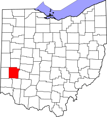 | |
| Villages | ||
| Townships | ||
| CDPs | ||
| Unincorporated communities | ||
| Ghost towns | ||
| Footnotes | ‡This populated place also has portions in an adjacent county or counties | |
Municipalities and communities of Warren County, Ohio, United States | ||
|---|---|---|
| Cities | 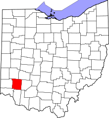 | |
| Villages | ||
| Townships | ||
| CDPs | ||
| Unincorporated communities |
| |
| Ghost towns | ||
| Footnotes | ‡This populated place also has portions in an adjacent county or counties | |