Carrizozo, New Mexico
| Carrizozo, New Mexico | |
|---|---|
| Town | |
|
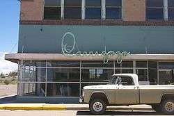
Downtown Carrizozo | |
| Nickname(s): 'Zozo | |
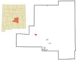 Location of Carrizozo, New Mexico | |
 Carrizozo, New Mexico Location in the United States | |
| Coordinates: 33°38′38″N 105°52′39″W / 33.64389°N 105.87750°WCoordinates: 33°38′38″N 105°52′39″W / 33.64389°N 105.87750°W | |
| Country | United States |
| State | New Mexico |
| County | Lincoln |
| Area | |
| • Total | 2.7 sq mi (7.0 km2) |
| • Land | 2.7 sq mi (7.0 km2) |
| • Water | 0.0 sq mi (0.0 km2) |
| Elevation | 5,429 ft (1,657 m) |
| Population (2010) | |
| • Total | 996[1] |
| Time zone | Mountain (MST) (UTC-7) |
| • Summer (DST) | MDT (UTC-6) |
| ZIP code | 88301 |
| Area code(s) | 575 |
| FIPS code | 35-12500 |
| GNIS feature ID | 0918425 |

Carrizozo is a town in Lincoln County, New Mexico and is the county seat with a population of 996 at the 2010 census. Founded in 1899, the town provided the main railroad access for Lincoln County, and the town experienced significant population growth in the early decades of the 1900s. However, with declining relevance of the railroad, the population of the town has gradually declined. The town is located at the intersection of U.S. Route 54 and U.S. Route 380.
Name
The name of the town is derived from the Spanish vernacular for reed grass (Carrizo), which grew significantly in the area and provided excellent feed for ranch cattle. The additional 'zo' at the end of the town name was added to indicate abundance of Carrizo grass.[2] The town is now often referred to as 'Zozo.[3]
History
Prior to 1899, the area was primarily a few ranches and a stagecoach crossing with limited permanent settlement.[4] Lawrence Murphy, a merchant active in the Lincoln County War (1878), owned a major ranch in the area.[5][6] The location of Carrizozo was selected as the site for a station on the El Paso and Northeastern Railway (EP&NE) main line in 1899. Carrizozo was chosen over the nearby booming mine town of White Oaks, New Mexico, resulting in large-scale migration from White Oaks to Carrizozo.[7]
The railroad brought businesses, growing populations, and increased importance to the town of Carrizozo. As a result, a county referendum in 1909 moved the county seat of Lincoln County from the town of Lincoln to Carrizozo.[4] This decision resulted in a four-year legal battle that was eventually resolved in favor of Carrizozo by the United States Supreme Court in the case of Gray v. Taylor. The result was a boom period where railroad access and political importance combined to lead to significant population growth in Carrizozo. The population reached around 2,000 by 1920.[2]
During this time, Albert Bacon Fall, first Senator of New Mexico and later Secretary of the Interior, owned the Three Rivers Ranch just south of Carrizozo but had to sell it to settle legal debts as a result of his involvement in the Teapot Dome scandal (1922-1923).[8] During the same time, journalist Quentin Reynolds visited the town and wrote a piece on it for Collier's Weekly. Later, he wrote in The Wounded Don't Cry that "I used to agree with Bugs that once you left New York, you were strictly on the horse and buggy circuit. But of late years I’ve had to modify that. Since then I’ve discovered New Orleans, San Francisco and a little place called Carrizozo, New Mexico, where I want to go when I die. I want to go there and gang around the drug store and sneak behind the prescription counter with Art Rolland and have a nip of what he calls Old Granddaddy then type out his prescriptions for him."[9]
Carrizozo is about 50 miles from Trinity Site, where the first nuclear bomb was detonated on July 16, 1945. Residents reported tremors like an earthquake and, as the first major downwind settlement, the town received a significant part of the remnants of the mushroom cloud (resulting in some radioactive contamination of the area, which faded quickly and does not persist today).[10]
With the rise of the automobile, Carrizozo's proximity to the railroad became less important starting in the 1950s, and the last passenger train passed through in 1968.[4] The result was a decrease in economic opportunity in Carrizozo, and the population fell back to about 1,200 people for much of the end of the 20th century.[11] Recently, the town has seen increasing focus on tourism,[2] and cherry cider produced in the town is known nationally.[12]
Geography
Carrizozo is located at the northern point of the Tularosa Basin which extends southward to the New Mexico-Texas border. The town itself is located in a flat area known prior to the founding of the town as the Corrizo flats, with typical Chihuahua desert scrub.[12][13]
To the west of the town is the Carrizozo Malpais, a 40 mile long lava flow that is about 1,500 years old and accessible through the Valley of Fires Recreation Area[14] To the northeast is the Carrizo mountain, a 9,000-foot peak, and to the southeast are the Sacramento Mountains.
Demographics
| Historical population | |||
|---|---|---|---|
| Census | Pop. | %± | |
| 1920 | 1,301 | — | |
| 1930 | 1,171 | −10.0% | |
| 1940 | 1,457 | 24.4% | |
| 1950 | 1,389 | −4.7% | |
| 1960 | 1,546 | 11.3% | |
| 1970 | 1,123 | −27.4% | |
| 1980 | 1,222 | 8.8% | |
| 1990 | 1,075 | −12.0% | |
| 2000 | 1,036 | −3.6% | |
| 2010 | 996 | −3.9% | |
| Est. 2015 | 941 | [15] | −5.5% |
As of the 2010 census,[1] there were 996 people residing in the town. The racial makeup of the town was 78.71% White, 0.70% African American, 2.61% American Indian, 14.16% Other, and 3.82% identified as two or more. Hispanics of any race were 43.57% of the population. 54.72% of the population were men, 45.28% were women. 15.96% were under the age of 18, 24.50% were over 65, and 59.54% were between 18 and 65.
Transportation
Carrizozo is located at the intersection of U.S. Route 54 and U.S. Route 380. For general aviation, the town is served by Carrizozo Municipal Airport.
Points of interest

- Carrizozo Women's Club (1920 Pueblo Revival style building listed in the National Register of Historic Places)
- Carrizozo Heritage Museum (1940s built as a frozen food locker—converted into local history museum in 2003)
- Lincoln National Forest (southeast of the city via U.S. Route 380 and NM 37)
- Valley of Fires Recreation Area (west-northwest of the city via U.S. Route 380)
Film and Television
| Carrizozo, New Mexico | ||||||||||||||||||||||||||||||||||||||||||||||||||||||||||||
|---|---|---|---|---|---|---|---|---|---|---|---|---|---|---|---|---|---|---|---|---|---|---|---|---|---|---|---|---|---|---|---|---|---|---|---|---|---|---|---|---|---|---|---|---|---|---|---|---|---|---|---|---|---|---|---|---|---|---|---|---|
| Climate chart (explanation) | ||||||||||||||||||||||||||||||||||||||||||||||||||||||||||||
| ||||||||||||||||||||||||||||||||||||||||||||||||||||||||||||
| ||||||||||||||||||||||||||||||||||||||||||||||||||||||||||||
A number of movies have been filmed in Carrizozo. Movies which have been filmed at least partially in Carrizozo include:[17]
- Gambit (2012)
- This Must be the Place (2011)
- The Book of Eli (2010)
- Deja Vu, Hera's Odyssey (2004)
- The Outfitters (1999)
- Mad Love (1995)
Notable people
- Albert B. Fall - First Senator of the State of New Mexico (1912-1921) and later U.S. Secretary of the Interior (1921-1923) owned the Three Rivers Ranch on the outskirts of Carrizozo.
- William C. McDonald - First Governor of the State of New Mexico (1912-1917) owned a ranch on the outskirts of Carrizozo.
- Charles Siringo - Famous Pinkerton detective was assigned to Carrizozo to catch cattle thieves (1916-1917).[18]
- Earl Reece Stadtman - Biochemist born in Carrizozo in 1919.
References
- 1 2 U.S. Census Bureau. "2010 Population Finder". Retrieved 9/3/2012. Check date values in:
|access-date=(help) - 1 2 3 Banks, Phyllis Eileen. "Carrizozo -- named for reed grass". Southern New Mexico. Archived from the original on 2012-01-20. Retrieved 9/1/2012. Check date values in:
|access-date=(help) - ↑ LeDuc, Eric (8-23-12). "Cowboy Days, 'Zozo Fair Returns for Labor Day". Ruidoso News. Archived from the original on 2014-11-04. Check date values in:
|date=(help) - 1 2 3 Cosentino, Stew (2010). History of New Mexico: Land of the Brave, Land of the Slaves. Bloomington, IN: iUniverse.
- ↑ Drago, Harry Sinclair (1970). The Great Range Wars: Violence on the Plains. New York: Dodd & Mead.
- ↑ Mullin, Robert N. (1966). "The Life and Death of John Henry Tunstall". Journal of the Southwest. 8 (2): 181.
- ↑ Dietrich, Bruce M. "Carrizozo". New Mexico Office of the State Historian. Archived from the original on 2010-10-07. Retrieved 9/1/2012. Check date values in:
|access-date=(help) - ↑ Pike, David (2004). Roadside New Mexico: A Guide to Historical Markers. Albuquerque, NM: University of New Mexico Press.
- ↑ Reynolds, Quentin (1941). The Wounded Don't Cry. p. 103.
- ↑ Szasz, Ferenc Morton (1984). The Day the Sun Rose Twice. Albuquerque, NM: University of New Mexico Press.
- ↑ "Lincoln County Comprehensive Plan" (PDF). Lincoln County. Retrieved 9/5/2012. Check date values in:
|access-date=(help) - 1 2 Heim, Michael (2007). Exploring New Mexico Highways. Wabasha, MN: Travel Organization Network Organization.
- ↑ Dick-Peddie, William (1993). New Mexico Vegetation: Past, Present, and Future. University of New Mexico Press: Albuquerque, NM.
- ↑ "Valley of Fires Recreation Area, Carrizozo, New Mexico" Retrieved January 30, 2010.
- ↑ "Annual Estimates of the Resident Population for Incorporated Places: April 1, 2010 to July 1, 2015". Retrieved July 2, 2016.
- ↑ "Census of Population and Housing". Census.gov. Archived from the original on May 11, 2015. Retrieved June 4, 2015.
- ↑ "Film Carrizozo". Carrizozo Chamber of Commerce. Archived from the original on 2012-10-21. Retrieved 9/4/2012. Check date values in:
|access-date=(help) - ↑ Simmons, Marc (2005). New Mexico Maverics. Santa Fe, New Mexico: Sunstone Press.
External links
| Wikimedia Commons has media related to Carrizozo, New Mexico. |
Municipalities and communities of Lincoln County, New Mexico, United States | ||
|---|---|---|
| City | 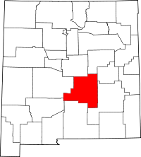 | |
| Town | ||
| Villages | ||
| CDP | ||
| Other unincorporated communities | ||
| Ghost town | ||