Carroll Township, Vermilion County, Illinois
| Carroll Township | |
|---|---|
| Township | |
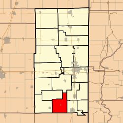 Location in Vermilion County | |
| Coordinates: 39°55′41″N 87°44′38″W / 39.92806°N 87.74389°WCoordinates: 39°55′41″N 87°44′38″W / 39.92806°N 87.74389°W | |
| Country | United States |
| State | Illinois |
| County | Vermilion |
| Created | 1851 |
| Area | |
| • Total | 37.29 sq mi (96.6 km2) |
| • Land | 37.29 sq mi (96.6 km2) |
| • Water | 0 sq mi (0 km2) 0% |
| Elevation | 679 ft (207 m) |
| Population (2010) | |
| • Total | 612 |
| • Density | 16.4/sq mi (6.3/km2) |
| Time zone | CST (UTC-6) |
| • Summer (DST) | CDT (UTC-5) |
| ZIP codes | 61817, 61846, 61850, 61870, 61876 |
| Area code(s) | 217 |
| GNIS feature ID | 0428767 |
Carroll Township is a township in Vermilion County, Illinois, USA. As of the 2010 census, its population was 612 and it contained 263 housing units.[1]
History
Carroll Township was one of the eight townships created in 1851. It was also the name of one of the original two townships created in March 1826, the other being called Ripley Township. It was probably named for Charles Carroll of Carrollton, a signer of the Declaration of Independence. Abraham Carroll, a resident of the area, may have influenced the choice.[2]
Geography
According to the 2010 census, the township has a total area of 37.29 square miles (96.6 km2), all land.[1]
Cities and towns
Extinct towns
- Maizetown
Adjacent townships
- Catlin Township (north)
- Georgetown Township (northeast)
- Elwood Township (east)
- Ross Township, Edgar County (south)
- Young America Township, Edgar County (southwest)
- Sidell Township (west)
- Jamaica Township (northwest)
Cemeteries
The township contains seven cemeteries: Lebanon, Michael, Sandusky, Stunkard, Weaver, Woodlawn and Workheiser.
School districts
- Georgetown-Ridge Farm Consolidated Unit School District 4
- Jamaica Community Unit School District 12
Political districts
- Illinois' 15th congressional district
- State House District 104
- State Senate District 52
References
- 1 2 "Population, Housing Units, Area, and Density: 2010 - County -- County Subdivision and Place -- 2010 Census Summary File 1". United States Census. Retrieved 2013-05-28.
- ↑ Callary, Edmund (2009). Place Names of Illinois. Urbana: University of Illinois Press. p. 60. ISBN 978-0-252-03356-8.
External links
Municipalities and communities of Vermilion County, Illinois, United States | ||
|---|---|---|
| Cities | ||
| Villages | ||
| Townships | ||
| CDP | ||
| Other unincorporated communities | ||
| Footnotes | ‡This populated place also has portions in an adjacent county or counties | |
This article is issued from Wikipedia - version of the 11/16/2016. The text is available under the Creative Commons Attribution/Share Alike but additional terms may apply for the media files.