Catlin Township, Vermilion County, Illinois
| Catlin Township | |
|---|---|
| Township | |
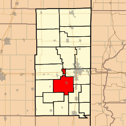 Location in Vermilion County | |
| Coordinates: 40°03′38″N 87°43′28″W / 40.06056°N 87.72444°WCoordinates: 40°03′38″N 87°43′28″W / 40.06056°N 87.72444°W | |
| Country | United States |
| State | Illinois |
| County | Vermilion |
| Created | 1858 |
| Area | |
| • Total | 50.07 sq mi (129.7 km2) |
| • Land | 49.79 sq mi (129.0 km2) |
| • Water | 0.28 sq mi (0.7 km2) 0.56% |
| Elevation | 673 ft (205 m) |
| Population (2010) | |
| • Total | 3,300 |
| • Density | 66.3/sq mi (25.6/km2) |
| Time zone | CST (UTC-6) |
| • Summer (DST) | CDT (UTC-5) |
| ZIP codes | 61817, 61832, 61834, 61841, 61846, 61858, 61883 |
| Area code(s) | 217 |
| GNIS feature ID | 0428776 |
Catlin Township is a township in Vermilion County, Illinois, USA. As of the 2010 census, its population was 3,300 and it contained 1,342 housing units.[1]
History
Catlin Township was created in 1858.
Geography
According to the 2010 census, the township has a total area of 50.07 square miles (129.7 km2), of which 49.79 square miles (129.0 km2) (or 99.44%) is land and 0.28 square miles (0.73 km2) (or 0.56%) is water.[1]
Cities and towns
Extinct towns
- Bennett
- Charity
- Ryan
Adjacent townships
- Blount Township (north)
- Danville Township (east)
- Georgetown Township (southeast)
- Carroll Township (south)
- Jamaica Township (southwest)
- Vance Township (west)
- Oakwood Township (northwest)
Cemeteries
The township contains fourteen cemeteries: Allhands, Cox, Dougherty, God's Acre, Hickman, Jones Grove, Kight's, Mount Vernon, New Atherton, Oak Ridge, Pate, Songer, Spicer Family Plot and Wright Family.
Major highways
Airports and landing strips
- Cast Airport
Lakes
- Skyline Lake
School districts
- Catlin Community Unit School District 5
- Danville Community Consolidated School District 118
- Georgetown-Ridge Farm Consolidated Unit School District 4
- Jamaica Community Unit School District 12
- Oakwood Community Unit School District 76
- Westville Community Unit School District 2
Political districts
- Illinois' 15th congressional district
- State House District 104
- State Senate District 52
References
- 1 2 "Population, Housing Units, Area, and Density: 2010 - County -- County Subdivision and Place -- 2010 Census Summary File 1". United States Census. Retrieved 2013-05-28.
External links
Municipalities and communities of Vermilion County, Illinois, United States | ||
|---|---|---|
| Cities | ||
| Villages | ||
| Townships | ||
| CDP | ||
| Other unincorporated communities | ||
| Footnotes | ‡This populated place also has portions in an adjacent county or counties | |
This article is issued from Wikipedia - version of the 11/17/2016. The text is available under the Creative Commons Attribution/Share Alike but additional terms may apply for the media files.