Indianola, Illinois
| Indianola | |
|---|---|
| Village | |
|
Indianola from the northeast | |
 Vermilion County's location in Illinois | |
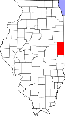
 Indianola Indianola's location in Vermilion County | |
| Coordinates: 39°55′38″N 87°44′25″W / 39.92722°N 87.74028°WCoordinates: 39°55′38″N 87°44′25″W / 39.92722°N 87.74028°W | |
| Country | United States |
| State | Illinois |
| County | Vermilion |
| Township | Carroll |
| Area | |
| • Total | 0.39 sq mi (1.0 km2) |
| • Land | 0.39 sq mi (1.0 km2) |
| • Water | 0.00 sq mi (0.0 km2) 0% |
| Elevation[1] | 673 ft (205 m) |
| Population (2000) | |
| • Total | 207 |
| Time zone | CST (UTC-6) |
| • Summer (DST) | CDT (UTC-5) |
| ZIP code | 61850 |
| Area code(s) | 217 |

Indianola is a village in Carroll Township, Vermilion County, Illinois, United States. It is part of the Danville, Illinois Metropolitan Statistical Area. The population was 207 at the 2000 census.

Geography
Indianola is located at 39°55′38″N 87°44′25″W / 39.92722°N 87.74028°W (39.927173, -87.740221).[2]
According to the 2010 census, Indianola has a total area of 0.39 square miles (1.01 km2), all land.[3]
Demographics
| Historical population | |||
|---|---|---|---|
| Census | Pop. | %± | |
| 1880 | 308 | — | |
| 1890 | 472 | 53.2% | |
| 1900 | 381 | −19.3% | |
| 1910 | 365 | −4.2% | |
| 1920 | 359 | −1.6% | |
| 1930 | 408 | 13.6% | |
| 1940 | 411 | 0.7% | |
| 1950 | 392 | −4.6% | |
| 1960 | 295 | −24.7% | |
| 1970 | 374 | 26.8% | |
| 1980 | 370 | −1.1% | |
| 1990 | 336 | −9.2% | |
| 2000 | 207 | −38.4% | |
| 2010 | 276 | 33.3% | |
| Est. 2015 | 270 | [4] | −2.2% |
As of the census[6] of 2000, there were 207 people, 79 households, and 57 families residing in the village. The population density was 535.8 people per square mile (204.9/km²). There were 86 housing units at an average density of 222.6 per square mile (85.1/km²). The racial makeup of the village was 98.55% White, 0.48% African American, 0.48% Asian, and 0.48% from two or more races.
There were 79 households out of which 36.7% had children under the age of 18 living with them, 60.8% were married couples living together, 7.6% had a female householder with no husband present, and 27.8% were non-families. 21.5% of all households were made up of individuals and 10.1% had someone living alone who was 65 years of age or older. The average household size was 2.62 and the average family size was 3.05.
In the village the population was spread out with 27.5% under the age of 18, 9.2% from 18 to 24, 27.5% from 25 to 44, 28.0% from 45 to 64, and 7.7% who were 65 years of age or older. The median age was 37 years. For every 100 females there were 102.9 males. For every 100 females age 18 and over, there were 97.4 males.
The median income for a household in the village was $42,125, and the median income for a family was $44,688. Males had a median income of $33,125 versus $17,250 for females. The per capita income for the village was $16,284. About 6.2% of families and 6.0% of the population were below the poverty line, including 13.3% of those under the age of eighteen and none of those sixty five or over.
Notable people
- William Parker McKee, president of Shimer College (1897-1930)
- Oscar E. Moreland, Corporal, United States Marine Corps, Awarded Distinguished Service Cross for extraordinary heroism for his actions at Blanc Mont, France, October 3–5, 1918.[7][8]
- Ryan Drew Thomas, UFC Fighter
References
- ↑ "USGS detail on Georgetown". Retrieved 2007-09-30.
- ↑ "US Gazetteer files: 2010, 2000, and 1990". United States Census Bureau. 2011-02-12. Retrieved 2011-04-23.
- ↑ "G001 - Geographic Identifiers - 2010 Census Summary File 1". United States Census Bureau. Retrieved 2015-08-04.
- ↑ "Annual Estimates of the Resident Population for Incorporated Places: April 1, 2010 to July 1, 2015". Retrieved July 2, 2016.
- ↑ "Census of Population and Housing". Census.gov. Archived from the original on May 11, 2015. Retrieved June 4, 2015.
- ↑ "American FactFinder". United States Census Bureau. Archived from the original on September 11, 2013. Retrieved 2008-01-31.
- ↑ Heroes All, Harry R. Stringer, Editor, Fassett Publishing Company, Washington, D.C. 1919
- ↑ "Valor Awards for Oscar E. Moreland". Military Times. Retrieved 2015-02-07.
Municipalities and communities of Vermilion County, Illinois, United States | ||
|---|---|---|
| Cities | ||
| Villages | ||
| Townships | ||
| CDP | ||
| Other unincorporated communities | ||
| Footnotes | ‡This populated place also has portions in an adjacent county or counties | |
