Castana, Iowa
| Castana, Iowa | |
|---|---|
| City | |
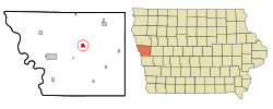 Location of Castana, Iowa | |
| Coordinates: 42°4′21″N 95°54′30″W / 42.07250°N 95.90833°WCoordinates: 42°4′21″N 95°54′30″W / 42.07250°N 95.90833°W | |
| Country |
|
| State |
|
| County | Monona |
| Area[1] | |
| • Total | 0.93 sq mi (2.41 km2) |
| • Land | 0.93 sq mi (2.41 km2) |
| • Water | 0 sq mi (0 km2) |
| Elevation | 1,148 ft (350 m) |
| Population (2010)[2] | |
| • Total | 147 |
| • Estimate (2012[3]) | 145 |
| • Density | 158.1/sq mi (61.0/km2) |
| Time zone | Central (CST) (UTC-6) |
| • Summer (DST) | CDT (UTC-5) |
| ZIP code | 51010 |
| Area code(s) | 712 |
| FIPS code | 19-11530 |
| GNIS feature ID | 0455207 |
| Website | City website |
Castana is a city in Monona County, Iowa, United States. The population was 147 at the 2010 census.
History
A post office has been in operation at Castana since 1865.[4] Castana was platted in 1886 by the railroad.[5] The name Castana was selected by an early settler who believed it to be a Latin word meaning "chestnuts".[6]
Geography
Castana is located at 42°4′21″N 95°54′30″W / 42.07250°N 95.90833°W (42.072518, -95.908266).[7]
According to the United States Census Bureau, the city has a total area of 0.93 square miles (2.41 km2), all of it land.[1] The city is a distance of 10 miles (16 km) from Onawa[8] and 39 miles (63 km) miles from Sioux City.[9]
Academic research
The Western Iowa Experimental farm, a part of Iowa State University, is located just outside Castana. Here research is carried out in beef cattle, swine, forage and the effects of fertiliser on soya beans and corn.[10]
Demographics
| Historical populations | ||
|---|---|---|
| Year | Pop. | ±% |
| 1900 | 355 | — |
| 1910 | 364 | +2.5% |
| 1920 | 389 | +6.9% |
| 1930 | 334 | −14.1% |
| 1940 | 336 | +0.6% |
| 1950 | 265 | −21.1% |
| 1960 | 230 | −13.2% |
| 1970 | 211 | −8.3% |
| 1980 | 228 | +8.1% |
| 1990 | 159 | −30.3% |
| 2000 | 178 | +11.9% |
| 2010 | 147 | −17.4% |
| 2014 | 137 | −6.8% |
| 2015 | 137 | +0.0% |
| Source:"American FactFinder". United States Census Bureau. and Iowa Data Center Source: | ||
2010 census
As of the census[2] of 2010, there were 147 people, 68 households, and 37 families residing in the city. The population density was 158.1 inhabitants per square mile (61.0/km2). There were 78 housing units at an average density of 83.9 per square mile (32.4/km2). The racial makeup of the city was 100.0% White. Hispanic or Latino of any race were 0.7% of the population.
There were 68 households of which 29.4% had children under the age of 18 living with them, 41.2% were married couples living together, 8.8% had a female householder with no husband present, 4.4% had a male householder with no wife present, and 45.6% were non-families. 42.6% of all households were made up of individuals and 7.3% had someone living alone who was 65 years of age or older. The average household size was 2.16 and the average family size was 2.89.
The median age in the city was 38.3 years. 26.5% of residents were under the age of 18; 8.9% were between the ages of 18 and 24; 17.7% were from 25 to 44; 33.3% were from 45 to 64; and 13.6% were 65 years of age or older. The gender makeup of the city was 53.7% male and 46.3% female.
2000 census
As of the census[12] of 2000, there were 178 people, 77 households, and 47 families residing in the city. The population density was 192.2 people per square mile (73.9/km²). There were 84 housing units at an average density of 90.7 per square mile (34.9/km²). The racial makeup of the city was 98.31% White, 1.12% Native American and 0.56% Pacific Islander.
There were 77 households out of which 31.2% had children under the age of 18 living with them, 45.5% were married couples living together, 7.8% had a female householder with no husband present, and 37.7% were non-families. 32.5% of all households were made up of individuals and 14.3% had someone living alone who was 65 years of age or older. The average household size was 2.31 and the average family size was 2.94.
In the city the population was spread out with 29.2% under the age of 18, 6.2% from 18 to 24, 21.9% from 25 to 44, 25.3% from 45 to 64, and 17.4% who were 65 years of age or older. The median age was 38 years. For every 100 females there were 104.6 males. For every 100 females age 18 and over, there were 100.0 males.
The median income for a household in the city was $25,000, and the median income for a family was $32,500. Males had a median income of $24,000 versus $15,417 for females. The per capita income for the city was $12,327. About 20.4% of families and 25.0% of the population were below the poverty line, including 36.9% of those under the age of eighteen and 13.3% of those sixty five or over.
Notable natives
References
- 1 2 "US Gazetteer files 2010". United States Census Bureau. Archived from the original on 2012-07-14. Retrieved 2012-05-11.
- 1 2 "American FactFinder". United States Census Bureau. Retrieved 2012-05-11.
- ↑ "Population Estimates". United States Census Bureau. Archived from the original on 2013-06-17. Retrieved 2013-05-23.
- ↑ "Monona County". Jim Forte Postal History. Retrieved 28 February 2015.
- ↑ The Early Years, Old Castana, accessed 24 March 2010
- ↑ Chicago and North Western Railway Company (1908). A History of the Origin of the Place Names Connected with the Chicago & North Western and Chicago, St. Paul, Minneapolis & Omaha Railways. p. 52.
- ↑ "US Gazetteer files: 2010, 2000, and 1990". United States Census Bureau. 2011-02-12. Retrieved 2011-04-23.
- ↑ indo.com (2009). "How Far is It? Distance Server: As the Crow Flies". Retrieved 2010-05-09.
- ↑ indo.com (2009). "How Far is It? Distance Server: As the Crow Flies". Retrieved 2010-05-09.
- ↑ Western Research and Demonstration Farm accessed 24 March 2010
- ↑ "Census of Population and Housing". Census.gov. Archived from the original on April 22, 2013. Retrieved June 4, 2015.
- ↑ "American FactFinder". United States Census Bureau. Archived from the original on 2013-09-11. Retrieved 2008-01-31.
- ↑ United States Air Force. "Biographies: CHIEF MASTER SERGEANT OF THE AIR FORCE RICHARD D. KISLING". Retrieved 2010-05-09.
External links
Municipalities and communities of Monona County, Iowa, United States | ||
|---|---|---|
| Cities | ||
| Ghost town | ||
| Indian reservations | ||
| Footnotes | ‡This populated place also has portions in an adjacent county or counties | |