Chazel, Quebec
| Chazel | |
|---|---|
| Municipality | |
 Location within Abitibi-Ouest RCM. | |
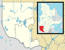 Chazel Location in western Quebec. | |
| Coordinates: 48°52′N 79°03′W / 48.867°N 79.050°WCoordinates: 48°52′N 79°03′W / 48.867°N 79.050°W[1] | |
| Country |
|
| Province |
|
| Region | Abitibi-Témiscamingue |
| RCM | Abitibi-Ouest |
| Settled | 1917 |
| Constituted | February 19, 1938 |
| Government[2] | |
| • Mayor | Daniel Favreau |
| • Federal riding | Abitibi—Témiscamingue |
| • Prov. riding | Abitibi-Ouest |
| Area[2][3] | |
| • Total | 138.90 km2 (53.63 sq mi) |
| • Land | 134.30 km2 (51.85 sq mi) |
| Population (2011)[3] | |
| • Total | 289 |
| • Density | 2.2/km2 (6/sq mi) |
| • Pop 2006-2011 |
|
| • Dwellings | 125 |
| Time zone | EST (UTC−5) |
| • Summer (DST) | EDT (UTC−4) |
| Postal code(s) | J0Z 1N0 |
| Area code(s) | 819 |
| Highways | No major routes |
| Website |
www |
Chazel is a municipality in northwestern Quebec, Canada, in the Abitibi-Ouest Regional County Municipality. It had a population of 289 in the Canada 2011 Census.
The municipality was incorporated on February 19, 1938, as the Municipality of Saint-Janvier, and commonly known as Saint-Janvier-de-Chazel. In 1991, it was renamed to Chazel, named after Guillaume Chazel, a French soldier who died in 1725 near Cape Breton.[1]
Demographics
Population
| Canada census – Chazel, Quebec community profile | |||
|---|---|---|---|
| 2011 | 2006 | 2001 | |
| Population: | 289 (-10.0% from 2006) | 321 (-2.7% from 2001) | 330 (-14.9% from 1996) |
| Land area: | 134.30 km2 (51.85 sq mi) | 134.24 km2 (51.83 sq mi) | 134.24 km2 (51.83 sq mi) |
| Population density: | 2.2/km2 (5.7/sq mi) | 2.4/km2 (6.2/sq mi) | 2.5/km2 (6.5/sq mi) |
| Median age: | 44.4 (M: 45.0, F: 44.2) | 42.1 (M: 42.7, F: 41.0) | 38.0 (M: 37.3, F: 39.5) |
| Total private dwellings: | 125 | 133 | 137 |
| Median household income: | $56,800 | $53,565 | $39,217 |
| References: 2011[3] 2006[4] 2001[5] | |||
| Historical Census Data - Chazel, Quebec[6] | ||||||||||||||||||||||||||
|---|---|---|---|---|---|---|---|---|---|---|---|---|---|---|---|---|---|---|---|---|---|---|---|---|---|---|
|
|
| ||||||||||||||||||||||||
Language
| Canada Census Mother Tongue - Chazel, Quebec[6] | ||||||||||||||||||
|---|---|---|---|---|---|---|---|---|---|---|---|---|---|---|---|---|---|---|
| Census | Total | French |
English |
French & English |
Other | |||||||||||||
| Year | Responses | Count | Trend | Pop % | Count | Trend | Pop % | Count | Trend | Pop % | Count | Trend | Pop % | |||||
| 2011 |
290 |
290 | |
100.00% | 0 | |
0.00% | 0 | |
0.00% | 0 | |
0.00% | |||||
| 2006 |
320 |
320 | |
100.00% | 0 | |
0.00% | 0 | |
0.00% | 0 | |
0.00% | |||||
| 2001 |
330 |
320 | |
96.97% | 10 | |
3.03% | 0 | |
0.00% | 0 | |
0.00% | |||||
| 1996 |
390 |
390 | n/a | 100.00% | 0 | n/a | 0.00% | 0 | n/a | 0.00% | 0 | n/a | 0.00% | |||||
See also
Municipal council
- Mayor: Daniel Favreau
- Councillors: Nancy Bureau, Anne Breton, René Frappier, Armande Bouchard, Hélène Lévesque-Charrois, Yves Frappier
References
- 1 2 "Chazel (Municipalité)" (in French). Commission de toponymie du Québec. Retrieved 2011-01-10.
- 1 2 "Chazel". Répertoire des municipalités (in French). Ministère des Affaires municipales, des Régions et de l'Occupation du territoire. Retrieved 2011-01-10.
- 1 2 3 "Chazel census profile". 2011 Census data. Statistics Canada. Retrieved 2011-01-10.
- ↑ "2006 Community Profiles". Canada 2006 Census. Statistics Canada. March 30, 2011. Retrieved 2014-03-30.
- ↑ "2001 Community Profiles". Canada 2001 Census. Statistics Canada. February 17, 2012. Retrieved 2014-03-30.
- 1 2 Statistics Canada: 1996, 2001, 2006, 2011 census
 |
Clermont | Val-Saint-Gilles, Rivière-Ojima | | |
| |
Authier-Nord | |||
| ||||
| | ||||
| La Sarre | Macamic |
| Towns | |
|---|---|
| Municipalities | |
| Townships | |
| Parishes | |
| Unorganized territories | |
| |
This article is issued from Wikipedia - version of the 3/31/2014. The text is available under the Creative Commons Attribution/Share Alike but additional terms may apply for the media files.