Chetek, Wisconsin
| Chetek, Wisconsin | |
|---|---|
| City | |
|
U.S. Route 53 at Chetek | |
 Location of Chetek within Wisconsin | |
| Coordinates: 45°19′7″N 91°39′16″W / 45.31861°N 91.65444°WCoordinates: 45°19′7″N 91°39′16″W / 45.31861°N 91.65444°W | |
| Country | United States |
| State | Wisconsin |
| County | Barron |
| Area[1] | |
| • Total | 3.13 sq mi (8.11 km2) |
| • Land | 2.42 sq mi (6.27 km2) |
| • Water | 0.71 sq mi (1.84 km2) |
| Elevation[2] | 1,050 ft (320 m) |
| Population (2010)[3] | |
| • Total | 2,221 |
| • Estimate (2012[4]) | 2,207 |
| • Density | 917.8/sq mi (354.4/km2) |
| Time zone | Central (CST) (UTC-6) |
| • Summer (DST) | CDT (UTC-5) |
| Area code(s) | 715 & 534 |
| FIPS code | 55-14325[5] |
| GNIS feature ID | 1562995[2] |
| Website |
cityofchetek-wi |

Chetek is a city in Barron County in the U.S. state of Wisconsin. The population was 2,221 at the 2010 census. The city is located partially within the Town of Chetek.
History
The original inhabitants of the area were the Ojibwa Indians, who referred to the area as zhede (g), meaning pelican. This was translated into various spellings, such as Sheetak, Shetak, Shetuk, Chetack, until the first post office was opened in 1872. The spelling was then standardized to "Chetek."
In 1872, the Omaha Railroad began service to Chetek, the Knapp-Stout logging camp was established, and the first log schoolhouse was built.
Other important dates:
- 1881 – Medical care became available
- 1882 - The Chetek Alert began publication, a newspaper still serving the area
- 1891 - Became a city
- 1903 – Telephone service was introduced
- 1904 – Fire Department began[6]
- 1960 - Roselawn Elementary opened
- 2010 - School District of Chetek consolidates with Weyerhaeuser School District
Geography
Chetek is located at 45°19′7″N 91°39′16″W / 45.31861°N 91.65444°W (45.318656, -91.65447).[7]
According to the United States Census Bureau, the city has a total area of 3.13 square miles (8.11 km2), of which, 2.42 square miles (6.27 km2) is land and 0.71 square miles (1.84 km2) is water.[1]
Demographics
| Historical population | |||
|---|---|---|---|
| Census | Pop. | %± | |
| 1890 | 406 | — | |
| 1900 | 531 | 30.8% | |
| 1910 | 829 | 56.1% | |
| 1920 | 1,154 | 39.2% | |
| 1930 | 1,076 | −6.8% | |
| 1940 | 1,227 | 14.0% | |
| 1950 | 1,585 | 29.2% | |
| 1960 | 1,729 | 9.1% | |
| 1970 | 1,630 | −5.7% | |
| 1980 | 1,931 | 18.5% | |
| 1990 | 1,953 | 1.1% | |
| 2000 | 2,180 | 11.6% | |
| 2010 | 2,221 | 1.9% | |
| Est. 2015 | 2,191 | [8] | −1.4% |
2010 census
As of the census[3] of 2010, there were 2,221 people, 951 households, and 564 families residing in the city. The population density was 917.8 inhabitants per square mile (354.4/km2). There were 1,104 housing units at an average density of 456.2 per square mile (176.1/km2). The racial makeup of the city was 97.4% White, 0.2% African American, 0.4% Native American, 0.3% Asian, 0.7% from other races, and 0.9% from two or more races. Hispanic or Latino of any race were 1.8% of the population.
There were 951 households of which 26.9% had children under the age of 18 living with them, 43.2% were married couples living together, 11.3% had a female householder with no husband present, 4.8% had a male householder with no wife present, and 40.7% were non-families. 34.8% of all households were made up of individuals and 18.4% had someone living alone who was 65 years of age or older. The average household size was 2.22 and the average family size was 2.82.
The median age in the city was 44.7 years. 21.1% of residents were under the age of 18; 6.8% were between the ages of 18 and 24; 22.6% were from 25 to 44; 24.7% were from 45 to 64; and 25% were 65 years of age or older. The gender makeup of the city was 45.9% male and 54.1% female.
2000 census
As of the census[5] of 2000, there were 2,180 people, 939 households, and 568 families residing in the city. The population density was 925.7 people per square mile (358.2/km²). There were 1,052 housing units at an average density of 446.7 per square mile (172.8/km²). The racial makeup of the city was 98.62% White, 0.09% Black or African American, 0.32% Native American, 0.23% Asian, 0.05% Pacific Islander, 0.09% from other races, and 0.60% from two or more races. Hispanic or Latino of any race were 0.96% of the population.
There were 939 households out of which 25.0% had children under the age of 18 living with them, 47.9% were married couples living together, 8.7% had a female householder with no husband present, and 39.5% were non-families. 34.9% of all households were made up of individuals and 20.4% had someone living alone who was 65 years of age or older. The average household size was 2.21 and the average family size was 2.81.
In the city the population was spread out with 22.2% under the age of 18, 7.2% from 18 to 24, 24.3% from 25 to 44, 20.8% from 45 to 64, and 25.6% who were 65 years of age or older. The median age was 43 years. For every 100 females there were 92.9 males. For every 100 females age 18 and over, there were 88.6 males.
The median income for a household in the city was $31,270, and the median income for a family was $40,114. Males had a median income of $28,375 versus $18,906 for females. The per capita income for the city was $17,922. About 9.0% of families and 12.4% of the population were below the poverty line, including 15.0% of those under age 18 and 8.3% of those age 65 or over.
Transportation
Chetek Municipal–Southworth Airport (Y23) serves the city and surrounding communities.
Notable residents
- J. B. Van Hollen, Wisconsin Attorney General
- John C. Van Hollen, Wisconsin realtor and politician
- Larry Walker, former Colorado Rockies and St. Louis Cardinals right fielder
References
- 1 2 "US Gazetteer files 2010". United States Census Bureau. Archived from the original on 2012-01-24. Retrieved 2012-11-18.
- 1 2 "US Board on Geographic Names". United States Geological Survey. 2007-10-25. Retrieved 2008-01-31.
- 1 2 "American FactFinder". United States Census Bureau. Retrieved 2012-11-18.
- ↑ "Population Estimates". United States Census Bureau. Archived from the original on 2013-06-17. Retrieved 2013-06-24.
- 1 2 "American FactFinder". United States Census Bureau. Archived from the original on 2013-09-11. Retrieved 2008-01-31.
- ↑ Chetek, Wisconsin - Visitor Information Archived January 15, 2008, at the Wayback Machine.
- ↑ "US Gazetteer files: 2010, 2000, and 1990". United States Census Bureau. 2011-02-12. Retrieved 2011-04-23.
- ↑ "Annual Estimates of the Resident Population for Incorporated Places: April 1, 2010 to July 1, 2015". Retrieved July 2, 2016.
- ↑ "Census of Population and Housing". Census.gov. Archived from the original on May 11, 2015. Retrieved June 4, 2015.
External links
- City of Chetek, Wisconsin - Official Website
- Chetek Chamber of Commerce
- Chetek - Weyerhaeuser Area School District
Municipalities and communities of Barron County, Wisconsin, United States | ||
|---|---|---|
| Cities | 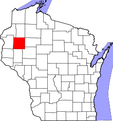 | |
| Villages | ||
| Towns | ||
| CDP | ||
| Unincorporated communities | ||
| Indian reservations | ||
| Footnotes | ‡This populated place also has portions in an adjacent county or counties | |