Haugen, Wisconsin
| Haugen, Wisconsin | |
|---|---|
| Village | |
|
Haugen School | |
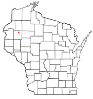 Location of Haugen, Wisconsin | |
| Coordinates: 45°36′31″N 91°46′39″W / 45.60861°N 91.77750°WCoordinates: 45°36′31″N 91°46′39″W / 45.60861°N 91.77750°W | |
| Country | United States |
| State | Wisconsin |
| County | Barron |
| Area[1] | |
| • Total | 0.52 sq mi (1.35 km2) |
| • Land | 0.51 sq mi (1.32 km2) |
| • Water | 0.01 sq mi (0.03 km2) |
| Elevation[2] | 1,230 ft (375 m) |
| Population (2010)[3] | |
| • Total | 287 |
| • Estimate (2012[4]) | 286 |
| • Density | 562.7/sq mi (217.3/km2) |
| Time zone | Central (CST) (UTC-6) |
| • Summer (DST) | CDT (UTC-5) |
| Area code(s) | 715 & 534 |
| FIPS code | 55-33225[5] |
| GNIS feature ID | 1566142[2] |
| Website | http://www.villageofhaugen.com/ |

Haugen (/ˈhɑːɡən/ HAH-gən) is a village in Barron County in the U.S. state of Wisconsin. The population was 287 at the 2010 census.
History
Haugen was named in 1886 for N. P. Haugen, a local landowner.[6] A post office called Haugen has been in operation since 1889.[7]
The ZCBJ Hall in Haugen, a historical meeting place for Czech-Americans, is listed on the National Register of Historic Places.
Geography
Haugen is located at 45°36′31″N 91°46′39″W / 45.60861°N 91.77750°W (45.608497, -91.777379).[8]
According to the United States Census Bureau, the village has a total area of 0.52 square miles (1.35 km2), of which, 0.51 square miles (1.32 km2) of it is land and 0.01 square miles (0.03 km2) is water.[1]
Demographics
| Historical population | |||
|---|---|---|---|
| Census | Pop. | %± | |
| 1920 | 426 | — | |
| 1930 | 249 | −41.5% | |
| 1940 | 268 | 7.6% | |
| 1950 | 246 | −8.2% | |
| 1960 | 265 | 7.7% | |
| 1970 | 246 | −7.2% | |
| 1980 | 251 | 2.0% | |
| 1990 | 305 | 21.5% | |
| 2000 | 287 | −5.9% | |
| 2010 | 287 | 0.0% | |
| Est. 2015 | 286 | [9] | −0.3% |
2010 census
As of the census[3] of 2010, there were 287 people, 128 households, and 72 families residing in the village. The population density was 562.7 inhabitants per square mile (217.3/km2). There were 143 housing units at an average density of 280.4 per square mile (108.3/km2). The racial makeup of the village was 94.1% White, 0.7% Asian, 1.4% from other races, and 3.8% from two or more races. Hispanic or Latino of any race were 1.7% of the population.
There were 128 households of which 32.0% had children under the age of 18 living with them, 46.1% were married couples living together, 7.0% had a female householder with no husband present, 3.1% had a male householder with no wife present, and 43.8% were non-families. 32.8% of all households were made up of individuals and 15.6% had someone living alone who was 65 years of age or older. The average household size was 2.24 and the average family size was 2.93.
The median age in the village was 38.6 years. 23.7% of residents were under the age of 18; 5.6% were between the ages of 18 and 24; 33.1% were from 25 to 44; 23.1% were from 45 to 64; and 14.6% were 65 years of age or older. The gender makeup of the village was 52.3% male and 47.7% female.
2000 census
As of the census[5] of 2000, there were 287 people, 120 households, and 75 families residing in the village. The population density was 562.5 people per square mile (217.3/km²). There were 131 housing units at an average density of 256.8 per square mile (99.2/km²). The racial makeup of the village was 100.00% White. Hispanic or Latino of any race were 0.70% of the population.
There were 120 households out of which 29.2% had children under the age of 18 living with them, 50.0% were married couples living together, 7.5% had a female householder with no husband present, and 37.5% were non-families. 31.7% of all households were made up of individuals and 19.2% had someone living alone who was 65 years of age or older. The average household size was 2.39 and the average family size was 3.07.
In the village the population was spread out with 26.8% under the age of 18, 4.2% from 18 to 24, 33.4% from 25 to 44, 16.7% from 45 to 64, and 18.8% who were 65 years of age or older. The median age was 38 years. For every 100 females there were 111.0 males. For every 100 females age 18 and over, there were 112.1 males.
The median income for a household in the village was $30,714, and the median income for a family was $46,250. Males had a median income of $29,375 versus $22,500 for females. The per capita income for the village was $17,258. About 8.3% of families and 10.9% of the population were below the poverty line, including 15.3% of those under the age of eighteen and 14.7% of those sixty five or over.
References
- 1 2 "US Gazetteer files 2010". United States Census Bureau. Retrieved 2012-11-18.
- 1 2 "US Board on Geographic Names". United States Geological Survey. 2007-10-25. Retrieved 2008-01-31.
- 1 2 "American FactFinder". United States Census Bureau. Retrieved 2012-11-18.
- ↑ "Population Estimates". United States Census Bureau. Retrieved 2013-06-24.
- 1 2 "American FactFinder". United States Census Bureau. Retrieved 2008-01-31.
- ↑ Chicago and North Western Railway Company (1908). A History of the Origin of the Place Names Connected with the Chicago & North Western and Chicago, St. Paul, Minneapolis & Omaha Railways. p. 178.
- ↑ "Barron County". Jim Forte Postal History. Retrieved 4 April 2015.
- ↑ "US Gazetteer files: 2010, 2000, and 1990". United States Census Bureau. 2011-02-12. Retrieved 2011-04-23.
- ↑ "Annual Estimates of the Resident Population for Incorporated Places: April 1, 2010 to July 1, 2015". Retrieved July 2, 2016.
- ↑ "Census of Population and Housing". Census.gov. Retrieved June 4, 2015.
Municipalities and communities of Barron County, Wisconsin, United States | ||
|---|---|---|
| Cities | 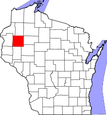 | |
| Villages | ||
| Towns | ||
| CDP | ||
| Unincorporated communities | ||
| Indian reservations | ||
| Footnotes | ‡This populated place also has portions in an adjacent county or counties | |