Rice Lake, Wisconsin
| Rice Lake, Wisconsin | ||
|---|---|---|
| City | ||
| ||
| Motto: You'll love our friendly nature | ||
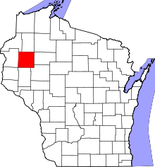
 Location of Rice Lake in Barron County, Wisconsin | ||
| Coordinates: 45°29′54″N 91°44′20″W / 45.49833°N 91.73889°WCoordinates: 45°29′54″N 91°44′20″W / 45.49833°N 91.73889°W | ||
| Country | United States | |
| State | Wisconsin | |
| County | Barron | |
| Incorporated | 1 Apr 1887 | |
| Government | ||
| • Mayor |
Steve Harrington
| |
| Area[1] | ||
| • Total | 9.70 sq mi sq mi (25.12 km² km2) | |
| • Land | 8.60 sq mi sq mi (22.27 km² km2) | |
| • Water | 1.10 sq mi sq mi (2.85 km² km2) | |
| Elevation | 1,148 ft (350 m) | |
| Population (2010)[2] | ||
| • Total | 8,438 | |
| • Estimate (2012[3]) | 8,348 | |
| • Density | 981.2/sq mi (378.8/km2) | |
| Time zone | Central (UTC-6) | |
| • Summer (DST) | CDT (UTC-5) | |
| ZIP Code | 54868 | |
| Area code(s) | 715 & 534 | |
| FIPS code | 55-67350[4] | |
| GNIS feature ID | 1572268[5] | |
| Website | www.ci.rice-lake.wi.us | |
Rice Lake is a city in Barron County in the U.S. state of Wisconsin. As of the 2010 census, the city had a total population of 8,438. The city is located mostly within the Town of Rice Lake.
History
The village was named in 1870 after nearby Rice Lake.[6] A post office has been in operation in Rice Lake since 1872.[7]
Geography
Rice Lake is located at 45°29′54″N 91°44′20″W / 45.49833°N 91.73889°W (45.498408, -91.738844).[8]
According to the United States Census Bureau, the city has a total area of 9.70 square miles (25.12 km2), of which, 8.60 square miles (22.27 km2) is land and 1.10 square miles (2.85 km2) is water.[1]
Demographics
| Historical population | |||
|---|---|---|---|
| Census | Pop. | %± | |
| 1880 | 362 | — | |
| 1890 | 2,130 | 488.4% | |
| 1900 | 3,002 | 40.9% | |
| 1910 | 3,968 | 32.2% | |
| 1920 | 4,457 | 12.3% | |
| 1930 | 5,177 | 16.2% | |
| 1940 | 5,719 | 10.5% | |
| 1950 | 6,898 | 20.6% | |
| 1960 | 7,303 | 5.9% | |
| 1970 | 7,278 | −0.3% | |
| 1980 | 7,691 | 5.7% | |
| 1990 | 7,998 | 4.0% | |
| 2000 | 8,320 | 4.0% | |
| 2010 | 8,438 | 1.4% | |
| Est. 2015 | 8,391 | [9] | −0.6% |
As of 2000 the median income for a household in the city was $34,637, and the median income for a family was $53,056. Males had a median income of $40,450 versus $30,211 for females. The per capita income for the city was $22,354. About 6.9% of families and 13.3% of the population were below the poverty line, including 13.4% of those under age 18 and 13.1% of those age 65 or over.
2010 census
As of the census[2] of 2010, there were 8,438 people, 3,936 households, and 2,065 families residing in the city. The population density was 981.2 inhabitants per square mile (378.8/km2). There were 4,239 housing units at an average density of 492.9 per square mile (190.3/km2). The racial makeup of the city was 96.2% White, 0.3% African American, 0.9% Native American, 0.8% Asian, 0.5% from other races, and 1.3% from two or more races. Hispanic or Latino of any race were 2.4% of the population.
There were 3,936 households of which 24.3% had children under the age of 18 living with them, 37.6% were married couples living together, 10.9% had a female householder with no husband present, 4.0% had a male householder with no wife present, and 47.5% were non-families. 39.3% of all households were made up of individuals and 17.6% had someone living alone who was 65 years of age or older. The average household size was 2.09 and the average family size was 2.79.
The median age in the city was 41.2 years. 20.6% of residents were under the age of 18; 10.1% were between the ages of 18 and 24; 23.5% were from 25 to 44; 24.5% were from 45 to 64; and 21.2% were 65 years of age or older. The gender makeup of the city was 46.8% male and 53.2% female.
Transportation
U.S. Highway 53, Wisconsin Highway 48, and County Road SS (Main Street) are three arterial routes in the city.
Airport
The area is served by Rice Lake Regional Airport - Carl's Field (KRPD), which is located south of Rice Lake.
Education
Public schools
- Rice Lake High School
- Northern Lakes Regional Academy
- Rice Lake Middle School
- Haugen Elementary
- Hilltop Elementary
- Tainter Elementary
Private schools
- St. Joseph School
Post-secondary education
- University of Wisconsin–Barron County
- Wisconsin Indianhead Technical College - Rice Lake Campus
Economy
Rice Lake serves as a shopping, industrial, educational, and medical hub for the surrounding rural communities of Barron, Cameron, Chetek, Shell Lake, Cumberland, Spooner, Ladysmith.
Notable people
- John G. Blystone - film director
- Edward R. Brunner - justice of the Wisconsin Court of Appeals
- William M. Conley - federal judge
- William Henry Dietz - NFL head coach
- Henry Ellenson - Professional Basketball player for the Detroit Pistons
- Foster Friess - businessman
- Eric G. Gibson - Medal of Honor recipient[11]
- Hal Kolstad - MLB player
- Isaac J. Kvam - Wisconsin State Assemblyman
- Dick Lane - actor
- Warren D. Leary - Wisconsin State Assemblyman
- Pug Lund - football player
- Harold Olsen - head coach of the Chicago Stags, member of the Naismith Memorial Basketball Hall of Fame
- Clay Perry - MLB player
- Jason Rae - youngest elected member of the Democratic National Committee
- Joshua J. Swanson - physicist involved in the discovery of the Higgs Boson [12]
- Fred Thomas - MLB player
Local media
- WAQE (AM) 1090, Talk & Sports
- WAQE-FM 97.7, All the Stars, All the Time
- WJMC (AM) 1240, Good Friends and Great Information
- WJMC-FM 96.1, The Best Country Station, Number One
- WKFX FM 99.1, Classic Hits
- WWJP-LP FM 101.7, 3ABN Radio, Christian
References
- 1 2 "US Gazetteer files 2010". United States Census Bureau. Archived from the original on January 24, 2012. Retrieved 2012-11-18.
- 1 2 "American FactFinder". United States Census Bureau. Retrieved 2012-11-18.
- ↑ "Population Estimates". United States Census Bureau. Archived from the original on June 17, 2013. Retrieved 2013-06-24.
- ↑ "American FactFinder". United States Census Bureau. Archived from the original on September 11, 2013. Retrieved 2008-01-31.
- ↑ "US Board on Geographic Names". United States Geological Survey. 2007-10-25. Retrieved 2008-01-31.
- ↑ Chicago and North Western Railway Company (1908). A History of the Origin of the Place Names Connected with the Chicago & North Western and Chicago, St. Paul, Minneapolis & Omaha Railways. p. 189.
- ↑ "Barron County". Jim Forte Postal History. Retrieved 4 April 2015.
- ↑ "US Gazetteer files: 2010, 2000, and 1990". United States Census Bureau. 2011-02-12. Retrieved 2011-04-23.
- ↑ "Annual Estimates of the Resident Population for Incorporated Places: April 1, 2010 to July 1, 2015". Retrieved July 2, 2016.
- ↑ "Census of Population and Housing". Census.gov. Archived from the original on May 11, 2015. Retrieved June 4, 2015.
- ↑ "Military Sealift Command - Medal of Honor Recipient". Washington Navy Yard, DC: Military Sealift Command. Retrieved 3 July 2011.
- ↑ "Observation of a new boson at a mass of 125 GeV with the CMS experiment at the LHC". Physics Letters B. Retrieved 15 Aug 2013.
External links
- City of Rice Lake
- Rice Lake Chamber of Commerce
- Sanborn fire insurance maps: 1893 1899 1917

