Chiang Rai Province
| Chiang Rai | ||
|---|---|---|
| Province | ||
| เชียงราย | ||
| ||
|
| ||
| Coordinates: 19°54′N 99°49′E / 19.900°N 99.817°ECoordinates: 19°54′N 99°49′E / 19.900°N 99.817°E | ||
| Capital | Chiang Rai | |
| Government | ||
| • Governor | Bunsong Techamanisathit (since October 2015) | |
| Area | ||
| • Total | 11,678 km2 (4,509 sq mi) | |
| Population (2014) | ||
| • Total | 1,207,699[1] | |
| Human Development Index | ||
| • HDI (2009) | 0.752 (high) (rank?) | |
| Postal code | 57xxx | |
| Calling code | 053 | |
| Vehicle registration | เชียงราย | |
| Accession into Kingdom of Thailand | 1910 | |
| Accession into Kingdom of Thailand | 1932 | |
| Website | http://www.chiangrai.go.th | |
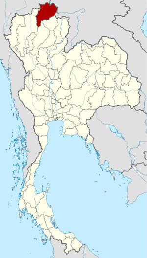
Chiang Rai (Thai: เชียงราย, pronounced [t͡ɕʰīaŋ.rāːj]; Lanna: ᨩ᩠ᨿᨦᩁᩣ᩠ᨿ, pronounced [tɕiaŋ.haːj]; Burmese: ![]() ) is the northernmost province of Thailand. It is bordered by the Shan State of Myanmar to the north, Bokeo Province of Laos to the east, Phayao to the south, Lampang to the southwest, and Chiang Mai to the west.
) is the northernmost province of Thailand. It is bordered by the Shan State of Myanmar to the north, Bokeo Province of Laos to the east, Phayao to the south, Lampang to the southwest, and Chiang Mai to the west.
Geography
The average elevation of the province is 580 metres (1,900 ft). The north of the province is part of the so-called Golden Triangle, where the borders of Thailand, Laos and Burma converge, an area which prior to the rise of agricultural production of coffee, pineapple, coconuts, and banana plantations, was unsafe because of drug smuggling across the borders. The Mekong River forms the boundary with Laos, the Mae Sai and Ruak River with Burma. Through the town of Chiang Rai itself, flows the "Mae Kok" Kok River and south of it the Lao River, a tributary of the Kok.
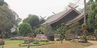
While the eastern part of the province is characterized by relatively flat river plains, the northern and western part consist of the hilly terrain of the Thai highlands with the Khun Tan Range and the Phi Pan Nam Range in the west and the Daen Lao Range in the north. While not the highest elevation of the province, the 1,389-metre (4,557 ft) high[2] Doi Tung ("flag hill") is the most important terrain feature. The Wat Phra That Doi Tung temple on top of the hill, according to the chronicles, dates back to the year 911. Nearby is the Doi Tung royal villa, former residence of the late princess mother (mother of the present king) Somdej Phra Srinagarindra. Thanks to her activities the hills were reforested, and the hill tribes diverted from growing opium poppies to other crops including coffee, bananas, coconuts, and pineapples.
History
Populations have dwelled in Chiang Rai since the 7th century and it became the center of the Lanna Thai Kingdom during the 13th century. The region, rich in natural resources, was occupied by the Burmese until 1786.
Chiang Rai Province's golden triangle bordering Laos and Burma was once the hub of opium production.
Chiang Rai became a province in 1910, after being part of the kingdom of Lannathai for centuries. After Lanna Thai was incorporated into Thailand, it remained an autonomous region and thus the Chiang Rai area was administered from Chiang Mai.
Chiang Rai Province is a transit point for Rohingya refugees from Myanmar (Burma) who are transported there from Sangkhlaburi district in Kanchanaburi Province.[3]
Demographics
The majority of the population are ethnic Thai who speak Kham Muang among themselves, but 12.5% are of hill tribes origin, a sizeable minority in the north provinces. A smaller number are of Chinese descent, mainly descendants of the Kuomintang soldiers who settled in the region, notably in Santikhiri.
Symbols
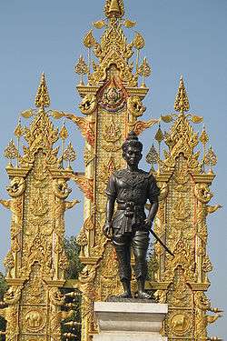
The seal of the province shows a white elephant, the royal symbol, recalling that Chiang Rai was founded by King Mengrai, according to legend because his elephant liked the place.
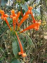
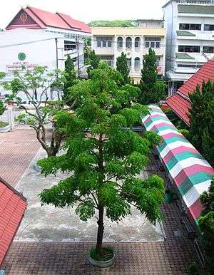
The provincial tree is the tree jasmine (Radermachera ignea), and the provincial flower is the orange trumpet (Pyrostegia venusta).
The former provincial slogan was: "เหนือสุดในสยาม อร่ามดอยตุง ผดุงวัฒนธรรม รสล้ำข้าวสาร หอมหวานลิ้นจี่ สตรีโสภา ชาเลิศรส สัปปะรดนางแล" ("Northernmost in Siam, beautiful Doi Tung, repository of culture, most delicious rice, sweet and fragrant litchi, beautiful women, the finest flavoured tea, pineapple from Nang-Lae, source of the giant catfish).
The current slogan is, "เหนือสุดในสยาม ชายแดนสามแผ่นดิน ถิ่นวัฒนธรรมล้านนา ล้ำค่าพระธาตุดอยตุง" ("The northernmost of Siam, the frontier of three lands, the home to the culture of Lanna and Doi Tung Temple")
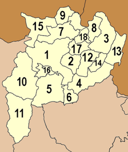
Administrative divisions
Chiang Rai is subdivided into 18 districts (amphoe). The districts are further subdivided into 124 subdistricts (tambon) and 1,751 villages (muban).
|
|
Transportation
- Air
- Chiang Rai Mae Fah Luang International Airport has domestic flights to both Bangkok airports, which connect to regional and international flights.
- Boat
- There is daily boat service between Chiang Rai and Tha Ton.
- Rail
- There is no railway system in Chiang Rai. The nearest station is in Chiang Mai.
- Road
- Chiang Rai Province is intersected by Asian Highway 2, which runs for over 13,000 km (over 8,000 miles) from Denpasar in Indonesia to Kosravi in Iran, and by Asian Highway 3, which runs for over 7,000 km (4,300 mi) from Kentung in Myanmar to Ulan-Ude in Russia.
Decent bus services are available in the province. In more remote areas, songthaews are the norm.
Ethnic groups
Khon Muang are the city folk who originally came from Chiang Mai, Lamphun, Lampang, and Phrae. Culturally, they design their houses having only one floor with wooden gable decorations called "ka-lae". They are known for their craftsmanship in wood carving, weaving, lacquer ware, and musical instruments.
Tai Yai (Shan) are a Tai ethnic group who primarily live in what is now Shan State in Burma, and also in Mae Hong Son Province in Thailand. They grow rice, farm, raise cattle, and trade. Their craftsmanship lies in weaving, pottery, wood carving, and bronze ware.
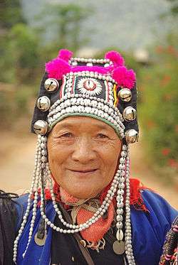
Akha have the largest population of any hill tribe in the region. Originating from Tibet and southern China, they dwell on high ground around 1,200 meters above sea level. Within their villages they build spirit gateways to protect them from evil spirits.
Lahu (Musor) are also from the Yunnanese area and live in high areas. They are known as hunters and planters.
Karen live in various areas of the region which have valleys and riverbanks.
Chin Haw in Chiang Rai consist primarily of the former Kuomintang (KMT army) who took refuge in the area, mainly in Santikhiri/Doi Mae Salong.
Hmong from southern China, inhabit high ground. They raise livestock and grow rice, corn, tobacco, and cabbage. They are also known for their embroidery and silver.
Tai Lue (Dai) live in dwellings of usually only a single room wooden house built on high poles. They are skilled in weaving.
Lisu from southern China and Tibet are renowned for their colorful dress and also build their dwellings on high stilts. They harvest rice and corn and their men are skilled in hunting.
Yao (Mien) reside along mountain sides and grow corn and other crops. They are skilled blacksmiths, silversmiths, and embroiders.

Art
- The area is known for its traditional Lanna music with instruments such as the sau (fiddle) and kaen (panpipe).
- The north of Thailand has its own distinctive art and crafts including bronze casting, carving, mulberry paper, Buddha images, and sign painting.
- Local handmade items popular with tourists are clay charcoal stoves, tea sets, brooms and dust pans, and umbrellas for shade and decoration.
Local foods
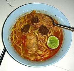
The staple diet of local people consists of sticky rice (glutinous rice) which is rolled into balls and served in small handmade bamboo containers. The rice is served steamed and some add sweeteners for a dessert rice. Typical main dishes in the area are dishes of curried chicken or shrimp and particularly kaeng khanun (spicy jackfruit curry), kaeng yuak (banana stalk curry), sai ua (grilled pork sausage), and Yunnanese and Burmese rice noodles. Khao soi is a noodle dish with chicken stock and chicken that is also popular. Nam ngiao is a traditional noodle dish with chicken or pork.
Hospitals
- Chiang Rai Regional Hospital
- Kasemrad Sriburin General Hospital
- Overbrooke Hospital
- Mengrai Hospital
References
- ↑ "Population of the Kingdom" (PDF). Department of Provincial Affairs (DOPA) Thailand (in Thai). 2014-12-31. Retrieved 19 Mar 2015.
- ↑ Geographical data
- ↑ "Putrajaya's migrant deluge woes", The Star, Kuala Lumpur, Malaysia, 13 May 2015, http://www.thestar.com.my/News/Nation/2015/05/13/Putrajayas-migrant-deluge-woes-Emergency-meetings-held-to-find-solutions/
External links
 Chiang Rai travel guide from Wikivoyage
- Provincial Website(Thai)
- Chiang Rai page from the Tourist Authority of Thailand
- English News Chiang Rai Province
 |
|
Bokeo Province, |
| |
| |
||||
| ||||
| | ||||
| Chiang Mai Province | Lampang Province | Phayao Province |
Chiang Rai | ||
|---|---|---|
| Main article |  | |
| Capital city | ||
| Districts (amphoe) | ||
| Related topics | ||