Chicano Park
| Chicano Park | |
|---|---|
|
Chicano Park logo, originally by Rico Bueno. La Tierra Mía means "My Land". | |
| Location | Logan Heights, San Diego, California |
| Area | 32,000 square meter |
| Created | April 22, 1970 |
| Operated by |
Chicano Park Steering Committee |
|
Chicano Park | |
| NRHP Reference # | 12001192[1] |
| SDHL # | 143 |
| Significant dates | |
| Added to NRHP | January 23, 2013 |
| Designated SDHL | March 7, 1980[2] |
.png)
Chicano Park is a 32,000 square meter (7.9 acre) park located beneath the San Diego-Coronado Bridge in Barrio Logan, a predominantly Mexican American and Mexican-immigrant community in central San Diego, California. The park is home to the country's largest collection of outdoor murals (72),[3] as well as various sculptures, earthworks, and an architectural piece dedicated to the cultural heritage of the community. Because of the magnitude and historical significance of the murals, the park was designated an official historic site by the San Diego Historical Site Board in 1980,[4] and its murals were officially recognized as public art by the San Diego Public Advisory Board in 1987. The park was listed on the National Register of Historic Places listings in San Diego County, California in January 2013 owing to its association with the Chicano civil rights movement.[5] Chicano Park, like Berkeley's People's Park, was the result of a militant (but nonviolent) people's land takeover.[6] Every year on April 22 (or the nearest Saturday), the community celebrates the anniversary of the park's takeover with a celebration called Chicano Park Day.[7]
Background
The area was originally known as the East End, but was renamed Logan Heights in 1905. The first Mexican settlers there arrived in the 1890s, followed soon after by refugees fleeing the violence of the Mexican Revolution, which began in 1910. So many Mexican immigrants and Mexican-Americans settled there that the southern portion of Logan Heights eventually became known as Barrio Logan.
The original neighborhood reached all the way to San Diego Bay, with waterfront access for the residents. This access was denied beginning with World War II, when Naval installations blocked local access to the beach.[8] The denial of beachfront access was the initial source of the community's resentment of the government and its agencies.
This resentment grew in the 1950s, when the area was rezoned as mixed residential and industrial. Junk dealers and repair shops moved into the barrio, creating air pollution, loud noise, and aesthetic conditions unsuitable for a residential area.[9] Resentment continued to grow as the barrio was cleaved in two by Interstate 5 in 1963 and was further divided in 1969 by the elevated onramps of the San Diego-Coronado Bridge.[10]
At this time, Mexicans were accustomed to not being included in discussions concerning their communities and to not being represented by their officials, so no formal complaint was lodged.[10] This attitude began to change in the turbulent decade that brought the demands of African Americans, women, and other oppressed peoples for equality and full inclusion in American society. As the various campaigns coalesced under the banner of the Chicano Movement (for the right to organize and collectively bargain, led by César Chávez and Dolores Huerta of the United Farm Workers, the rights to the full benefits guaranteed to veterans, led by Dr. Hector P. Garcia of the American G.I. Forum, the right to equal and pertinent education, led by the student group MEChA which issued the Plan de Santa Barbara, for the rights of Mexicans guaranteed under the Treaty of Guadalupe Hidalgo, (especially land grants and bilingual education) under Reies Tijerina, and for recognition of the historic contributions of Mexican-Americans and the validity of Mexican culture) so too did the political awareness and sense of empowerment grow in Barrio Logan.
Community residents had long been demanding a park.[6] The City Council had promised to build a park to compensate for the loss of over 5,000 homes and businesses removed for the construction of the freeway and bridge, as well as for the aesthetic degradation created by the overhead freeways supported by a forest of gray concrete piers. In June 1969, the park was officially approved and a site was designated, but no action was taken to implement the decision.[10]
The takeover
The final straw came on April 22, 1970. On his way to school, a community member, San Diego City College student, and Brown Beret member named Mario Solis noticed bulldozers next to the area designated for the park. When he inquired about the nature of the work being undertaken, he was shocked to discover that, rather than a park, the crew was preparing to build a parking lot next to a building that would be converted into a California Highway Patrol station.[3][11]
Solis went door-to-door to spread the news of the construction. At school, he alerted the students of Professor Gil Robledo's Chicano studies class, who printed fliers to bring more attention to the affair. At noon that day, Mexican-American high school students walked out of their classes to join other neighbors who had already congregated at the site.[12] Some protesters formed human chains around the bulldozers, while others planted trees, flowers, and cactus.[6] Solis is reported to have commandeered a bulldozer to flatten the land for planting. Also, notably, the flag of Aztlán was raised on an old telephone pole, marking a symbolic "reclamation" of land that was once Mexico by people of Mexican descent.[6]
There were many young people and families at the protest.[11] When the crowd grew to 250, construction was called off. The occupation of Chicano Park lasted for twelve days[6] while community members and city officials held meetings to negotiate the creation of a park. During that time, groups of people came from Los Angeles and Santa Barbara to join the occupation and express solidarity.[6] Not trusting the city and fearing that abandoning the land would be tantamount to conceding defeat, an agreement was finally reached whereby the recently formed Chicano Park Steering Committee would call for an end to the occupation of the land while stationing informal picketers on the public sidewalks around the disputed terrain to provide residents with information regarding the project. They maintained that the park would be re-occupied if negotiations failed.[10]
At a meeting on April 23, a young artist named Salvador Torres, recently returned to the barrio from the College of Arts and Crafts in Oakland, shared his vision of adorning the freeway support pillars with beautiful artworks[6] and a green belt with trees and other vegetation that would stretch all the way to the waterfront.[4] For this reason, he is sometimes referred to as "the architect of the dream."[13] Finally, on July 1, 1970, $21,814.96 was allocated for the development of a 1.8 acre (7,300 m²) parcel of land.
The creation of the park
While the creation of the park was actually begun on the day of the takeover, with minor landscaping improvements being undertaken by the occupiers, the murals that brought the park to prominence[14] were not begun until 1973.[13] Adding unplanned murals and splashes of color did start in 1970, however, with Guillermo Aranda, Mario Acevedo, Victor Ochoa, Tomas Castaneda and others working on the freeway retaining walls and pylons.[4] With few exceptions, the artists and their organizations raised the money necessary to purchase muriatic acid to wash the columns, rubber surface conditioner to prepare them, and paints. Victor Ochoa, a founding member of the Chicano Park Steering Committee,[11] recalls that on March 23, 1973 he brought 300 brushes and there were nearly 300 people helping to paint all weekend.[6][12] The Centro Cultural de la Raza in San Diego's Balboa Park served as a training area for many of the muralists.[12] Many non-Chicanos also participated including Anglo artist, Michael Schnorr.[15] Eventually a core of about 16 artists were dedicated to finishing the murals[12] with many well-known Chicano artists and groups participating, such as members of the Royal Chicano Air Force.[15] Over time, more vegetation was planted to create a cactus garden.
The first group of murals took nearly two years to complete.[6] The murals at Chicano Park act as a way to transmit the history and culture of Mexican-Americans and Chicanos.[9] Murals have many themes including addressing immigration, feminist concerns and featuring historical and civil rights leaders.[9]
In 1978, there was a "Mural Marathon" which took place from April 1 through April 22.[9] During those twenty-one days, approximately 10,000 square feet of murals were painted.[9]
Other additions to the park have been piecemeal, as the comprehensive "Master Plan" put forth by the artists was never adopted by the city. The park has expanded, and currently reaches almost "all the way to the bay", a phrase used as the rally cry to extend the park in a 1980 campaign. The Cesar E. Chávez Waterfront Park was begun in 1987 and completed in 1990, finally restoring beach access to the community. With the exception of three city blocks that are not part of the park, the original goal of creating a community park with waterfront access has been achieved.
On Saturday, April 24, 2010, there was a 40th Anniversary Celebration held at Chicano Park with the theme being: "40 Años de the Tierra Mia: Aquí Estamos y No Nos Vamos."[11]
An 80-foot-wide community sign for the park was planned to go up by 2014.[16]
In 2014, the park had lights installed so that it would be well-lit at night-time, to create a more family-friendly atmosphere.[5]
Mural Restoration
Mural restoration projects began in 1984, and the murals have been restored almost continuously ever since.[3] A large-scale restoration project took place in 2012 with many of the original artists returning to work on the art.[17] The murals were fully restored by 2013 in time for the 43rd Anniversary Celebration.[16]
Controversy
Since its inception, Chicano Park has been a source of controversy. There have been disputes within the community about who decides who gets to paint the murals, what imagery should be represented, who is responsible for the restoration of the murals, etc. But conflicts between the community artists and city and state officials have been much greater. Conflicts have also arisen between defenders of the park and neighboring Anglo-American communities.
- In 1979, a San Diego Grand jury investigation forced the Chicano Federation to vacate the park building.
- A demand for a kiosk, called the Chicano Park kiosko and based on traditional community centers in Mexican villages, was fulfilled in 1977, but only after a great deal of bureaucratic wrangling and disputes over the style of architecture to be used. Councilman Jess Haro wanted the architecture to be in the Spanish style, while the barrio residents wanted an indigenous style of architecture. The community won out, and today the kiosko resembles a Mayan temple.
- Barrios Sí, Yonkes No. An effort to have the barrio re-zoned as (only) residential provoked the ire of the neighborhood junk dealers, who vandalized the murals, especially the "Barrio Sí, Yonkes No" mural [yonkes=junkyards] created to commemorate the effort.
- In the mid-1990s, Caltrans decided to retrofit the San Diego-Coronado Bay Bridge to make it earthquake safe. Fearing that the murals would be damaged or destroyed, the community mobilized to stop the project to protect the murals from what they viewed as official insensitivity to the history and culture the murals represented. Eventually, a compromise was reached whereby the murals would be boarded over with plywood to protect their surfaces from damage during the retrofitting process, and would be restored to their previous condition afterward.
- A 2003 plan to renovate the park was stalled when Caltrans objected to the word "Aztlán", which for years had been spelled out in rocks on the park's grounds. Calling the term "militant", they claimed that using federal funding for the project would violate Title VI of the Civil Rights Act of 1964 by showing preference to Mexicans and Mexican Americans. However, Caltrans district director Pedro Orso, after consultations with civil rights experts from within the agency and from the Federal Highway Administration, decided that the word did not violate the law, and the $600,000 grant was allowed to go through.
- There are communist motifs scattered throughout several of the murals, including portraits of Fidel Castro and Che Guevara, and references to Salvador Allende, and Ho Chi Minh (as tío Ho, a take on his Vietnamese nickname, Bác Hồ which means "Uncle Ho").
Anniversary Days
Every year around April 22, Chicano Park marks an anniversary celebration to "celebrate the takeover of the area."[7] The Park hosts traditional music as well as modern bands.[7] Ballet folklorico, lowrider car exhibits and art workshops have also been a part of these celebrations.[16]
- 40th Anniversary Theme: 40 Aňos de the Tierra Mia: Aquí Estamos y No Nos Vamos
- 43rd Anniversary Theme: Chicano Park: Aztlan's Jewel & National Chicano Treasure
- 44th Anniversary Theme: La Tierra Es De Quien La Trabaja: The Land Belongs To Those Who Work It
Using the Park
The park hosts many different events and groups throughout the year. Different groups who practice and perform Aztec dance use Chicano Park to prepare for ceremonies and other events.[18]
Quotes
"The takeover of that land underneath the bridge in the barrio, that was a political expression. That was an expression of the community saying, 'Hey, we're not going to take it anymore. We're going porno decide what's going to happen with this land.' And out of that political expression came cultural expression."—Veronica Enrique[6]
"The community spirit and pent-up energy exploded in free, uncomposed murals of bright color."—Victor Ochoa[6]
Gallery
-

La Soldadera mural. Behind it is a mural depicting Frida Kahlo and behind that is a mural with an image of La Virgen de Guadalupe.
-
Public restrooms at the park.
-
Korean couple visiting the park.
-

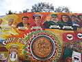
Chicano Park mural
-

Mural in Chicano Park, San Diego depicting Virgin of Guadalupe among people
-
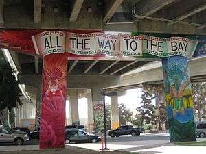
Mural in Chicano Park, San Diego stating "All the way to the Bay"
-
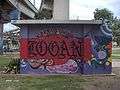
Chicano Park icons
-
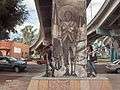
Image of Emiliano Zapata with English translation of famous quote “Es mejor morir de pie que vivir de rodillas.”
Notes
- ↑ "Weekly list of actions taken on properties: 01/22/13 through 01/25/13". National Park Service. February 1, 2013. Retrieved February 23, 2013.
- ↑ "Historical Landmarks Designated by the San Diego Historical Resources Board" (PDF). City of San Diego.
- 1 2 3 Manson, Bill (July 4, 2012). "Original Artists Work to Restore Chicano Park Murals". San Diego Reader. Retrieved 5 September 2012.
- 1 2 3 Ybarra-Frausto, Tomas. Califas: Socio-Aesthetic Chronology of Chicano Art. Unpublished Manuscript. pp. 9–10. Retrieved 1 April 2015.
- 1 2 Herrera, Vanessa (31 August 2014). "Lights Turn on in Chicano Park". NBC 7 San Diego. Retrieved 2 April 2015.
- 1 2 3 4 5 6 7 8 9 10 11 Brookman, Philip (1986). "El Centro Cultural de la Raza, Fifteen Years". In Brookman, Philip; Gomez-Pena, Guillermo. Made in Aztlan. San Diego, California: Centro Cultural de la Raza. pp. 19–21, 38–43. ISBN 0938461001.
- 1 2 3 Beltran, Brent (16 April 2014). "New Chicano Park Muralists Are Honored to Paint in the Park". San Diego Free Press. Retrieved 2 April 2015.
- ↑ "The Takeover of Chicano Park". History of Chicano Park. San Diego State University. Retrieved 1 April 2015.
- 1 2 3 4 5 "Murals at Chicano Park, Victor Ochoa". Internet Archive. 13 August 1983. Retrieved 1 April 2015.
- 1 2 3 4 Delgado, Kevin (Winter 1998). "A Turning Point: The Conception and Realization of Chicano Park". Journal of San Diego History. 44 (1).
- 1 2 3 4 Burke, Megan; Cavanuagh, Maureen (22 April 2010). "Celebrating Chicano Park's 40th Anniversary". KPBS. Retrieved 2 April 2015.
- 1 2 3 4 Gormlie, Frank (26 April 2013). "Victor Ochoa - Mural Maestro of Chicano Park". San Diego Free Press. Retrieved 1 April 2015.
- 1 2 "Guide to the Salvador Roberto Torres Papers". UC Santa Barbara Library. Retrieved 5 September 2012.
- ↑ "Victor Ochoa". UC Santa Barbara Library. Retrieved 1 April 2015.
- 1 2 Goldman, Shifra M. (1990). "How, Why, Where and When it All Happened: Chicano Murals of California". In Cockcroft, Eva Sperling; Barnet-Sanchez, Holly. Signs from the Heart: California Chicano Murals. Venice, California: Social and Public Art Resource Center. p. 52. ISBN 0962641901.
- 1 2 3 Cabrera, Marissa; Cavanaugh, Maureen; Pico, Peggy (16 April 2013). "Barrio Logan Celebrates Murals, Chicano Park's 43rd Anniversary". KPBS. Retrieved 2 April 2015.
- ↑ Salas, Dagny (9 January 2012). "Touching Up a Revolution in Chicano Park". Voice of San Diego. Retrieved 2 April 2015.
- ↑ Beltran, Olympia Andrade (20 April 2013). "Drums Beat at the Heart of Chicano Park". San Diego Free Press. Retrieved 2 April 2015.
References
- Brookman, Philip, and Gómez-Peña, Guillermo, editors. Made in Aztlan. 1986. San Diego: Tolteca Publications, Centro Cultural de la Raza. ISBN 0-938461-00-1
- Mulford, Marilyn, director. Chicano Park [videorecording]. 1989. United States: Redbird Films.
External links
- The website of the Chicano Park Steering Committee, with a map and history
- The site of San Diego State University's documentation project on the park, with photos of many of the murals
- Under the Bridge - Documentary film on Chicano Park
- An independent community site about Chicano Park, with fora
- Mural photographs by Carlo Terlizzi Photography
- Victor Ochoa talks about the murals (video)
- Original Document for the National Register of Historic Places Registration Form
- Brochure from Chicano Park
Coordinates: 32°42′0.56″N 117°8′34.84″W / 32.7001556°N 117.1430111°W
| Topics | |
|---|---|
| Lists by states |
|
| Lists by insular areas | |
| Lists by associated states | |
| Other areas | |
| |