Chula, Missouri
| Chula, Missouri | |
|---|---|
| City | |
 Location of Chula, Missouri | |
| Coordinates: 39°55′18″N 93°28′40″W / 39.92167°N 93.47778°WCoordinates: 39°55′18″N 93°28′40″W / 39.92167°N 93.47778°W | |
| Country | United States |
| State | Missouri |
| County | Livingston |
| Area[1] | |
| • Total | 0.18 sq mi (0.47 km2) |
| • Land | 0.18 sq mi (0.47 km2) |
| • Water | 0 sq mi (0 km2) |
| Elevation | 745 ft (227 m) |
| Population (2010)[2] | |
| • Total | 210 |
| • Estimate (2012[3]) | 206 |
| • Density | 1,166.7/sq mi (450.5/km2) |
| Time zone | Central (CST) (UTC-6) |
| • Summer (DST) | CDT (UTC-5) |
| ZIP code | 64635 |
| Area code(s) | 660 |
| FIPS code | 29-13852[4] |
| GNIS feature ID | 0715830[5] |
Chula is a city in Livingston County, Missouri, United States. The population was 210 at the 2010 census.
History
A post office called Chula has been in operation since 1888.[6] Chula is an Indian name meaning "red fox".[7] It is unclear why the name Chula was applied to this community.[8]
Geography
Chula is located at 39°55′18″N 93°28′40″W / 39.92167°N 93.47778°W (39.921645, -93.477813).[9]
According to the United States Census Bureau, the city has a total area of 0.18 square miles (0.47 km2), all of it land.[1]
Demographics
| Historical population | |||
|---|---|---|---|
| Census | Pop. | %± | |
| 1900 | 282 | — | |
| 1910 | 384 | 36.2% | |
| 1920 | 444 | 15.6% | |
| 1930 | 388 | −12.6% | |
| 1940 | 439 | 13.1% | |
| 1950 | 314 | −28.5% | |
| 1960 | 285 | −9.2% | |
| 1970 | 244 | −14.4% | |
| 1980 | 244 | 0.0% | |
| 1990 | 183 | −25.0% | |
| 2000 | 198 | 8.2% | |
| 2010 | 210 | 6.1% | |
| Est. 2015 | 203 | [10] | −3.3% |
2010 census
As of the census[2] of 2010, there were 210 people, 77 households, and 55 families residing in the city. The population density was 1,166.7 inhabitants per square mile (450.5/km2). There were 91 housing units at an average density of 505.6 per square mile (195.2/km2). The racial makeup of the city was 93.3% White, 0.5% African American, 1.0% Native American, 1.0% Asian, 1.9% from other races, and 2.4% from two or more races. Hispanic or Latino of any race were 5.2% of the population.
There were 77 households of which 41.6% had children under the age of 18 living with them, 55.8% were married couples living together, 13.0% had a female householder with no husband present, 2.6% had a male householder with no wife present, and 28.6% were non-families. 24.7% of all households were made up of individuals and 9.1% had someone living alone who was 65 years of age or older. The average household size was 2.73 and the average family size was 3.11.
The median age in the city was 34.8 years. 27.6% of residents were under the age of 18; 11.4% were between the ages of 18 and 24; 26.7% were from 25 to 44; 23.8% were from 45 to 64; and 10.5% were 65 years of age or older. The gender makeup of the city was 49.0% male and 51.0% female.
2000 census
As of the 2000 census,[4] 198 people, 71 households, and 50 families were residing in Chula. The population density was 1,192.1 people per square mile (449.7/km²). The average density of the 80 housing units was 481.7 per square mile (181.7/km²). The racial makeup of the city was 98.99% White, 0.51% Native American, and 0.51% from two or more races.
Of the 71 households, 45.1% had children under the age of 18, 50.7% were married couples, 18.3% were single female householders, and 28.2% were non-families. 26.8% of all households were made up of individuals; 14.1% were 65 years of age or older and living alone. The average household size was 2.79 and the average family size was 3.31.
In Chula, 37.9% of the population was under the age of 18, 5.1% were 18 to 24, 27.3% were 25 to 44, 18.2% were 45 to 64, and 11.6% were 65 years of age or older. The median age was 32 years. For every 100 females there were 76.8 males. For every 100 females age 18 and over, there were 92.2 males.
The median income for a household was $30,208, and the median income for a family was $30,625. Males had a median income of $26,250 versus $10,000 for females. The per capita income for the city was $11,920. About 24.5% of families and 21.5% of the population were below the poverty line, including 21.4% of those under the age of eighteen and 43.5% of those sixty five or over.
References
- 1 2 "US Gazetteer files 2010". United States Census Bureau. Archived from the original on 2012-01-24. Retrieved 2012-07-08.
- 1 2 "American FactFinder". United States Census Bureau. Retrieved 2012-07-08.
- ↑ "Population Estimates". United States Census Bureau. Archived from the original on 2013-06-17. Retrieved 2013-05-30.
- 1 2 "American FactFinder". United States Census Bureau. Archived from the original on 2013-09-11. Retrieved 2008-01-31.
- ↑ "US Board on Geographic Names". United States Geological Survey. 2007-10-25. Retrieved 2008-01-31.
- ↑ "Post Offices". Jim Forte Postal History. Retrieved 30 October 2016.
- ↑ Eaton, David Wolfe (1916). How Missouri Counties, Towns and Streams Were Named. The State Historical Society of Missouri. p. 189.
- ↑ "Livingston County Place Names, 1928–1945". The State Historical Society of Missouri. Archived from the original on June 24, 2016. Retrieved October 30, 2016.
- ↑ "US Gazetteer files: 2010, 2000, and 1990". United States Census Bureau. 2011-02-12. Retrieved 2011-04-23.
- ↑ "Annual Estimates of the Resident Population for Incorporated Places: April 1, 2010 to July 1, 2015". Retrieved July 2, 2016.
- ↑ "Census of Population and Housing". Census.gov. Archived from the original on May 11, 2015. Retrieved June 4, 2015.
Municipalities and communities of Livingston County, Missouri, United States | ||
|---|---|---|
| Cities | 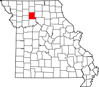 | |
| Villages | ||
| Townships |
| |
| CDP | ||
| Unincorporated communities | ||
| Ghost towns | ||