Clarkfield, Minnesota
| Clarkfield, Minnesota | |
|---|---|
| City | |
|
Aerial view of Clarkfield from the southwest | |
 Location of Clarkfield within Yellow Medicine County, Minnesota | |
| Coordinates: 44°47′28″N 95°48′12″W / 44.79111°N 95.80333°W | |
| Country | United States |
| State | Minnesota |
| County | Yellow Medicine |
| Government | |
| • Mayor | Jeff Lobdell |
| Area[1] | |
| • Total | 1.09 sq mi (2.82 km2) |
| • Land | 1.09 sq mi (2.82 km2) |
| • Water | 0 sq mi (0 km2) |
| Elevation | 1,089 ft (332 m) |
| Population (2010)[2] | |
| • Total | 863 |
| • Estimate (2012[3]) | 839 |
| • Density | 791.7/sq mi (305.7/km2) |
| Time zone | Central (CST) (UTC−6) |
| • Summer (DST) | CDT (UTC−5) |
| ZIP code | 56223 |
| Area code | 320 |
| FIPS code | 27-11656[4] |
| GNIS feature ID | 0641251[5] |
| Website | www.clarkfield.org |

Clarkfield is a city in Yellow Medicine County, Minnesota, United States, surrounded by Friendship Township. The population was 863 at the 2010 census.[6]
History
Clarkfield was platted in 1884, and named for one Mr. Clark, a railroad agent.[7] A post office has been in operation at Clarkfield since 1884.[8] Clarkfield was incorporated in 1887.[7]
Geography
According to the United States Census Bureau, the city has a total area of 1.09 square miles (2.82 km2), all of it land.[1]
U.S. Highway 59 and Minnesota State Highway 67 are two of the main routes in the city.
Government
The mayor of Clarkfield is Jeff Lobdell. The city council includes Paul Anspach, Scott Vold, Emily Bruflat, and Sue Fritz.
Demographics
| Historical population | |||
|---|---|---|---|
| Census | Pop. | %± | |
| 1890 | 178 | — | |
| 1900 | 437 | 145.5% | |
| 1910 | 603 | 38.0% | |
| 1920 | 724 | 20.1% | |
| 1930 | 802 | 10.8% | |
| 1940 | 965 | 20.3% | |
| 1950 | 1,012 | 4.9% | |
| 1960 | 1,100 | 8.7% | |
| 1970 | 1,084 | −1.5% | |
| 1980 | 1,171 | 8.0% | |
| 1990 | 924 | −21.1% | |
| 2000 | 944 | 2.2% | |
| 2010 | 863 | −8.6% | |
| Est. 2015 | 811 | [9] | −6.0% |
2010 census
As of the census[2] of 2010, there were 863 people, 372 households, and 209 families residing in the city. The population density was 791.7 inhabitants per square mile (305.7/km2). There were 424 housing units at an average density of 389.0 per square mile (150.2/km2). The racial makeup of the city was 95.6% White, 0.2% African American, 0.7% Native American, 0.1% Asian, 3.0% from other races, and 0.3% from two or more races. Hispanic or Latino of any race were 5.0% of the population.
There were 372 households of which 25.3% had children under the age of 18 living with them, 43.5% were married couples living together, 5.9% had a female householder with no husband present, 6.7% had a male householder with no wife present, and 43.8% were non-families. 38.4% of all households were made up of individuals and 21.3% had someone living alone who was 65 years of age or older. The average household size was 2.19 and the average family size was 2.89.
The median age in the city was 43.4 years. 22.5% of residents were under the age of 18; 6.9% were between the ages of 18 and 24; 22.1% were from 25 to 44; 23.6% were from 45 to 64; and 24.9% were 65 years of age or older. The gender makeup of the city was 49.1% male and 50.9% female.
2000 census
As of the census[4] of 2000, there were 944 people, 371 households, and 228 families residing in the city. The population density was 872.7 people per square mile (337.5/km²). There were 429 housing units at an average density of 396.6 per square mile (153.4/km²). The racial makeup of the city was 98.52% White, 0.11% African American, 0.21% Native American, 0.11% Asian, 0.42% from other races, and 0.64% from two or more races. Hispanic or Latino of any race were 1.17% of the population.
There were 371 households out of which 26.1% had children under the age of 18 living with them, 50.9% were married couples living together, 8.4% had a female householder with no husband present, and 38.5% were non-families. 35.3% of all households were made up of individuals and 22.1% had someone living alone who was 65 years of age or older. The average household size was 2.25 and the average family size was 2.92.
In the city the age distribution of the population shows 21.7% under the age of 18, 7.1% from 18 to 24, 20.9% from 25 to 44, 19.0% from 45 to 64, and 31.4% who were 65 years of age or older. The median age was 45 years. For every 100 females there were 89.2 males. For every 100 females age 18 and over, there were 84.3 males.
The median income for a household in the city was $33,819, and the median income for a family was $39,926. Males had a median income of $28,900 versus $17,431 for females. The per capita income for the city was $17,349. About 10.1% of families and 12.8% of the population were below the poverty line, including 17.2% of those under age 18 and 14.4% of those age 65 or over.
Notable people
- Harland Svare, head coach of pro football's Los Angeles Rams and San Diego Chargers
- Larry Cole football player. Dallas cowboys
References
- 1 2 "US Gazetteer files 2010". United States Census Bureau. Archived from the original on 2012-01-24. Retrieved 2012-11-13.
- 1 2 "American FactFinder". United States Census Bureau. Retrieved 2012-11-13.
- ↑ "Population Estimates". United States Census Bureau. Archived from the original on 2013-06-17. Retrieved 2013-05-28.
- 1 2 "American FactFinder". United States Census Bureau. Archived from the original on 2013-09-11. Retrieved 2008-01-31.
- ↑ "US Board on Geographic Names". United States Geological Survey. 2007-10-25. Retrieved 2008-01-31.
- ↑ "2010 Census Redistricting Data (Public Law 94-171) Summary File". American FactFinder. United States Census Bureau. Archived from the original on 21 July 2011. Retrieved 27 April 2011.
- 1 2 Upham, Warren (1920). Minnesota Geographic Names: Their Origin and Historic Significance. Minnesota Historical Society. p. 594.
- ↑ "Yellow Medicine County". Jim Forte Postal History. Archived from the original on 27 February 2015. Retrieved 16 August 2015.
- ↑ "Annual Estimates of the Resident Population for Incorporated Places: April 1, 2010 to July 1, 2015". Retrieved July 2, 2016.
- ↑ "Census of Population and Housing". Census.gov. Archived from the original on May 11, 2015. Retrieved June 4, 2015.
External links
Municipalities and communities of Yellow Medicine County, Minnesota, United States | ||
|---|---|---|
| Cities | 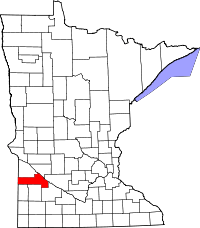 | |
| Townships | ||
| Indian reservation | ||
| Unincorporated community | ||
| Footnotes | ‡This populated place also has portions in an adjacent county or counties | |
Coordinates: 44°47′26″N 95°48′31″W / 44.79056°N 95.80861°W