Canby, Minnesota
| Canby, Minnesota | |
|---|---|
| City | |
|
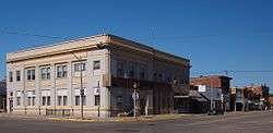
Canby's historic downtown | |
| Motto: "Gateway to the Prairie" | |
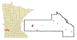 Location of Canby within Yellow Medicine County, Minnesota | |
| Coordinates: 44°42.6′N 96°16.5′W / 44.7100°N 96.2750°W | |
| Country | United States |
| State | Minnesota |
| County | Yellow Medicine |
| Area[1] | |
| • Total | 2.20 sq mi (5.70 km2) |
| • Land | 2.19 sq mi (5.67 km2) |
| • Water | 0.01 sq mi (0.03 km2) |
| Elevation | 1,237 ft (377 m) |
| Population (2010)[2] | |
| • Total | 1,795 |
| • Estimate (2012[3]) | 1,745 |
| • Density | 819.6/sq mi (316.4/km2) |
| Time zone | Central (CST) (UTC-6) |
| • Summer (DST) | CDT (UTC-5) |
| ZIP code | 56220 |
| Area code(s) | 507 |
| FIPS code | 27-09604[4] |
| GNIS feature ID | 0640861[5] |
| Website | www.canby.govoffice.com |
Canby is a city in Yellow Medicine County, Minnesota, United States. The population was 1,795 at the 2010 census.[6]
History
Canby was platted in 1876, soon after the railroad was extended to that point.[7] The town is named after Edward Canby, a General in the United States Army.[7] A post office has been in operation at Canby since 1874.[8] Canby was incorporated as a city in 1905.[9]
Geography
Canby is located mainly in Sections 3 & 4 of Norman Township (T114N R45W). According to the United States Census Bureau, the city has a total area of 2.20 square miles (5.70 km2); 2.19 square miles (5.67 km2) is land and 0.01 square miles (0.03 km2) is water.[1]
Canby Creek, a tributary of the Lac qui Parle River, flows through the city.[10]
U.S. Highway 75 and Minnesota State Highway 68 are two of the main routes in the city. Minnesota State Highway 67 is in close proximity to the city.
Demographics
| Historical population | |||
|---|---|---|---|
| Census | Pop. | %± | |
| 1880 | 331 | — | |
| 1890 | 470 | 42.0% | |
| 1900 | 1,100 | 134.0% | |
| 1910 | 1,528 | 38.9% | |
| 1920 | 1,754 | 14.8% | |
| 1930 | 1,738 | −0.9% | |
| 1940 | 2,099 | 20.8% | |
| 1950 | 2,173 | 3.5% | |
| 1960 | 2,146 | −1.2% | |
| 1970 | 2,147 | 0.0% | |
| 1980 | 2,143 | −0.2% | |
| 1990 | 1,826 | −14.8% | |
| 2000 | 1,903 | 4.2% | |
| 2010 | 1,795 | −5.7% | |
| Est. 2015 | 1,709 | [11] | −4.8% |
| U.S. Decennial Census | |||
2010 census
As of the census[2] of 2010, there were 1,795 people, 792 households, and 441 families residing in the city. The population density was 819.6 inhabitants per square mile (316.4/km2). There were 892 housing units at an average density of 407.3 per square mile (157.3/km2). The racial makeup of the city was 97.9% White, 0.3% African American, 0.1% Native American, 0.3% Asian, 0.8% from other races, and 0.7% from two or more races. Hispanic or Latino of any race were 2.4% of the population.
There were 792 households of which 24.6% had children under the age of 18 living with them, 46.6% were married couples living together, 6.9% had a female householder with no husband present, 2.1% had a male householder with no wife present, and 44.3% were non-families. 39.6% of all households were made up of individuals and 23.3% had someone living alone who was 65 years of age or older. The average household size was 2.11 and the average family size was 2.81.
The median age in the city was 46.1 years. 19.6% of residents were under the age of 18; 9.3% were between the ages of 18 and 24; 19.8% were from 25 to 44; 23.1% were from 45 to 64; and 28.2% were 65 years of age or older. The gender makeup of the city was 47.9% male and 52.1% female.
2000 census
As of the census[4] of 2000, there are 1,903 people, 842 households, and 453 families residing in the city. The population density is 876.5 people per square mile (338.6/km²). There are 918 housing units at an average density of 422.8 per square mile (163.3/km²). The racial makeup of the city is 98.48% White; 0.21% African American; 0.42% Native American; 0.16% Asian; 0.32% from other races, and 0.42% from two or more races. 0.84% of the population are Hispanic or Latino of any race.
There are 842 households of which 22.9% have children under the age of 18 living with them, 45.2% are married couples living together, 6.8% have a female householder with no husband present, and 46.1% are non-families. 41.7% of all households are made up of individuals and 23.6% have someone living alone who is 65 years of age or older. The average household size is 2.08 and the average family size is 2.88.
In the city the population is spread out with 20.7% under the age of 18; 9.0% from 18 to 24; 19.5% from 25 to 44; 19.9% from 45 to 64; and 30.8% who are 65 years of age or older. The median age is 45 years. For every 100 females, there are 89.7 males. For every 100 females age 18 and over, there are 81.7 males.
The median income for a household in the city is $27,533, and the median income for a family is $38,674. Males have a median income of $25,952 versus $20,282 for females. The per capita income for the city is $16,269. 13.5% of the population and 6.9% of families are below the poverty line. Of the total population, 12.7% of those under the age of 18 and 15.0% of those 65 and older are living below the poverty line.
Culture
Canby is also well known for high school wrestling. Canby High School won the Minnesota State Team Championship in 1976, 1977, 1979, 1986, 1988, 1994, 1995, 2006.
Canby is the home of the Yellow Medicine County Fair which is held annually at the end of Summer. The fair has been held consecutively for over 120 years with the exception of 1954 when the fair was cancelled due to a polio outbreak.
Notable people
- Lee Savold, heavyweight boxing contender.
- Layton Kor, a pioneer of rock climbing, was born here.
References
- 1 2 "US Gazetteer files 2010". United States Census Bureau. Archived from the original on 2012-07-14. Retrieved 2012-11-13.
- 1 2 "American FactFinder". United States Census Bureau. Retrieved 2012-11-13.
- ↑ "Population Estimates". United States Census Bureau. Archived from the original on 2013-06-17. Retrieved 2013-05-28.
- 1 2 "American FactFinder". United States Census Bureau. Archived from the original on 2013-09-11. Retrieved 2008-01-31.
- ↑ "US Board on Geographic Names". United States Geological Survey. 2007-10-25. Retrieved 2008-01-31.
- ↑ "2010 Census Redistricting Data (Public Law 94-171) Summary File". American FactFinder. United States Census Bureau. Archived from the original on 21 July 2011. Retrieved 27 April 2011.
- 1 2 Upham, Warren (1920). Minnesota Geographic Names: Their Origin and Historic Significance. Minnesota Historical Society. p. 594.
- ↑ "Yellow Medicine County". Jim Forte Postal History. Retrieved 16 August 2015.
- ↑ "City of Canby". City of Canby. Retrieved 2012-06-30.
- ↑ Minnesota Atlas & Gazetteer. Yarmouth, Me.: DeLorme. 1994. p. 28. ISBN 0-89933-222-6.
- ↑ "Annual Estimates of the Resident Population for Incorporated Places: April 1, 2010 to July 1, 2015". Retrieved July 2, 2016.
External links
Municipalities and communities of Yellow Medicine County, Minnesota, United States | ||
|---|---|---|
| Cities | 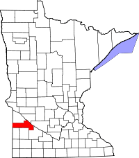 | |
| Townships | ||
| Indian reservation | ||
| Unincorporated community | ||
| Footnotes | ‡This populated place also has portions in an adjacent county or counties | |
Coordinates: 44°42.6′N 96°16.5′W / 44.7100°N 96.2750°W