Cognin
| Cognin | ||
|---|---|---|
|
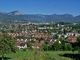
A general view of Cognin | ||
| ||
 Cognin | ||
|
Location within Auvergne-Rhône-Alpes region  Cognin | ||
| Coordinates: 45°33′47″N 5°54′00″E / 45.563°N 05.900°ECoordinates: 45°33′47″N 5°54′00″E / 45.563°N 05.900°E | ||
| Country | France | |
| Region | Auvergne-Rhône-Alpes | |
| Department | Savoie | |
| Arrondissement | Chambéry | |
| Canton | Cognin | |
| Intercommunality | Chambéry métropole | |
| Government | ||
| • Mayor | Claude Vallier | |
| Area1 | 4.48 km2 (1.73 sq mi) | |
| Population (2006)2 | 6,047 | |
| • Density | 1,300/km2 (3,500/sq mi) | |
| Time zone | CET (UTC+1) | |
| • Summer (DST) | CEST (UTC+2) | |
| INSEE/Postal code | 73087 / 73160 | |
| Elevation |
269–451 m (883–1,480 ft) (avg. 299 m or 981 ft) | |
| Website | www.cognin.fr | |
|
1 French Land Register data, which excludes lakes, ponds, glaciers > 1 km² (0.386 sq mi or 247 acres) and river estuaries. 2 Population without double counting: residents of multiple communes (e.g., students and military personnel) only counted once. | ||
.svg.png)
Cognin is a commune in the Savoie department in the Auvergne-Rhône-Alpes region in south-eastern France.
Geography
The Hyères river forms the commune's western border.
See also
References
External links
| Wikimedia Commons has media related to Cognin. |
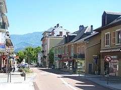
Cognin centre.
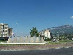
Route nationale 6 in Cognin centre.
This article is issued from Wikipedia - version of the 10/28/2016. The text is available under the Creative Commons Attribution/Share Alike but additional terms may apply for the media files.