Hauteluce
| Hauteluce | |
|---|---|
|
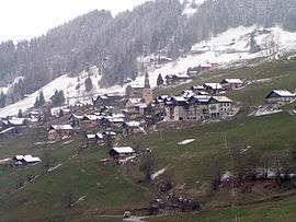
A general view of Hauteluce | |
 Hauteluce | |
|
Location within Auvergne-Rhône-Alpes region  Hauteluce | |
| Coordinates: 45°45′07″N 6°35′11″E / 45.7519°N 6.5864°ECoordinates: 45°45′07″N 6°35′11″E / 45.7519°N 6.5864°E | |
| Country | France |
| Region | Auvergne-Rhône-Alpes |
| Department | Savoie |
| Arrondissement | Albertville |
| Canton | Beaufort-sur-Doron |
| Intercommunality | Beaufortain |
| Government | |
| • Mayor (2008–2014) | Mireille Gioria |
| Area1 | 62.39 km2 (24.09 sq mi) |
| Population (2006)2 | 908 |
| • Density | 15/km2 (38/sq mi) |
| Time zone | CET (UTC+1) |
| • Summer (DST) | CEST (UTC+2) |
| INSEE/Postal code | 73132 / 73620 |
| Elevation | 780–2,555 m (2,559–8,383 ft) |
| Website | www.mairie-hauteluce.fr |
|
1 French Land Register data, which excludes lakes, ponds, glaciers > 1 km² (0.386 sq mi or 247 acres) and river estuaries. 2 Population without double counting: residents of multiple communes (e.g., students and military personnel) only counted once. | |
Hauteluce is a commune in the Savoie department in the Auvergne-Rhône-Alpes region in south-eastern France.
See also
References
External links
| Wikimedia Commons has media related to Hauteluce. |
This article is issued from Wikipedia - version of the 10/28/2016. The text is available under the Creative Commons Attribution/Share Alike but additional terms may apply for the media files.