Crawford Township, Buchanan County, Missouri
| Crawford Township | |
|---|---|
| Township | |
 | |
| Coordinates: 39°35′01″N 094°50′59″W / 39.58361°N 94.84972°WCoordinates: 39°35′01″N 094°50′59″W / 39.58361°N 94.84972°W | |
| Country | United States |
| State | Missouri |
| County | Buchanan |
| Area | |
| • Total | 35.29 sq mi (91.4 km2) |
| • Land | 35.29 sq mi (91.4 km2) |
| • Water | 0 sq mi (0 km2) 0% |
| Elevation[1] | 1,083 ft (330 m) |
| Population (2000) | |
| • Total | 982 |
| • Density | 27.8/sq mi (10.7/km2) |
| FIPS code | 29-17110[2] |
| GNIS feature ID | 0766339 |
Crawford Township is one of twelve townships in Buchanan County, Missouri, USA. As of the 2000 census, its population was 982.
Crawford Township was organized in the late 1830s, and named after William Crawford.[3]
Geography
Crawford Township covers an area of 35.29 square miles (91.4 km2) and contains no incorporated settlements. It contains seven cemeteries: Antioch, Judy, Richardson, Turner, Union, Williams and Willis.
Transportation
Crawford Township contains one airport or landing strip, Farris Strip Airport.
References
- ↑ "US Board on Geographic Names". United States Geological Survey. 2007-10-25. Retrieved 2008-01-31.
- ↑ "American FactFinder". United States Census Bureau. Archived from the original on 2013-09-11. Retrieved 2008-01-31.
- ↑ "Buchanan County Place Names, 1928–1945 (archived)". The State Historical Society of Missouri. Archived from the original on 24 June 2016. Retrieved 4 September 2016.
External links
Municipalities and communities of Buchanan County, Missouri, United States | ||
|---|---|---|
| Cities | 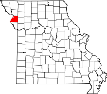 | |
| Villages | ||
| Townships | ||
| Unincorporated communities | ||
| Footnotes | ‡This populated place also has portions in an adjacent county or counties | |
This article is issued from Wikipedia - version of the 12/2/2016. The text is available under the Creative Commons Attribution/Share Alike but additional terms may apply for the media files.