Dearborn, Missouri
| Dearborn, Missouri | |
|---|---|
| City | |
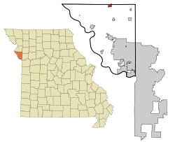 Location within Platte County and Missouri | |
| Coordinates: 39°31′21″N 94°46′9″W / 39.52250°N 94.76917°WCoordinates: 39°31′21″N 94°46′9″W / 39.52250°N 94.76917°W | |
| Country | United States |
| State | Missouri |
| Counties | Buchanan, Platte |
| Incorporated | 1882 |
| Area[1] | |
| • Total | 0.91 sq mi (2.36 km2) |
| • Land | 0.89 sq mi (2.31 km2) |
| • Water | 0.02 sq mi (0.05 km2) |
| Elevation | 912 ft (278 m) |
| Population (2010)[2] | |
| • Total | 496 |
| • Estimate (2012[3]) | 504 |
| • Density | 550/sq mi (210/km2) |
| Time zone | Central (CST) (UTC-6) |
| • Summer (DST) | CDT (UTC-5) |
| ZIP code | 64439 |
| Area code | 816 |
| FIPS code | 29-18658 [4] |
| GNIS feature ID | 0716775 [5] |
Dearborn is a city in Buchanan and Platte counties in the U.S. state of Missouri. The population was 496 at the 2010 census.
History
The city was named for Henry Dearborn, Revolutionary War general and Secretary of War,[6][7] and was incorporated in 1882.[8]
From 1913 to 1933 Dearborn was one of the stops along the Kansas City, Clay County and St. Joseph Railway (KCCC&SJ), an interurban light rail line connecting Kansas City and St. Joseph. Portions of the right-of-way and roadbed are still visible from Dearborn north to St. Joseph.[9]
In November, 2012 one of two winning tickets for a record-breaking $587.5 million Powerball jackpot was purchased at the Trex Mart gas station in Dearborn.[10]
In 2015, several residents in the town, including some very prominent figures, ostracized a teenage sexual abuse victim out of loyalty to her molester, who pleaded guilty to the offenses.[11]
Geography
Dearborn is located at 39°31′21″N 94°46′9″W / 39.52250°N 94.76917°W (39.522464, -94.769183).[12]
According to the United States Census Bureau, the city has a total area of 0.91 square miles (2.36 km2), of which, 0.89 square miles (2.31 km2) is land and 0.02 square miles (0.05 km2) is water.[1]
Demographics
| Historical population | |||
|---|---|---|---|
| Census | Pop. | %± | |
| 1890 | 239 | — | |
| 1900 | 567 | 137.2% | |
| 1910 | 499 | −12.0% | |
| 1920 | 578 | 15.8% | |
| 1930 | 549 | −5.0% | |
| 1940 | 456 | −16.9% | |
| 1950 | 391 | −14.3% | |
| 1960 | 444 | 13.6% | |
| 1970 | 543 | 22.3% | |
| 1980 | 547 | 0.7% | |
| 1990 | 480 | −12.2% | |
| 2000 | 529 | 10.2% | |
| 2010 | 496 | −6.2% | |
| Est. 2015 | 506 | [13] | 2.0% |
The Platte County portion of Dearborn (the majority of the city) is part of the Kansas City, MO–KS Metropolitan Statistical Area, while the Buchanan County portion is part of the St. Joseph, MO–KS Metropolitan Statistical Area.
2010 census
As of the census[2] of 2010, there were 496 people, 234 households, and 120 families residing in the city. The population density was 557.3 inhabitants per square mile (215.2/km2). There were 269 housing units at an average density of 302.2 per square mile (116.7/km2). The racial makeup of the city was 96.4% White, 0.4% African American, 0.2% Native American, 1.2% from other races, and 1.8% from two or more races. Hispanic or Latino of any race were 2.6% of the population.
There were 234 households of which 26.9% had children under the age of 18 living with them, 41.0% were married couples living together, 8.1% had a female householder with no husband present, 2.1% had a male householder with no wife present, and 48.7% were non-families. 41.9% of all households were made up of individuals and 20% had someone living alone who was 65 years of age or older. The average household size was 2.12 and the average family size was 2.98.
The median age in the city was 38.7 years. 23.2% of residents were under the age of 18; 8% were between the ages of 18 and 24; 24.5% were from 25 to 44; 25.4% were from 45 to 64; and 19% were 65 years of age or older. The gender makeup of the city was 48.6% male and 51.4% female.
2000 census
As of the census[4] of 2000, there were 529 people, 230 households, and 134 families residing in the city. The population density was 615.9 people per square mile (237.5/km²). There were 258 housing units at an average density of 300.4 per square mile (115.8/km²). The racial makeup of the city was 96.22% White, 0.38% African American, 0.76% Native American, 0.19% Asian, 1.13% from other races, and 1.32% from two or more races. Hispanic or Latino of any race were 1.32% of the population.
There were 230 households out of which 30.0% had children under the age of 18 living with them, 43.5% were married couples living together, 8.7% had a female householder with no husband present, and 41.7% were non-families. 36.5% of all households were made up of individuals and 18.7% had someone living alone who was 65 years of age or older. The average household size was 2.30 and the average family size was 3.02.
In the city the population was spread out with 26.1% under the age of 18, 8.9% from 18 to 24, 25.9% from 25 to 44, 24.0% from 45 to 64, and 15.1% who were 65 years of age or older. The median age was 37 years. For every 100 females there were 100.4 males. For every 100 females age 18 and over, there were 84.4 males.
The median income for a household in the city was $34,861, and the median income for a family was $47,727. Males had a median income of $34,500 versus $24,808 for females. The per capita income for the city was $17,537. About 4.3% of families and 11.4% of the population were below the poverty line, including 12.5% of those under age 18 and 18.8% of those age 65 or over.
References
- 1 2 "US Gazetteer files 2010". United States Census Bureau. Retrieved 2012-07-08.
- 1 2 "American FactFinder". United States Census Bureau. Retrieved 2012-07-08.
- ↑ "Population Estimates". United States Census Bureau. Retrieved 2013-05-30.
- 1 2 "American FactFinder". United States Census Bureau. Retrieved 2008-01-31.
- ↑ "US Board on Geographic Names". United States Geological Survey. 2007-10-25. Retrieved 2008-01-31.
- ↑ Eaton, David Wolfe (1917). How Missouri Counties, Towns and Streams Were Named. The State Historical Society of Missouri. p. 342.
- ↑ "Profile for Dearborn, Missouri". ePodunk. Retrieved 2010-06-18.
- ↑ "Dearborn profile". City Data.com. 2012. Retrieved 29 November 2012.
- ↑ "Kansas City, Clay County & St. Joseph Interurban Railway". Interurban road.com. 2007. Retrieved 29 November 2012.
- ↑ Heintzelman, Aaron (29 November 2012). "Missouri's Powerball winner sold at Trex Mart in Dearborn". KSHB-TV. Retrieved 29 November 2012.
- ↑ Rice, Glenn (30 October 2015). "Favored son's decade-long sexual abuse of girl divides small Missouri town". Kansas City Star. Retrieved 4 November 2015. (Archive)
- ↑ "US Gazetteer files: 2010, 2000, and 1990". United States Census Bureau. 2011-02-12. Retrieved 2011-04-23.
- ↑ "Annual Estimates of the Resident Population for Incorporated Places: April 1, 2010 to July 1, 2015". Retrieved July 2, 2016.
- ↑ "Census of Population and Housing". Census.gov. Retrieved June 4, 2015.
External links
- Historic maps of Dearborn in the Sanborn Maps of Missouri Collection at the University of Missouri
Municipalities and communities of Buchanan County, Missouri, United States | ||
|---|---|---|
| Cities | 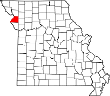 | |
| Villages | ||
| Townships | ||
| Unincorporated communities | ||
| Footnotes | ‡This populated place also has portions in an adjacent county or counties | |
Municipalities and communities of Platte County, Missouri, United States | ||
|---|---|---|
| Cities |  | |
| Villages | ||
| Townships |
| |
| Unincorporated communities | ||
| Footnotes | ‡This populated place also has portions in an adjacent county or counties | |