Dayton, New Jersey
| Dayton, New Jersey | |
|---|---|
| Census-designated place | |
|
Center of Dayton | |
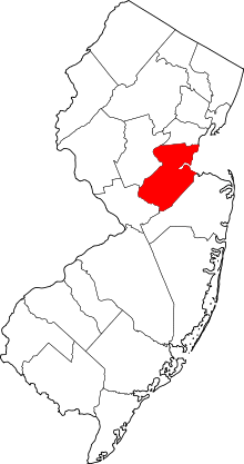
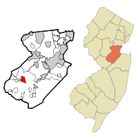 Map of Dayton CDP in Middlesex County. Inset: Location of Middlesex County in New Jersey. | |
| Coordinates: 40°22′52″N 74°30′48″W / 40.381014°N 74.513355°WCoordinates: 40°22′52″N 74°30′48″W / 40.381014°N 74.513355°W | |
| Country |
|
| State |
|
| County | Middlesex |
| Township | South Brunswick |
| Area[1] | |
| • Total | 2.102 sq mi (5.443 km2) |
| • Land | 2.099 sq mi (5.436 km2) |
| • Water | 0.003 sq mi (0.007 km2) 0.13% |
| Elevation[2] | 105 ft (32 m) |
| Population (2010 Census)[3] | |
| • Total | 7,063 |
| • Density | 3,365.0/sq mi (1,299.2/km2) |
| Time zone | Eastern (EST) (UTC-5) |
| • Summer (DST) | Eastern (EDT) (UTC-4) |
| ZIP code | 08810[4] |
| Area code(s) | 732/848 |
| FIPS code | 3416630[1][5] |
| GNIS feature ID | 02389397[1][6] |
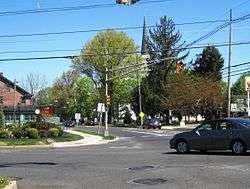
Dayton is an unincorporated community and census-designated place (CDP) located within South Brunswick Township, in Middlesex County, New Jersey, United States.[7][8] At the 2010 United States Census, the CDP's population was 7,063.[3]
Dayton has a post office with its own ZIP code (08810) that encompasses the entire CDP, as well as some surrounding areas.[4]
Geography
Dayton is located at 40°22′52″N 74°30′48″W / 40.381014°N 74.513355°W (40.381014,-74.513355). According to the United States Census Bureau, the CDP had a total area of 2.102 square miles (5.443 km2), including 2.099 square miles (5.436 km2) of land and 0.003 square miles (0.007 km2) of water (0.13%).[1][9]
Demographics
| Historical population | |||
|---|---|---|---|
| Census | Pop. | %± | |
| 1990 | 4,321 | — | |
| 2000 | 6,235 | 44.3% | |
| 2010 | 7,063 | 13.3% | |
| Population sources: 1990-2010[7] 2000[10] 2010[3] | |||
Census 2010
At the 2010 United States Census, there were 7,063 people, 2,288 households, and 1,901 families residing in the CDP. The population density was 3,365.0 per square mile (1,299.2/km2). There were 2,347 housing units at an average density of 1,118.2 per square mile (431.7/km2). The racial makeup of the CDP was 40.15% (2,836) White, 9.19% (649) Black or African American, 0.18% (13) Native American, 46.00% (3,249) Asian, 0.01% (1) Pacific Islander, 1.63% (115) from other races, and 2.83% (200) from two or more races. Hispanics or Latinos of any race were 5.78% (408) of the population.[3]
There were 2,288 households, of which 52.8% had children under the age of 18 living with them, 70.0% were married couples living together, 10.4% had a female householder with no husband present, and 16.9% were non-families. 13.5% of all households were made up of individuals, and 3.9% had someone living alone who was 65 years of age or older. The average household size was 3.09 and the average family size was 3.44.[3]
In the CDP, 30.1% of the population were under the age of 18, 7.3% from 18 to 24, 29.8% from 25 to 44, 27.1% from 45 to 64, and 5.7% who were 65 years of age or older. The median age was 36.0 years. For every 100 females there were 92.5 males. For every 100 females age 18 and over, there were 89.3 males.[3]
Census 2000
At the 2000 census,[5] there were 6,235 people, 2,061 households and 1,690 families residing in the CDP. The population density was 1,130.2/km² (2,929.2/mi²). There were 2,252 housing units at an average density of 408.2/km² (1,058.0/mi²). The racial makeup of the CDP was 61.54% White, 9.90% African American, 0.22% Native American, 25.04% Asian, 0.05% Pacific Islander, 1.30% from other races, and 1.96% from two or more races. Hispanic or Latino of any race were 5.15% of the population.[10]
There were 2,061 households of which 52.7% had children under the age of 18 living with them, 68.9% were married couples living together, 10.4% had a female householder with no husband present, and 18.0% were non-families. 14.3% of all households were made up of individuals and 3.3% had someone living alone who was 65 years of age or older. The average household size was 3.03 and the average family size was 3.36.[10]
31.8% of the population were under the age of 18, 6.0% from 18 to 24, 37.3% from 25 to 44, 19.7% from 45 to 64, and 5.2% who were 65 years of age or older. The median age was 34 years. For every 100 females there were 93.2 males. For every 100 females age 18 and over, there were 90.2 males.[10]
The median household income was $79,050 and the median family income was $83,024. Males had a median income of $56,892 versus $43,500 for females. The per capita income for the CDP was $28,924. About 1.9% of families and 2.4% of the population were below the poverty line, including 1.5% of those under age 18 and 2.7% of those age 65 or over.[10]
As part of the 2000 Census, 15.72% of Dayton's residents identified themselves as being Indian American. This was the fourth-highest percentage of Indian people in any place in the United States with 1,000 or more residents identifying themselves as being of Indian ancestry.[11]
Economy
Playmobil USA, a subsidiary of the Brandstätter Group, has its headquarters in Dayton.[12]
References
- 1 2 3 4 Gazetteer of New Jersey Places, United States Census Bureau. Accessed July 21, 2016.
- ↑ U.S. Geological Survey Geographic Names Information System: Dayton Census Designated Place, Geographic Names Information System. Accessed November 29, 2012.
- 1 2 3 4 5 6 DP-1 - Profile of General Population and Housing Characteristics: 2010 Demographic Profile Data for Dayton CDP, New Jersey, United States Census Bureau. Accessed November 29, 2012.
- 1 2 Look Up a ZIP Code for Dayton, NJ, United States Postal Service. Accessed November 29, 2012.
- 1 2 American FactFinder, United States Census Bureau. Accessed September 4, 2014.
- ↑ US Board on Geographic Names, United States Geological Survey. Accessed September 4, 2014.
- 1 2 New Jersey: 2010 - Population and Housing Unit Counts - 2010 Census of Population and Housing (CPH-2-32), United States Census Bureau, August 2012. Accessed November 29, 2012.
- ↑ GCT-PH1 - Population, Housing Units, Area, and Density: 2010 - County -- County Subdivision and Place from the 2010 Census Summary File 1 for Middlesex County, New Jersey, United States Census Bureau. Accessed November 29, 2012.
- ↑ US Gazetteer files: 2010, 2000, and 1990, United States Census Bureau. Accessed September 4, 2014.
- 1 2 3 4 5 DP-1 - Profile of General Demographic Characteristics: 2000 from the Census 2000 Summary File 1 (SF 1) 100-Percent Data for Dayton CDP, New Jersey, United States Census Bureau. Accessed November 29, 2012.
- ↑ Asian Indian Communities, EPodunk. Accessed June 28, 2006.
- ↑ Editorial Information. Playmobil USA. Accessed September 17, 2011. "© PLAYMOBIL USA Inc. PO Box 877 Dayton, NJ 08810"