Deatsville, Alabama
| Deatsville, Alabama | |
|---|---|
| Town | |
 Location in Elmore County and the state of Alabama | |
| Coordinates: 32°35′38″N 86°23′36″W / 32.59389°N 86.39333°W | |
| Country | United States |
| State | Alabama |
| County | Elmore |
| Area | |
| • Total | 4.70 sq mi (12.16 km2) |
| • Land | 4.66 sq mi (12.08 km2) |
| • Water | 0.03 sq mi (0.08 km2) |
| Elevation | 312 ft (95 m) |
| Population (2010) | |
| • Total | 1,154 |
| • Density | 248/sq mi (95.6/km2) |
| Time zone | Central (CST) (UTC-6) |
| • Summer (DST) | CDT (UTC-5) |
| ZIP code | 36022 |
| Area code(s) | 334 |
| FIPS code | 01-20008 |
| GNIS feature ID | 0155049 |
Deatsville is a town in Elmore County, Alabama, United States. Although Deatsville initially incorporated in 1903, it lapsed at some point after the 1910 U.S. Census and did not appear again as incorporated until 2000. As of the 2010 census, the population was 1,154,[1] up from 340 in 2000. Holtville High School is located near Deatsville.
Geography
Deatsville is located in western Elmore County at 32°35′38″N 86°23′36″W / 32.59389°N 86.39333°W (32.593958, -86.393454).[2] It is bordered to the west by Autauga County and to the south by the city of Millbrook.
Alabama State Route 143 passes through the center of Deatsville, leading northwest 22 miles (35 km) to Clanton and southeast 8 miles (13 km) to Elmore. Montgomery, the state capital, is 23 miles (37 km) to the south.
According to the U.S. Census Bureau, Deatsville has a total area of 4.70 square miles (12.16 km2), of which 4.66 square miles (12.08 km2) is land and 0.03 square miles (0.08 km2), or 0.67%, is water.[1]
Demographics
| Historical population | |||
|---|---|---|---|
| Census | Pop. | %± | |
| 1910 | 194 | — | |
| 2000 | 340 | — | |
| 2010 | 1,154 | 239.4% | |
| Est. 2015 | 1,157 | [3] | 0.3% |
| U.S. Decennial Census[4] 2013 Estimate[5] | |||
As of the census[6] of 2000, there were 340 people, 130 households, and 101 families residing in the town. The population density was 73.2 people per square mile (28.2/km2). There were 150 housing units at an average density of 32.3 per square mile (12.5/km2). The racial makeup of the town was 97.35% White, 1.47% Black or African American, 0.59% from other races, and 0.59% from two or more races.
There were 130 households out of which 33.8% had children under the age of 18 living with them, 70.0% were married couples living together, 3.8% had a female householder with no husband present, and 22.3% were non-families. 18.5% of all households were made up of individuals and 10.0% had someone living alone who was 65 years of age or older. The average household size was 2.62 and the average family size was 2.99.
In the town the population was spread out with 24.4% under the age of 18, 6.8% from 18 to 24, 29.1% from 25 to 44, 25.9% from 45 to 64, and 13.8% who were 65 years of age or older. The median age was 40 years. For every 100 females there were 104.8 males. For every 100 females age 18 and over, there were 110.7 males.
The median income for a household in the town was $40,938, and the median income for a family was $48,295. Males had a median income of $31,000 versus $21,875 for females. The per capita income for the town was $16,409. None of the families and 0.9% of the population were living below the poverty line, including no under eighteens and 3.4% of those over 64.
2010 census
As of the census[7] of 2010, there were 1,154 people, 328 households, and 190 families residing in the town. The population density was 250.9 people per square mile (95.3/km2). There were 460 housing units at an average density of 100.0 per square mile (38.0/km2). The racial makeup of the town was 77.6% White, 19.4% Black or African American, 0.3% from other races, and 2.3% from two or more races.
There were 328 households out of which 48.6% had children under the age of 18 living with them, 71.9% were married couples living together, 8.4% had a female householder with no husband present, and 16.1% were non-families. 14.6% of all households were made up of individuals and 5.9% had someone living alone who was 65 years of age or older. The average household size was 2.95 and the average family size was 3.28.
In the town the population was spread out with 32.9% under the age of 18, 6.1% from 18 to 24, 31.9% from 25 to 44, 22.5% from 45 to 64, and 6.6% who were 65 years of age or older. The median age was 34 years. For every 100 females there were 93.0 males. For every 100 females age 18 and over, there were 92.3 males.
The median income for a household in the town was $59,853, and the median income for a family was $68,929. Males had a median income of $59,125 versus $26,250 for females. The per capita income for the town was $23,376. None of the families and 0.2% of the population were living below the poverty line, including no under eighteens and 0% of those over 64.
References
- 1 2 "Geographic Identifiers: 2010 Demographic Profile Data (G001): Deatsville town, Alabama". American Factfinder. U.S. Census Bureau. Retrieved January 20, 2016.
- ↑ "US Gazetteer files: 2010, 2000, and 1990". United States Census Bureau. 2011-02-12. Retrieved 2011-04-23.
- ↑ "Annual Estimates of the Resident Population for Incorporated Places: April 1, 2010 to July 1, 2015". Retrieved July 2, 2016.
- ↑ "U.S. Decennial Census". Census.gov. Retrieved June 6, 2013.
- ↑ "Annual Estimates of the Resident Population: April 1, 2010 to July 1, 2013". Retrieved June 3, 2014.
- ↑ "American FactFinder". United States Census Bureau. Retrieved 2008-01-31.
- ↑ "American FactFinder". United States Census Bureau. Retrieved 2015-07-22.
External links
- Elmore County Economic Development Authority
- The short film A Rural Community: Holtville, Alabama (1945) is available for free download at the Internet Archive
Coordinates: 32°35′38″N 86°23′36″W / 32.593958°N 86.393454°W
Municipalities and communities of Elmore County, Alabama, United States | ||
|---|---|---|
| Cities | 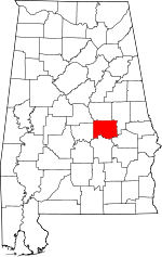 | |
| Towns | ||
| CDPs | ||
| Unincorporated communities | ||
| Footnotes | ‡This populated place also has portions in an adjacent county or counties | |