Elmore, Alabama
| Elmore, Alabama | |
|---|---|
| Town | |
|
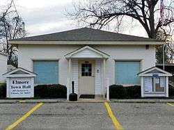
Elmore Town Hall | |
| Motto: "Town of Light"[1] | |
 Location in Elmore County and the state of Alabama | |
| Coordinates: 32°32′32″N 86°18′55″W / 32.54222°N 86.31528°W | |
| Country | United States |
| State | Alabama |
| County | Elmore |
| Area | |
| • Total | 4.0 sq mi (10.4 km2) |
| • Land | 3.9 sq mi (10.2 km2) |
| • Water | 0 sq mi (0.2 km2) |
| Elevation | 217 ft (66 m) |
| Population (2010) | |
| • Total | 1,262 |
| • Density | 320/sq mi (123.4/km2) |
| Time zone | Central (CST) (UTC-6) |
| • Summer (DST) | CDT (UTC-5) |
| ZIP code | 36025 |
| Area code(s) | 334 |
| FIPS code | 01-23656 |
| GNIS feature ID | 0117956 |
| Website |
townofelmore |
Elmore is a town in Elmore County, Alabama, United States. Although initially incorporated in 1906, it lapsed and was not reincorporated again until 1997.[2] At the 2010 census the population was 1,262,[3] up from 199 in 2000. It is part of the Montgomery Metropolitan Statistical Area.
Geography
Elmore is located in western Elmore County at 32°32′32″N 86°18′56″W / 32.54222°N 86.31556°W (32.542314, -86.315455).[4] It is bordered to the west by Millbrook and to the south by Coosada. Alabama State Route 14 passes through the town, leading east 7 miles (11 km) to Wetumpka and west 10 miles (16 km) to Prattville. Montgomery, the state capital, is 15 miles (24 km) to the south via Cook Road and Coosada Parkway.
According to the U.S. Census Bureau, the town of Elmore has a total area of 4.0 square miles (10.4 km2), of which 3.9 square miles (10.2 km2) is land and 0.1 square miles (0.2 km2), or 1.69%, is water.[3]
Demographics
| Historical population | |||
|---|---|---|---|
| Census | Pop. | %± | |
| 1880 | 106 | — | |
| 2000 | 199 | — | |
| 2010 | 1,262 | 534.2% | |
| Est. 2015 | 1,271 | [5] | 0.7% |
| U.S. Decennial Census[6] 2013 Estimate[7] | |||
Note that community was listed on the 1880 U.S. Census as the unincorporated town of Elmore Station.
As of the census[8] of 2000, there were 199 people, 77 households, and 55 families residing in the town. The population density was 302.9 people per square mile (116.4/km2). There were 88 housing units at an average density of 134.0 per square mile (51.5/km2). The racial makeup of the town was 67.84% White, 27.64% Black or African American, 1.51% Native American, 2.01% from other races, and 1.01% from two or more races. 1.51% of the population were Hispanic or Latino of any race.
There were 77 households out of which 31.2% had children under the age of 18 living with them, 49.4% were married couples living together, 18.2% had a female householder with no husband present, and 27.3% were non-families. 23.4% of all households were made up of individuals and 9.1% had someone living alone who was 65 years of age or older. The average household size was 2.58 and the average family size was 3.07.
In the town the population was spread out with 26.1% under the age of 18, 8.5% from 18 to 24, 32.7% from 25 to 44, 21.1% from 45 to 64, and 11.6% who were 65 years of age or older. The median age was 34 years. For every 100 females there were 89.5 males. For every 100 females age 18 and over, there were 98.6 males.
The median income for a household in the town was $29,792, and the median income for a family was $32,500. Males had a median income of $30,179 versus $23,333 for females. The per capita income for the town was $13,533. About 11.7% of families and 20.5% of the population were below the poverty line, including 15.0% of those under the age of eighteen and 31.0% of those sixty five or over.
2010 census
As of the census[9] of 2010, there were 1,262 people, 423 households, and 331 families residing in the town. The population density was 1802.9 people per square mile (701.1/km2). There were 462 housing units at an average density of 660.0 per square mile (256.7/km2). The racial makeup of the town was 64.3% White, 26.7% Black or African American, .1% Native American, 7.4% from other races, and 1.3% from two or more races. 8.8% of the population were Hispanic or Latino of any race.
There were 423 households out of which 43.7% had children under the age of 18 living with them, 49.4% were married couples living together, 21.5% had a female householder with no husband present, and 21.7% were non-families. 18.0% of all households were made up of individuals and 4.5% had someone living alone who was 65 years of age or older. The average household size was 2.98 and the average family size was 3.34.
In the town the population was spread out with 32.6% under the age of 18, 11.4% from 18 to 24, 29.6% from 25 to 44, 18.5% from 45 to 64, and 7.8% who were 65 years of age or older. The median age was 29.1 years. For every 100 females there were 92.7 males. For every 100 females age 18 and over, there were 96.2 males.
The median income for a household in the town was $33,295, and the median income for a family was $36,354. Males had a median income of $37,667 versus $22,193 for females. The per capita income for the town was $17,139. About 20.7% of families and 20.3% of the population were below the poverty line, including 29.8% of those under the age of eighteen and 13.9% of those sixty five or over.
See also
References
- ↑ Town of Elmore official website
- ↑ http://www.encyclopediaofalabama.org/article/h-3346
- 1 2 "Geographic Identifiers: 2010 Demographic Profile Data (G001): Elmore town, Alabama". American Factfinder. U.S. Census Bureau. Retrieved January 20, 2016.
- ↑ "US Gazetteer files: 2010, 2000, and 1990". United States Census Bureau. 2011-02-12. Retrieved 2011-04-23.
- ↑ "Annual Estimates of the Resident Population for Incorporated Places: April 1, 2010 to July 1, 2015". Retrieved July 2, 2016.
- ↑ "U.S. Decennial Census". Census.gov. Retrieved June 6, 2013.
- ↑ "Annual Estimates of the Resident Population: April 1, 2010 to July 1, 2013". Retrieved June 3, 2014.
- ↑ "American FactFinder". United States Census Bureau. Retrieved 2008-01-31.
- ↑ "American FactFinder". United States Census Bureau. Retrieved 2015-07-22.
External links
Coordinates: 32°32′32″N 86°18′56″W / 32.542314°N 86.315455°W
Municipalities and communities of Elmore County, Alabama, United States | ||
|---|---|---|
| Cities | 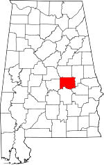 | |
| Towns | ||
| CDPs | ||
| Unincorporated communities | ||
| Footnotes | ‡This populated place also has portions in an adjacent county or counties | |