Deckers, Colorado
| Deckers, Colorado | |
|---|---|
| Unincorporated community | |
 Deckers  Deckers Location within the state of Colorado | |
| Coordinates: 39°15′19″N 105°13′38″W / 39.25528°N 105.22722°WCoordinates: 39°15′19″N 105°13′38″W / 39.25528°N 105.22722°W | |
| Country |
|
| State |
|
| County | Douglas |
| Area | |
| • | 0 sq mi (0 km2) |
| Elevation[1] | 6,400 ft (1,950 m) |
| Time zone | MST (UTC-7) |
| • Summer (DST) | MDT (UTC-6) |
| ZIP code[2] | Sedalia CO 80135 |
Deckers is an unincorporated community along the South Platte River in Douglas County, Colorado, United States. Stephen Decker built a general store here in the 1890s. He later added a saloon and called the settlement "Daffodil." The presence of natural springs led him to establish Deckers Mineral Springs and Resort in the popular region for fly-fishing. Deckers received national attention for the June 2002 forest fire, known as the Hayman Fire, which burned thousands of acres on the outskirts of the Denver metro area. The U.S. Post Office at Sedalia (ZIP Code 80135) now serves Deckers postal addresses.[2]
Geography
Deckers is located at 39°15′19″N 105°13′38″W / 39.25528°N 105.22722°W (39.255386,-105.227222).
Camp
National Ramah announced in March 2006 that it plans to open a Camp Ramah in the Rockies. A 360-acre (1.5 km2) camp site has been purchased in Deckers.
See also
- Denver-Aurora Metropolitan Statistical Area
- Denver-Aurora-Boulder Combined Statistical Area
- Front Range Urban Corridor
- List of cities and towns in Colorado
References
- ↑ "US Board on Geographic Names". United States Geological Survey. 2007-10-25. Retrieved 2008-01-31.
- 1 2 "ZIP Code Lookup" (JavaScript/HTML). United States Postal Service. January 3, 2007. Retrieved January 3, 2007.
Municipalities and communities of Douglas County, Colorado, United States | ||
|---|---|---|
| Cities | 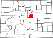 | |
| Towns | ||
| CDPs | ||
| Unincorporated communities | ||
| Footnotes | ‡This populated place also has portions in an adjacent county or counties | |