Lone Tree, Colorado
| Lone Tree, Colorado | |
|---|---|
| Home Rule Municipality | |
| City of Lone Tree | |
|
The Lone Tree Municipal Building | |
| Motto: "It's a great day to be in Lone Tree!" | |
 Location in Douglas County and the state of Colorado | |
| Coordinates: 39°32′56″N 104°53′33″W / 39.54889°N 104.89250°WCoordinates: 39°32′56″N 104°53′33″W / 39.54889°N 104.89250°W | |
| Country | United States |
| State | Colorado |
| County | Douglas County[1] |
| Incorporated | 1996[2] |
| Government | |
| • Type | Home Rule Municipality[1] |
| • Mayor | Jim Gunning[3] |
| Area | |
| • Total | 9.6 sq mi (24.8 km2) |
| • Land | 9.6 sq mi (24.8 km2) |
| • Water | 0 sq mi (0 km2) |
| Elevation[4] | 5,948 ft (1,813 m) |
| Population (2010)[5] | |
| • Total | 10,218 |
| • Estimate (2014)[6] | 13,545 |
| • Density | 1,415/sq mi (546.3/km2) |
| Time zone | MST (UTC-7) |
| • Summer (DST) | MDT (UTC-6) |
| ZIP code[7] | 80124 |
| Area code(s) | Both 303 and 720 |
| FIPS code | 08-45955 |
| GNIS feature ID | 1721392 |
| Website |
www |
_Municipal_Building.JPG)
Lone Tree is a home rule municipality in Douglas County, Colorado, United States. The city population was 10,218 at the 2010 United States Census,[8] with an estimated population of 13,545 in 2014.[6] Lone Tree is a part of the Denver-Aurora-Lakewood, CO Metropolitan Statistical Area.
Geography
Lone Tree is located at 39°32′56″N 104°53′33″W / 39.548947°N 104.892546°W,[9] on the northern border of Douglas County, directly adjacent to Arapahoe County. It is in what is called the "South Metro" area of Denver, located 18 miles (29 km) south of Denver's downtown.
According to the United States Census Bureau, the city has a total area of 9.6 square miles (24.8 km2), all of it land.[8]
Demographics
| Historical population | |||
|---|---|---|---|
| Census | Pop. | %± | |
| 2000 | 4,873 | — | |
| 2010 | 10,218 | 109.7% | |
| Est. 2015 | 13,175 | [10] | 28.9% |
As of the census of 2000, there were 4,873 people, 1,848 households, and 1,367 families residing in the city. The population density was 2,827.2 people per square mile (1,093.9/km²). There were 1,906 housing units at an average density of 1,105.8 per square mile (427.9/km²). The racial makeup of the city was 91.55% White, 1.48% African American, 0.25% Native American, 3.69% Asian, 0.04% Pacific Islander, 1.31% from other races, and 1.68% from two or more races. Hispanic or Latino of any race were 4.58% of the population.
There were 1,848 households out of which 38.7% had children under the age of 18 living with them, 67.0% were married couples living together, 4.9% had a female householder with no husband present, and 26.0% were non-families. 19.5% of all households were made up of individuals and 1.7% had someone living alone who was 65 years of age or older. The average household size was 2.64 and the average family size was 3.08.
In the city the population was spread out with 28.3% under the age of 18, 5.4% from 18 to 24, 34.5% from 25 to 44, 28.0% from 45 to 64, and 3.9% who were 65 years of age or older. The median age was 37 years. For every 100 females there were 98.4 males. For every 100 females age 18 and over, there were 94.7 males.
The median income for a household in the city was $96,308, and the median income for a family was $109,003. Males had a median income of $90,690 versus $43,125 for females. The per capita income for the city was $46,287. About 1.2% of families and 1.4% of the population were below the poverty line, including 1.5% of those under age 18 and 3.7% of those age 65 or over.
Transportation
Highways
Interstate 25 bisects the city, with access from four exits:
- Exit 192 (RidgeGate Parkway)
- Exit 193 (Lincoln Avenue)
- Exit 194 (Colorado State Highway 470/E-470)
- Exit 195 (County Line Road)
Colorado State Highway 470 (commonly known as C-470) also bisects the city and, in addition to the I-25 interchange, also provides access to Lone Tree via Yosemite Street.
Public transportation
The RTD Bus & Light Rail's E Line and F Line both make two stops in Lone Tree (County Line and Lincoln, the latter being the southern terminus of both lines). Under the FasTracks voter-approved initiative, three additional stations (at Sky Ridge Medical Center, Lone Tree City Center and RidgeGate Parkway) are planned for Lone Tree.
The Lone Tree Link operates free bus service along Park Meadows Drive during the weekdays, serving Lincoln Station and four other stops in the city.[12]
See also
References
- 1 2 "Active Colorado Municipalities". State of Colorado, Department of Local Affairs. Retrieved 2007-09-01.
- ↑ "Colorado Municipal Incorporations". State of Colorado, Department of Personnel & Administration, Colorado State Archives. 2004-12-01. Retrieved 2007-09-02.
- ↑ "City of Lone Tree Council Members". City of Lone Tree. Retrieved 2007-11-15.
- ↑ "US Board on Geographic Names". United States Geological Survey. 2007-10-25. Retrieved 2008-01-31.
- ↑ "American FactFinder". United States Census Bureau. Retrieved 2015-01-15.
- 1 2 "Population Estimates". United States Census Bureau. Retrieved June 5, 2015.
- ↑ "ZIP Code Lookup" (JavaScript/HTML). United States Postal Service. Retrieved November 15, 2007.
- 1 2 "Geographic Identifiers: 2010 Demographic Profile Data (G001): Lone Tree city, Colorado". U.S. Census Bureau, American Factfinder. Retrieved October 15, 2015.
- ↑ "US Gazetteer files: 2010, 2000, and 1990". United States Census Bureau. 2011-02-12. Retrieved 2011-04-23.
- ↑ "Annual Estimates of the Resident Population for Incorporated Places: April 1, 2010 to July 1, 2015". Retrieved July 2, 2016.
- ↑ "Census of Population and Housing". Census.gov. Retrieved June 4, 2015.
- ↑ http://www.lonetreelink.com/
External links
- City of Lone Tree official website
- CDOT map of the City of Lone Tree
- Lone Tree and Douglas County School Info
- Lone Tree Arts Center
- Lone Tree Symphony Orchestra
- Lone Tree Chamber of Commerce
Municipalities and communities of Douglas County, Colorado, United States | ||
|---|---|---|
| Cities | 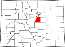 | |
| Towns | ||
| CDPs | ||
| Unincorporated communities | ||
| Footnotes | ‡This populated place also has portions in an adjacent county or counties | |
