Diggins, Missouri
| Diggins, Missouri | |
|---|---|
| Village | |
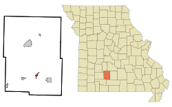 Location of Diggins, Missouri | |
| Coordinates: 37°10′27″N 92°51′9″W / 37.17417°N 92.85250°WCoordinates: 37°10′27″N 92°51′9″W / 37.17417°N 92.85250°W | |
| Country | United States |
| State | Missouri |
| County | Webster |
| Area[1] | |
| • Total | 0.97 sq mi (2.51 km2) |
| • Land | 0.97 sq mi (2.51 km2) |
| • Water | 0 sq mi (0 km2) |
| Elevation | 1,654 ft (504 m) |
| Population (2010)[2] | |
| • Total | 299 |
| • Estimate (2012[3]) | 300 |
| • Density | 308.2/sq mi (119.0/km2) |
| Time zone | Central (CST) (UTC-6) |
| • Summer (DST) | CDT (UTC-5) |
| ZIP code | 65636 |
| Area code(s) | 417 |
| FIPS code | 29-19504[4] |
| GNIS feature ID | 0716894[5] |
Diggins is a village in Webster County, Missouri, United States. The population was 299 at the 2010 census. It is part of the Springfield, Missouri Metropolitan Statistical Area.
The small community, which once had two grocery stores, two gas stations, a feed mill and a bank until the Great Depression, is located halfway between Fordland and Seymour on U.S. 60. Diggins has its own water and sewer system for residents inside its city limits.
Diggins is known best to the outside world as the hometown of Sam Walton, the founder of Wal-Mart. At the community's 100-year centennial celebration in 1987, Walton visited Diggins.
Today, Diggins has a post office and a few businesses. The village's gathering place is the Diggins Community Building, a facility that also includes a park and playground. Routes O and NN meet US 60 in Diggins, and the rural area surrounding the community has grown at a rapid rate over the past twenty years.
Geography
The village located at 37°10′27″N 92°51′9″W / 37.17417°N 92.85250°W (37.174085, -92.852447).[6]
According to the United States Census Bureau, the village has a total area of 0.97 square miles (2.51 km2), all of it land.[1]
Demographics
| Historical population | |||
|---|---|---|---|
| Census | Pop. | %± | |
| 1930 | 133 | — | |
| 1940 | 128 | −3.8% | |
| 1950 | 126 | −1.6% | |
| 1960 | 101 | −19.8% | |
| 1970 | 140 | 38.6% | |
| 1980 | 245 | 75.0% | |
| 1990 | 258 | 5.3% | |
| 2000 | 298 | 15.5% | |
| 2010 | 299 | 0.3% | |
| Est. 2015 | 308 | [7] | 3.0% |
2010 census
As of the census[2] of 2010, there were 299 people, 118 households, and 92 families residing in the village. The population density was 308.2 inhabitants per square mile (119.0/km2). There were 138 housing units at an average density of 142.3 per square mile (54.9/km2). The racial makeup of the village was 97.7% White, 0.3% African American, 0.7% from other races, and 1.3% from two or more races. Hispanic or Latino of any race were 1.0% of the population.
There were 118 households of which 35.6% had children under the age of 18 living with them, 56.8% were married couples living together, 14.4% had a female householder with no husband present, 6.8% had a male householder with no wife present, and 22.0% were non-families. 19.5% of all households were made up of individuals and 7.6% had someone living alone who was 65 years of age or older. The average household size was 2.53 and the average family size was 2.76.
The median age in the village was 41.1 years. 26.1% of residents were under the age of 18; 5.4% were between the ages of 18 and 24; 23.5% were from 25 to 44; 34.8% were from 45 to 64; and 10.4% were 65 years of age or older. The gender makeup of the village was 48.2% male and 51.8% female.
2000 census
As of the census[4] of 2000, there were 298 people, 115 households, and 87 families residing in the village. The population density was 371.0 people per square mile (143.8/km²). There were 134 housing units at an average density of 166.8 per square mile (64.7/km²). The racial makeup of the village was 94.63% White, 0.67% Native American, and 4.70% from two or more races. Hispanic or Latino of any race were 0.67% of the population.
There were 115 households out of which 36.5% had children under the age of 18 living with them, 64.3% were married couples living together, 7.0% had a female householder with no husband present, and 23.5% were non-families. 20.0% of all households were made up of individuals and 7.8% had someone living alone who was 65 years of age or older. The average household size was 2.59 and the average family size was 2.91.
In the village the population was spread out with 24.5% under the age of 18, 9.1% from 18 to 24, 35.2% from 25 to 44, 22.5% from 45 to 64, and 8.7% who were 65 years of age or older. The median age was 36 years. For every 100 females there were 104.1 males. For every 100 females age 18 and over, there were 100.9 males.
The median income for a household in the village was $29,688, and the median income for a family was $33,500. Males had a median income of $27,143 versus $18,500 for females. The per capita income for the village was $15,038. About 8.7% of families and 11.7% of the population were below the poverty line, including 20.0% of those under the age of eighteen and 21.7% of those sixty-five or over.
References
- 1 2 "US Gazetteer files 2010". United States Census Bureau. Retrieved 2012-07-08.
- 1 2 "American FactFinder". United States Census Bureau. Retrieved 2012-07-08.
- ↑ "Population Estimates". United States Census Bureau. Retrieved 2013-05-30.
- 1 2 "American FactFinder". United States Census Bureau. Retrieved 2008-01-31.
- ↑ "US Board on Geographic Names". United States Geological Survey. 2007-10-25. Retrieved 2008-01-31.
- ↑ "US Gazetteer files: 2010, 2000, and 1990". United States Census Bureau. 2011-02-12. Retrieved 2011-04-23.
- ↑ "Annual Estimates of the Resident Population for Incorporated Places: April 1, 2010 to July 1, 2015". Retrieved July 2, 2016.
- ↑ "Census of Population and Housing". Census.gov. Retrieved June 4, 2015.
Municipalities and communities of Webster County, Missouri, United States | ||
|---|---|---|
| Cities | 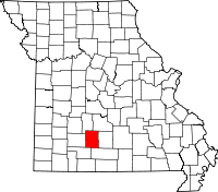 | |
| Village | ||
| Townships |
| |
| Unincorporated communities | ||
| Footnotes | ‡This populated place also has portions in an adjacent county or counties | |