Dora Creek, New South Wales
| Dora Creek New South Wales | |
|---|---|
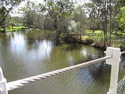
 Scenery from the bank of Dora Creek | |
| Coordinates | 33°04′55″S 151°30′04″E / 33.082°S 151.501°ECoordinates: 33°04′55″S 151°30′04″E / 33.082°S 151.501°E |
| Population | 1,671 (2011 census)[1] |
| • Density | 727/km2 (1,880/sq mi) |
| Postcode(s) | 2264 |
| Area | 2.3 km2 (0.9 sq mi) |
| Location | |
| LGA(s) | City of Lake Macquarie |
| Parish | Coorumbung |
| State electorate(s) | Lake Macquarie |
| Federal Division(s) | Hunter |
Dora Creek is a small rural suburb of the City of Lake Macquarie in New South Wales, Australia, located west of Lake Macquarie in New South Wales and north of the town of Morisset.
Location and features
Dora Creek is named for the creek running through its centre, and was originally known as Doree Doree in the local Aboriginal language, which means "Creek running into a lake".[2]
There is an interesting geological phenomena at Dora Creek's connection to the lake. The banks of the creek have formed into two peninsula jutting out into the lake like a point. Thus the aboriginal name is explained, the creek is literally in a lake - the points are merely the banks of the creek !. The sediment deposited by the creek has not formed a large flood plain or river delta, but has left behind two banks. This is where the agitation of the lake by winds causes enough erosion to wash away the flood plain that would otherwise appear at the delta or near were a creek floods. However the erosion caused by the lake's waves is not enough to erode away the clay sediments that deposit on the banks of the creek. For that reason, the banks of the creek have grown due to flooding, and appear now as two points, with a creek inside. Similar structures can be seen at creeks nearby too, with good examples at Stoney Creek, Lake Street, Blackalls Park, which is more clearly a type of river delta,where the flat land is created by floods deposition, and at Wyong Creek in a lake a little south, where a similar "two points with creek inside" or "creek in lake" , is in existence, but they are smaller and demonstrating how the points grow .. [3]
The Lake Macquarie Council has placed emphasis on the Dora Creek environment, carrying out major foreshore restoration works, and educating the public about the protection of creeks and waterways.[4] It is known for its beautiful scenery and proximity to the Watagan Mountains. It is convenient to the Sydney-Newcastle Freeway and Dora Creek Railway Station.[5]
References
- ↑ Australian Bureau of Statistics (31 October 2012). "Dora Creek (State Suburb)". 2011 Census QuickStats. Retrieved 16 February 2014.
- ↑ Read, Clive (2008). "Dora Creek Street Names" (PDF). City of Lake Macquarie. Retrieved 6 April 2013.
- ↑ Chamberlain, Michael (1997). Cooranbong, first town in Lake Macquarie, 1826–1996: a history including Martinsville and Dora Creek. City of Lake Macquarie. p. 281. ISBN 0-646-32958-8.
- ↑ Sustainability Department, City of Lake Macquarie (6 February 2012). "Fact Sheet 8 - Caring for our streams and wetlands". Retrieved 25 July 2014.
- ↑ "Lake Mac Libraries: Dora Creek". Lake Macquarie City Library.