Mount Sugarloaf (New South Wales)
| Mount Sugarloaf | |
|---|---|
| Great Sugar Loaf | |
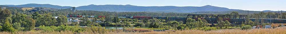
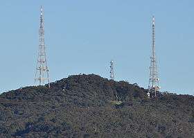 Mount Sugarloaf viewed from West Wallsend | |
| Highest point | |
| Elevation | 412 m (1,352 ft) |
| Coordinates | 32°52′54″S 151°32′4″E / 32.88167°S 151.53444°ECoordinates: 32°52′54″S 151°32′4″E / 32.88167°S 151.53444°E [1][2] |
| Geography | |
 Mount Sugarloaf Location of Mount Sugarloaf in New South Wales | |
| Location | Hunter Region, New South Wales, Australia |
| Parent range | Sugarloaf Range |
| Topo map |
NEWCASTLE 9232, WALLSEND 92323S |
| Climbing | |
| Easiest route | Road to carpark at 370 m (1,214 ft), walking track to summit |
Mount Sugarloaf, also known as Great Sugar Loaf, is a mountain in the lower Hunter Region of New South Wales, Australia, overlooking the cities of Newcastle, Lake Macquarie, Cessnock and Maitland.[1][2] The summit of the mountain is in the Lake Macquarie suburb of West Wallsend and access to the summit is gained via this suburb. However, the mountain itself is also part of the city of Cessnock suburbs Mulbring and Richmond Vale.[3] It is home to television transmitters that broadcast to the lower Hunter region. On 18 and 19 July 1965, the mountain received 10 centimetres (4 in) of snow. It also snowed on the summit in the winter of 1975.
Television transmitters
The mountain has two broadcast transmission towers. Since the 1960s their main function has been to transmit analogue television on VHF. In the 1990s two UHF analogue stations began to transmit from there. Since 2003, they have also been transmitting digital television in the UHF band (all digital television in the lower Hunter is on UHF). The analogue television transmitters (VHF and UHF) were switched off in November 2012. One tower, built to transmit the original VHF analogue television services of NBN Television on VHF Channel 3, transmits NBN and two government digital TV services. It is commonly referred to as the "NBN Tower". The second tower is transmitting the other two commercial digital (UHF) TV stations. The second tower is controlled by Broadcast Australia, being formerly run by the National Transmission Authority. There are many other radio antennae on these towers, including those belonging to Amateur Radio repeater and beacon stations.
Smaller tower
There is a third smaller tower that has many directional antennae, mainly used for telecommunications, but also for two way radio for emergency services and other similar purposes. It has Telstra markings on much of the equipment and sheds.
Gallery
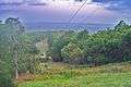 Looking toward Newcastle from the Mount Sugarloaf carpark
 Transmission Tower at Mount Sugarloaf
 Plaque commemorating the first recorded snowfall on the mountain in 1965
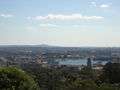 Mount Surgarloaf (just left of centre) as seen from inner city Newcastle
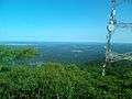 View from the top
See also
References
- 1 2 "Mount Sugarloaf". Geographical Names Register (GNR) of NSW. Geographical Names Board of New South Wales. Retrieved 25 August 2010.
- 1 2 "Great Sugar Loaf". Geographical Names Register (GNR) of NSW. Geographical Names Board of New South Wales. Retrieved 25 August 2010.
- ↑ "West Wallsend". Land and Property Management Authority - Spatial Information eXchange. New South Wales Land and Property Information. Retrieved 7 September 2010.
External links
| Wikimedia Commons has media related to Mount Sugarloaf (New South Wales). |